First Alert Weather: Rain and snow today before another chance of snow late this week
[anvplayer video=”5152180″ station=”998131″]
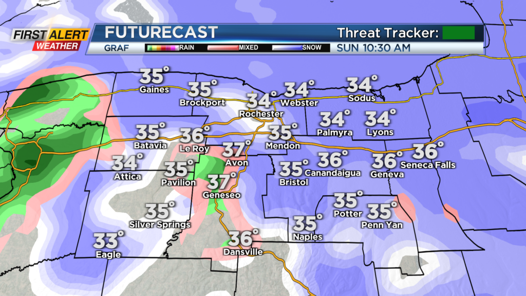
ROCHESTER, N.Y. Waking up to an unsettled start to our Sunday.
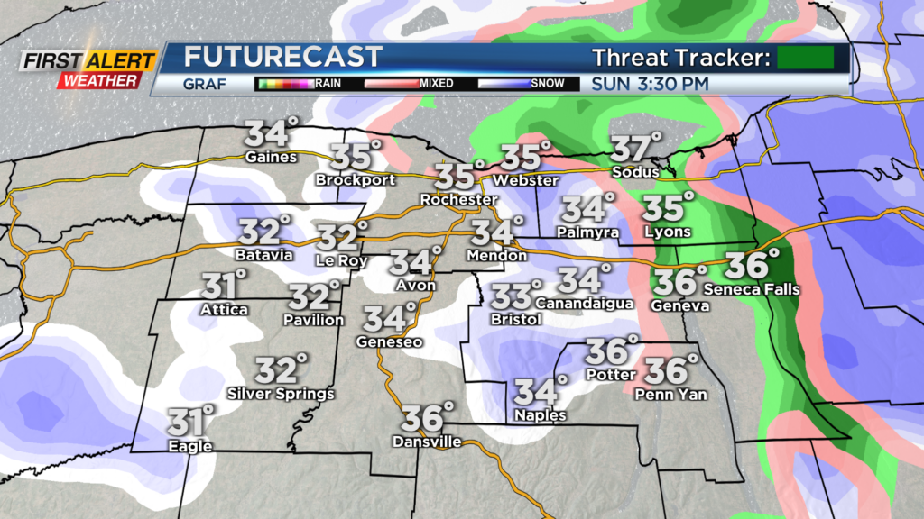
Snow showers have rolled in across our region, limiting visibility, but roads remain clear. We will continue to see snow showers this morning before milder air swings in for the afternoon and we see a mixture of rain and snow showers.
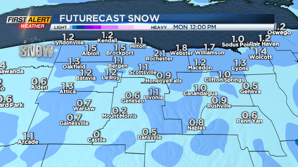
Chance for precipitation will slowly decrease this evening before a few snow showers off of Lake Ontario pop up late tonight and into Monday morning. Accumulations will be slushy at best through the evening, but a better chance for accumulations will come tonight and tomorrow morning.
Lake snow showers tonight could drop an inch or two by daybreak tomorrow morning for folks along the lakeshore. This could create a slick spot or two, especially as temperatures tonight drop into the upper 20s. After a few snow showers early tomorrow though, we will remain cloudy and cold for Monday.
We will remain on the chilly side through a good chunk of this week, but we are quiet until our next opportunity for snow late Thursday and Friday. We are still tracking the possibility of more snow accumulation late this week.
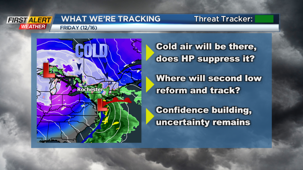
Uncertainty remains on where low pressure tracks, but we are gaining confidence on where it tracks and an idea as to how much snow will be possible. Low pressure will track into the Midwest by Thursday, and then transfer its energy to the East Coast and reform off the coast of New Jersey by Friday.
First Alert Meteorologist Alex Bielfeld has your Sunday forecast.
There are still questions on whether or not the second low will take over as the main low or the parent low hold the control. This will significantly impact our snowfall as a stronger parent low will usher in milder air while the stronger second low will wrap the cold air in with no mixing.
Also, a slower strengthening of the second low will let the heaviest of the snow miss us and fall well east of us. The energy for this storm remains off the California coast but does come ashore late tonight. So, models will get a much better sampling of the atmosphere later today and tomorrow morning.
At that time we will have a better understanding of the overall dynamics of this storm and the outcome will become much clearer.