First Alert Weather: Rain changes to snow; Yellow Alert for Tuesday
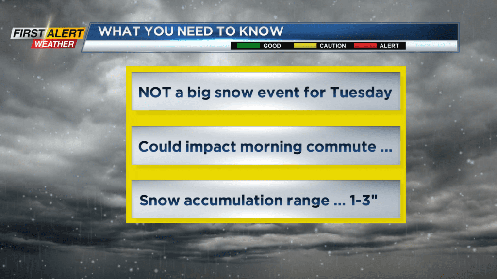
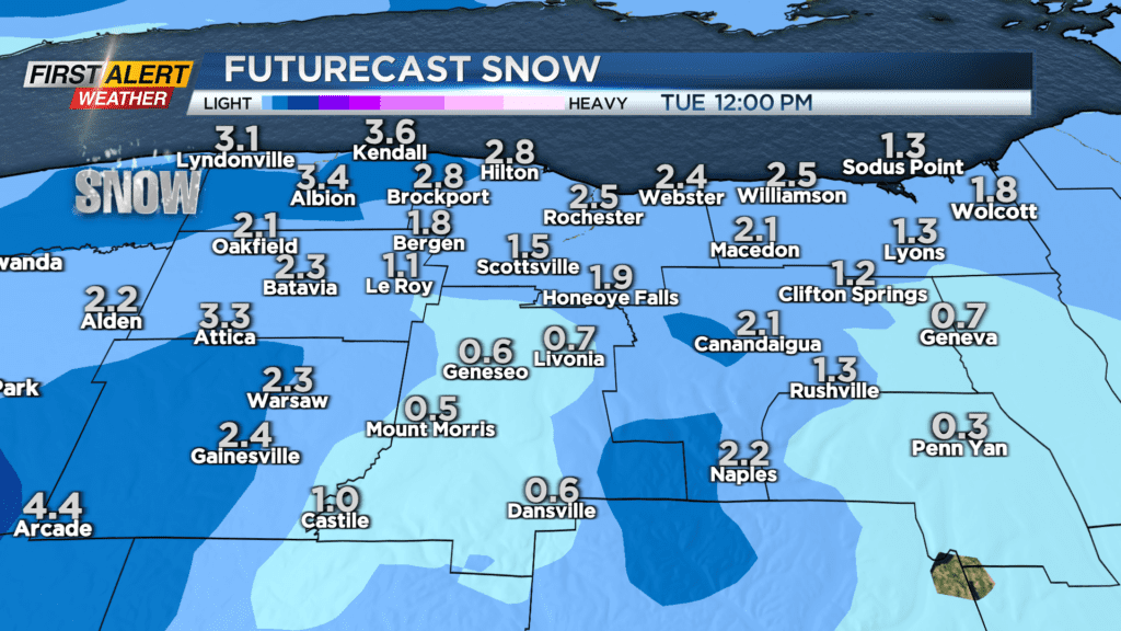
ROCHESTER, N.Y. – We continue to track a strong east coast storm as it moves north Sunday night into Monday. The heaviest rain will be over the Finger Lakes during this time frame with Rochester likely on the fringe of steady rainfall over the next 24 hours. Flood watches are in effect for central and eastern New York State. This storm will have missed much of the cold air that would be needed to produce a significant winter storm. However, a secondary low-pressure system will usher in colder temperatures later Monday night into Tuesday, which will produce an area wide snowfall into Tuesday morning. This is not a big snow event for Rochester, but accumulating snow could make the Tuesday morning commute challenging. As a result, News10NBC First Alert meteorologists have issued a Yellow Alert for Tuesday morning due to the snowfall.
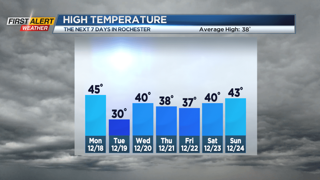
Sunday night, look for occasional rain and it will be rather mild for December as the low temperature will only fall into the middle 40s. Monday will bring more rain showers with steadier rain located though the Finger Lakes. The temperature will start in the middle 40s, but the mercury will slowly fall through the day. Monday night we expect rain to mix and change to snow. This occasional snow will last into Tuesday morning with accumulations running in the range of one to three inches. The snow will likely end by midday on Tuesday. It will be blustery and much colder as most of the day will be spent in the 20s.
The remainder of the week looks to be calm and tranquil with partial sunshine expected for Wednesday, Thursday, and Friday.
Stay tuned to News 10NBC First Alert weather for updates on the forecast.