First Alert Weather: Rain ends, but so does the mild air… for now

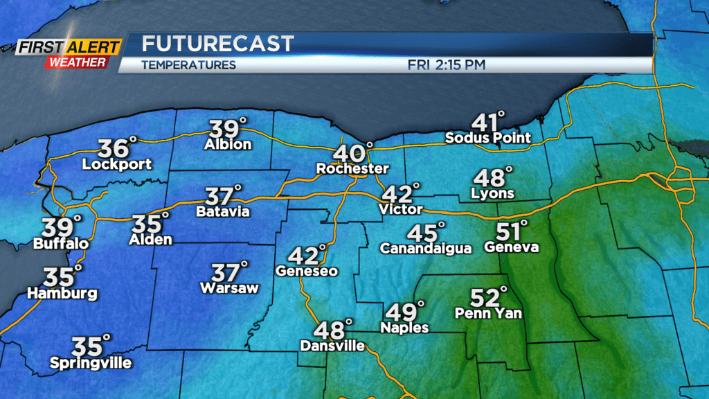
ROCHESTER, N.Y. — Rain ends Thursday as a wave of low pressure passes by to our east, but we’ll keep the clouds around into Friday morning.
While clouds will win out on Friday, we may see a few breaks of sun ahead of a strong cold front Friday evening. This will drop our temperatures from the 40s into the 30s within a few hours, then into the teens by Saturday morning. We’ll also see a few snow showers with the front Friday evening with the front, and some minor light lake effect snow showers into Saturday morning.
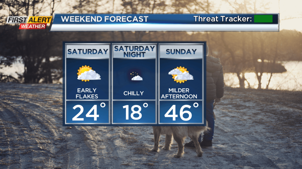
The biggest weather story will be the return to a (brief) winter chill on Saturday, with highs holding in the lower half of the 20s. Sunday starts off quite chilly in the teens, but rebounds nicely into the 40s.
We make take a little step back in the temperature department on Monday, but all signs are pointing to another major warmup by Tuesday and Wednesday of next week, with potential record highs in the 60s. This will also come with a breeze, some rain and perhaps some rumbles of thunder.