First Alert Weather: Rain is ending on Saturday evening and unseasonable warmth continues
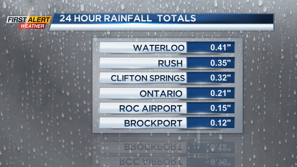
ROCHESTER, N.Y. — Rainfall measurements on Saturday were near a quarter of an inch, so maybe just enough wet weather to wash away the salt.
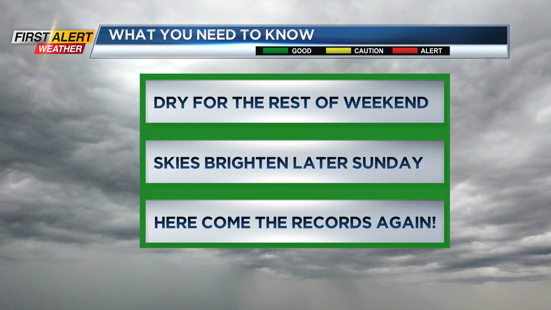
An upper level low-pressure system is in the process of moving away from Western New York and, as a result, most of the rain has come to an end. A high-pressure system is set to move in and will stick around for the beginning of the week.
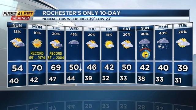
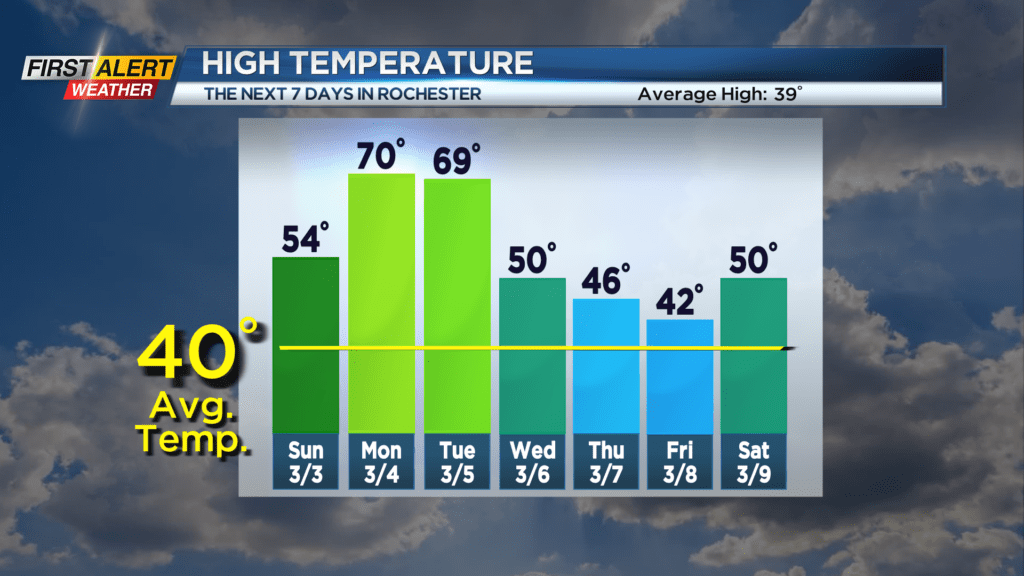
The system will provide several days of dry weather, but more importantly, unseasonably warm weather. This means Rochester will have several opportunities for record high temperatures this week.
On Friday night, look for mainly cloudy skies. It will dry and mild. The low temperature will be near 40 degrees. Typically, this time of the year the temperature is falling into the middle 20s.
Sunday will be dry, but mainly cloudy for the balance of the day. However, skies may brighten for the afternoon with the high temperature in the lower 50s, but it will be cooler near Lake Ontario.
On Monday, the heat is on for us with a record high temperature possible. The record on Monday is 69 degrees set in 1974 and with plenty of sunshine expected a new record is highly likely. Tuesday will bring breaks of sunshine then the chance of a spotty shower. Again another record is possible with the high temperature near 69 degrees.
Stay tuned to News10NBC First Alert weather for updates on the forecast.