First Alert Weather: Rain on the way for Tuesday and Wednesday
[anvplayer video=”5155555″ station=”998131″]
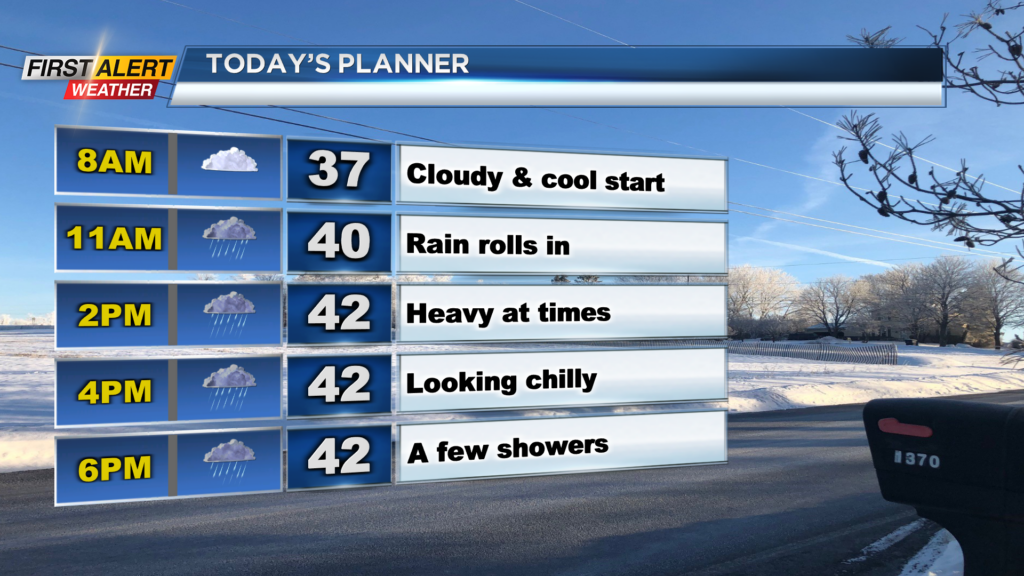
ROCHESTER, N.Y. — We’re waking up to a dry, yet cloudy start to our Tuesday. Temperatures are also mild once again with temperatures starting off in the upper 30s Tuesday morning.
We will see the cloud cover give way to rain by the mid morning hours. Rain will continue through the afternoon before turning over to scattered rain showers this evening.
The rain is thanks to a warm front that will stall across our region. This will have an impact on our temperatures as well. Highs north of the thruway will remain in the low 40s as the warm front stalls to the south.
Temperatures south of the Thruway will have the opportunity to warm up into the mid and upper 50s. The best chance for upper 50s will be for areas further away from the thruway.


The same story will continue for Wednesday as areas north of the Thruway will be stuck with the chilly weather where areas south will be mild once again.
This warm front will get kicked east when a cold front swing through Wednesday evening with another chance for widespread rain. As for Wednesday morning and afternoon, a few isolated to scattered showers will be possible before the widespread rain during the evening hours.
Rain for Wednesday evening will also be heavy at times before quickly swinging to our east. Rain Tuesday and Wednesday evenings will have the chance to limit visibility on local roadways at times and create pooling and ponding. Rain totals by Thursday morning will total nearly an inch with localized higher amounts.
______________
Download the WHEC First Alert Weather app to stay up to date while on the go.
Watch the latest full forecast online.