First Alert Weather: Rain returns and chillier air follows for the weekend
ROCHESTER, N.Y. — We made it into the 60s again on Thursday, and may squeeze out one more day on Friday, but it’ll come with some wet weather.
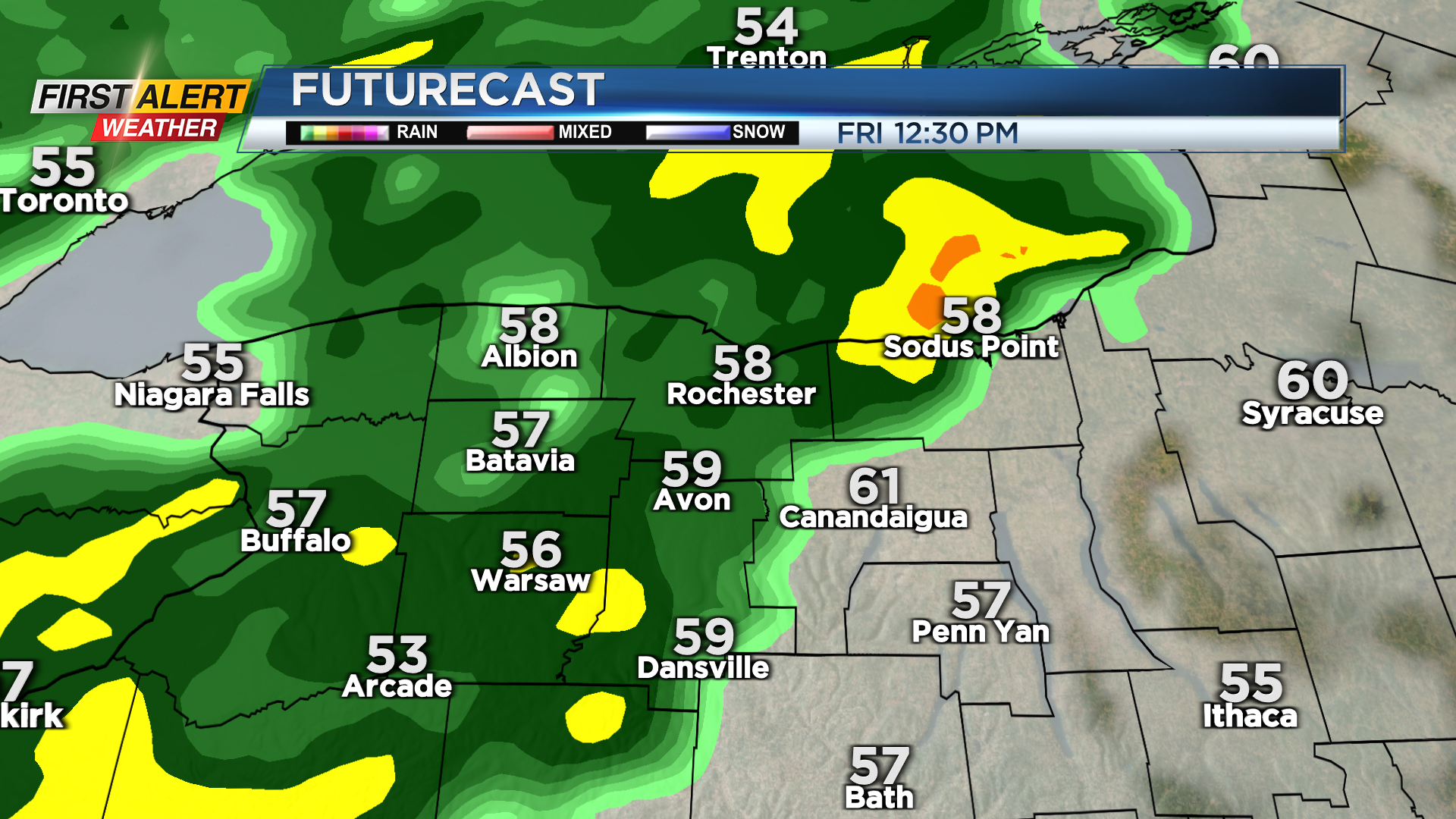
Friday starts off dry and breezy. Rain develops west of Rochester by mid morning, and moves east into the Finger Lakes by noon or early afternoon. Expect light rain for the rest of the afternoon, with rain tapering by 6 or 7 p.m. Friday. Drier but much cooler air will be blowing in for the start of the weekend.
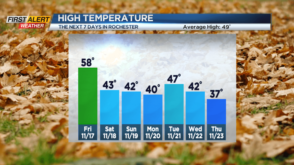

We’ll top out in the lower 40s both Saturday and Sunday. Saturday should feature mainly dry weather will a clearing sky. Sunday will see some scattered lake effect rain and snow showers, with no accumulation expected.
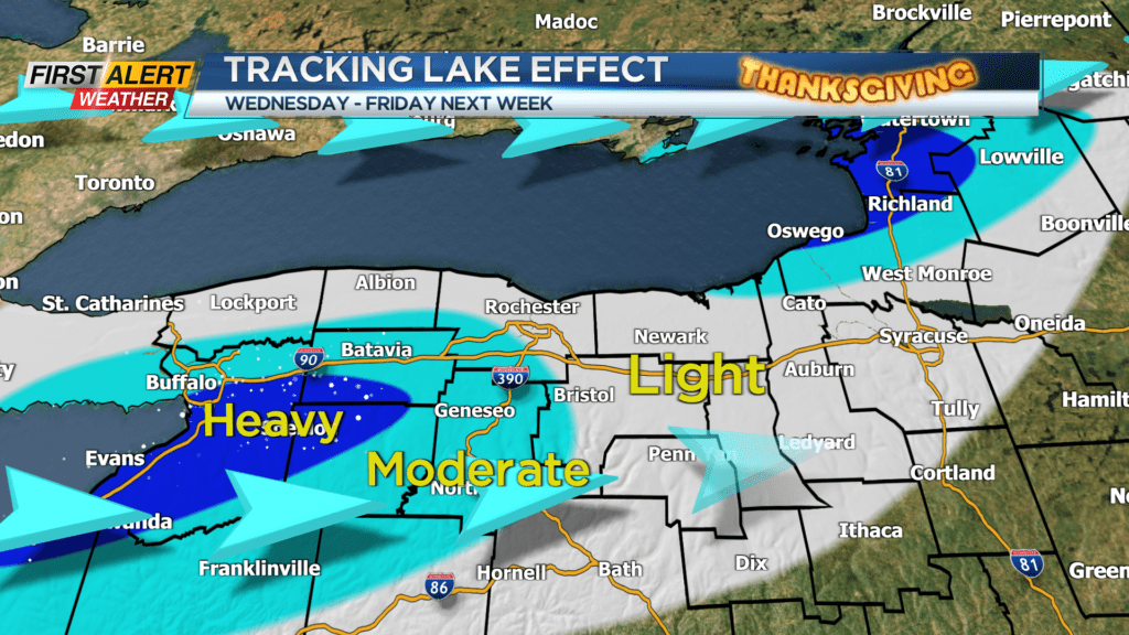
Thanksgiving week turns more unsettled. Monday will be dry with some sun, but rain arrives again on Tuesday. This rain will transition over to some wet snow on Wednesday, as colder air wraps in. As the colder air deepens, we’ll start to see lake effect snow developing off of Lake Ontario Wednesday evening into Thursday morning. There are some indications that we could see some accumulating, perhaps plowable snow closer to Buffalo.
This is something to monitor if you have plans to travel to Buffalo, or west along the Thruway for Thanksgiving. Details on lake effect are a bit fuzzy this far out, but we’ll continue to update.