First-Alert Weather: Rain returns, then changes to wet snow
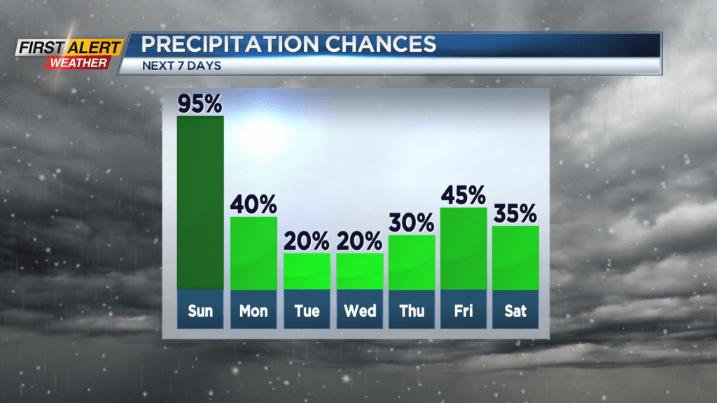
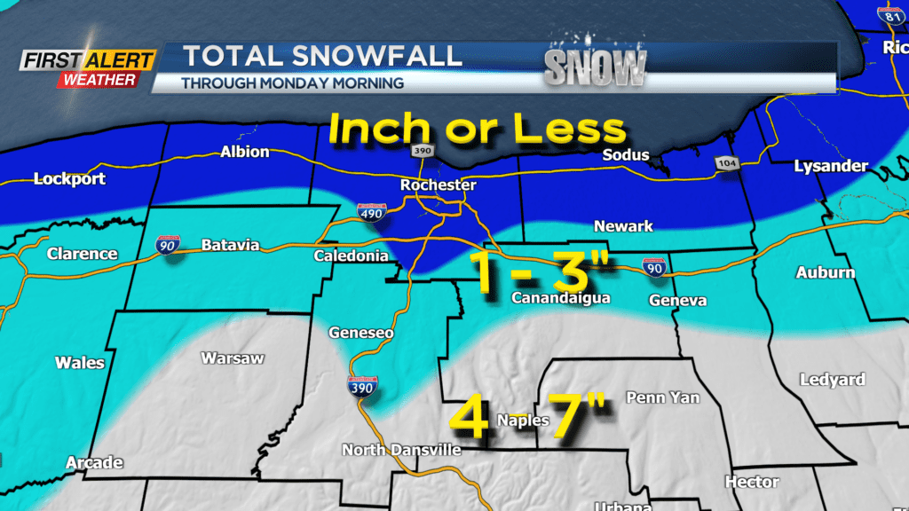
A low-pressure system will pass about 250 miles south of Rochester on Sunday. As a result, precipitation will begin as rain showers for later Saturday night, but it will change to a wet, slushy snowfall by midday Sunday. Since temperatures will be above freezing and marginal for snowfall, the actual accumulation will be minimal around the Rochester area. However, for communities south of Rochester where it will be a little colder, the amount of snow will be greater by Monday morning.
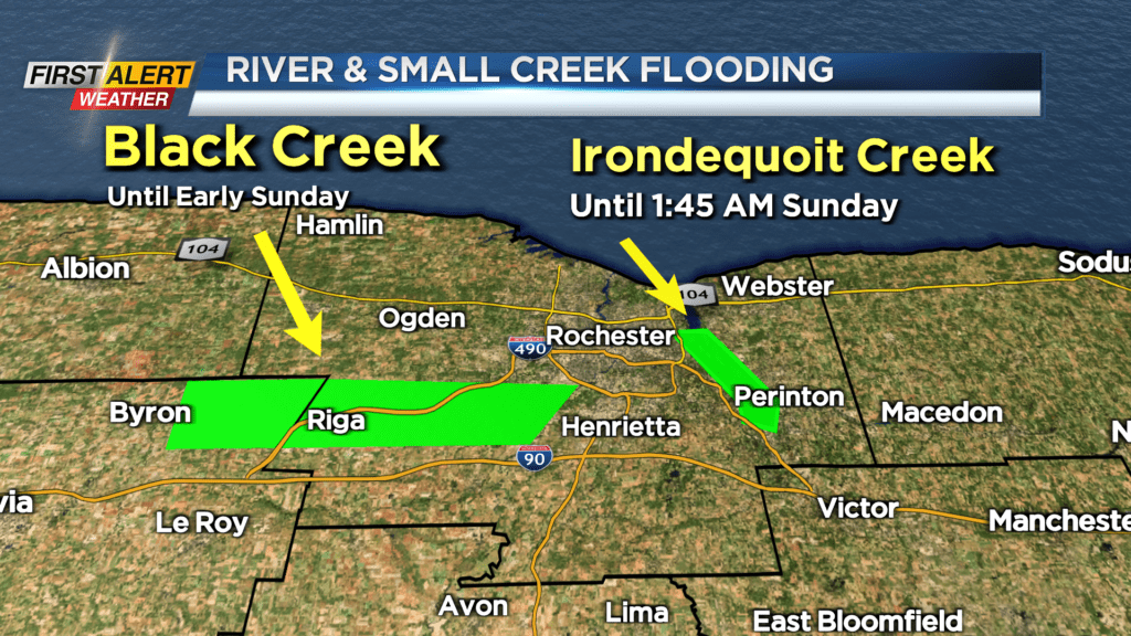
News10NBC First Alert weather is also tracking the potential for localized flooding. The combination of rain and melting snow the last couple of days has pushed water levels on area creeks and streams much higher. Even though the flooding has been minor, Irondequoit Creek and Black Creek are under a flood warning through Saturday night onto early Sunday.
Saturday evening appears to be mainly dry with patches of light fog. But then rain showers will arrive after midnight. The temperature should remain in the middle 30s. Sunday rain showers are expected for the morning and then the precipitation will transition to an area-wide wet snow by midday. The accumulation by the end of the afternoon should be limited to a coating to inch in the immediate Rochester area, but 2 to 4 inches will be possible south of the NYS Thruway. The temperature will remain in the middle 30s. Sunday night the steady snow will taper to snow showers with another coating to an inch in Rochester, but anther 2 to 3 inches is possible south – especially in the higher elevations.
Stay tuned to News10NBC First Alert weather for updates on the forecast.