First Alert Weather: Reality returns with rain, some wind and much cooler air
[anvplayer video=”5195002″ station=”998131″]
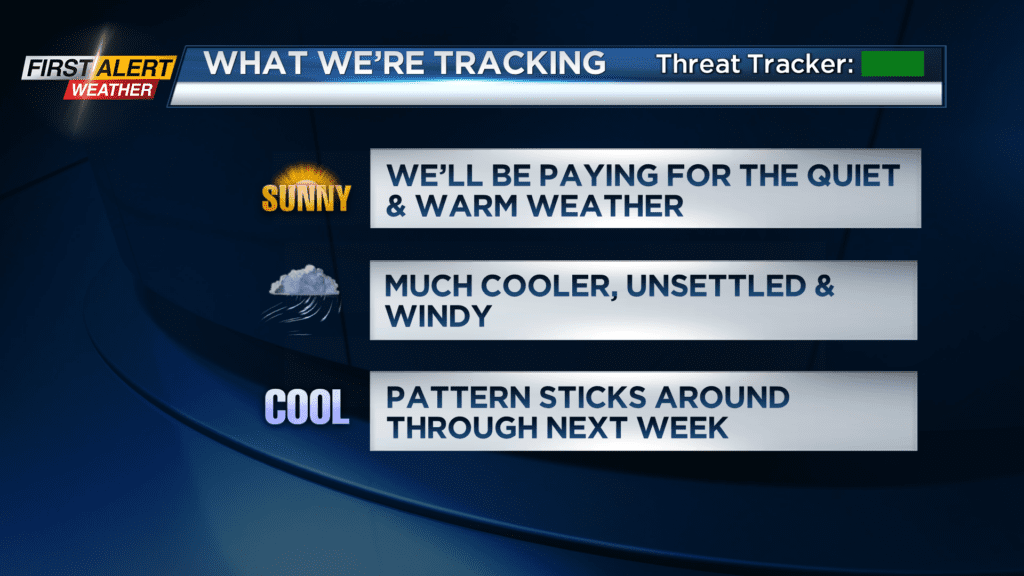
ROCHESTER, N.Y. — Say goodbye to the sunshine, dry weather and warm air we’ve had over the last week.
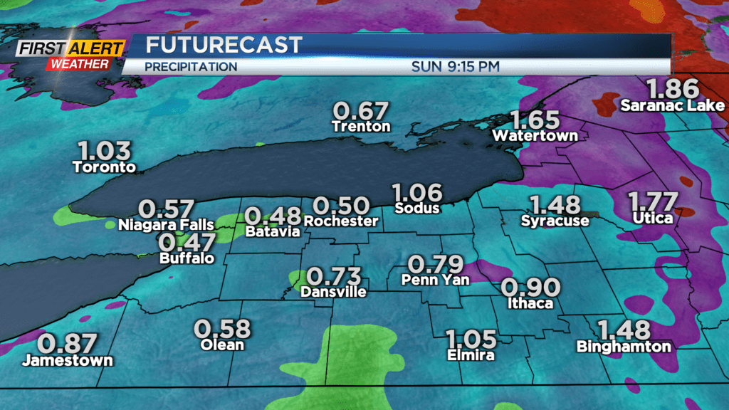
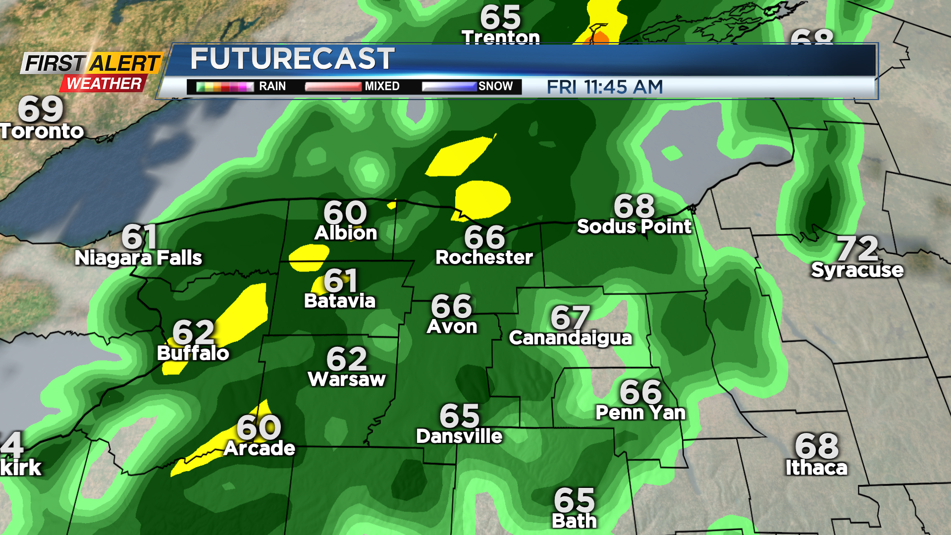
Reality sets back in starting Friday morning with a cold front moving through. Showers will arrive with the sun, and slowly cross the area from west to east through the morning into the middle afternoon. This is a slow moving front, so expect a length period of showers and rain, but we should see the wettest weather tapering by evening. A few more showers may fall overnight, but generally speaking we should see some clearing in the clouds. The weekend won’t be a washout, but we will be dealing with some rain, cooler air and some wind.
Breaking it down for you – Saturday will be the nicer weekend day, with just a few passing rain showers, and temperatures near 60 degrees. We’ll also feel a bit of a cooler breeze, but nothing too major. A secondary cold front moving in late Saturday will bring in another push of even cooler air, which will drop our temperatures into the upper 40s and lower 50s on Sunday, but it will also fire up the lake effect machine. The air will be cool enough for some lake enhanced and lake effect rain off and on through the day, along with a gust wind at 30 to 40 mph at times.
This should cause any issues, but it will add insult to injury when it comes to how cool the air feels.
We’ll remain quite cool into early next week, with highs in the lower 50s, but with mainly dry weather. Only a few passing showers Monday through Wednesday. There are some signs that we may enter into a similar pattern by late next week and possibly into next weekend, which means we could see another quite cool and unsettled weekend. That is still a ways away, so stay tuned.