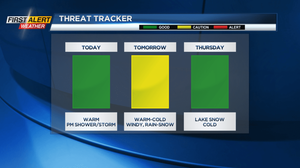
First Alert Weather: Record high is possible on Tuesday and Yellow Alert for Wednesday
ROCHESTER, N.Y. — Temperatures will soar into the mid 60s on Tuesday and few towns could be near 70 in the afternoon with a gusty south wind.
Clouds will increase later into Tuesday with a passing shower or thundery downpour possible for some late afternoon or early evening. Expect scattered showers and thunder overnight with temperatures staying in the low 50s.
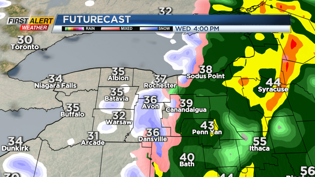
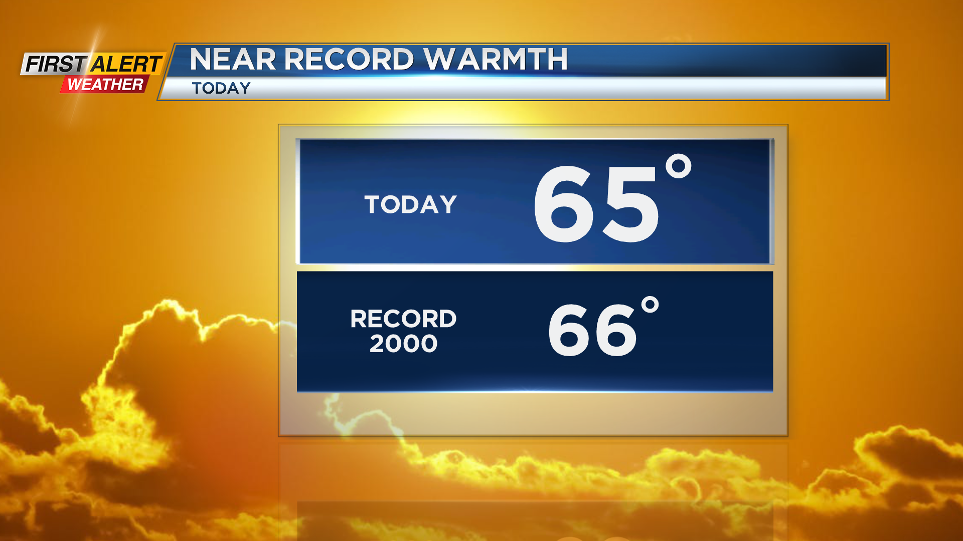
It will be very warm start to our Wednesday as temperatures in the 60s could break the record. Rain and thunder will arrive during the afternoon as a strong cold front crosses the region. Temperatures will quickly fall into the 30s later into Wednesday and into the 20s at night.
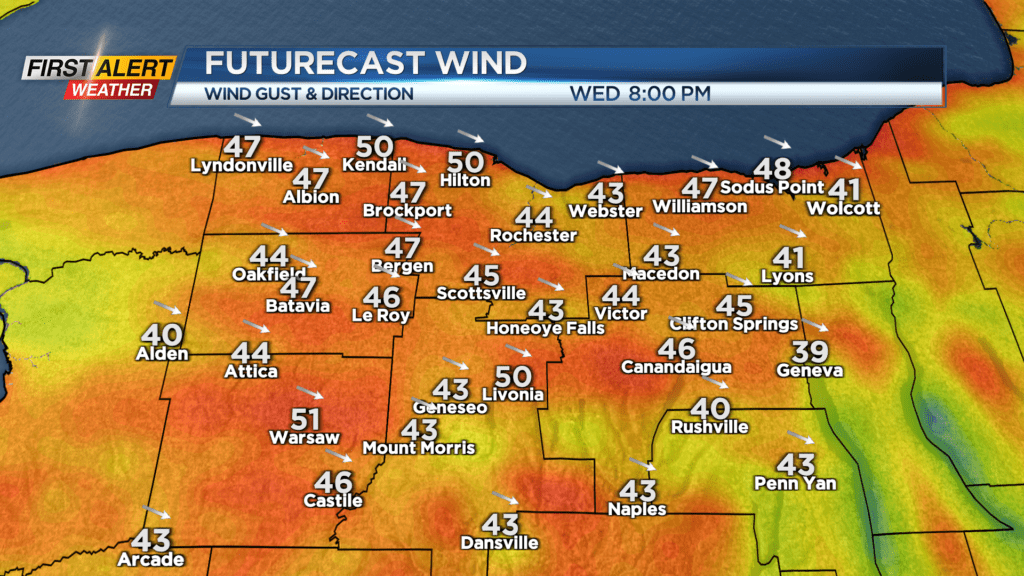
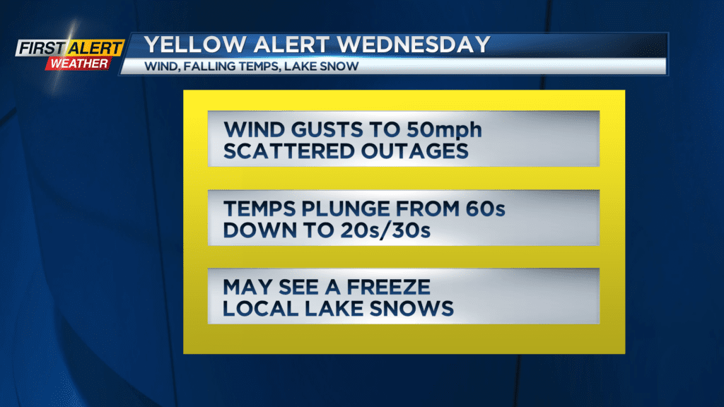
A Yellow Alert for the weather on Wednesday will cover several issues. One will be strong winds as gusts up to 50 mph that will develop along and behind the cold front. As temperatures drop, any moisture on the roads may freeze up toward the evening, making for slick roads.
Local lake snows will develop at night into Thursday morning as a few inches of snow could accumulate near Route 104 and Wayne County. Weather will clear and warm back up headed into next weekend. Stay tuned to News10NBC for the latest on the wind and snow threat for later into Wednesday.