First Alert Weather: Record warmth this afternoon, but it comes with gusty winds
[anvplayer video=”5146324″ station=”998131″]
ROCHESTER, N.Y. It is a wonderful start across the region this morning as temperatures are starting near 60 degrees!
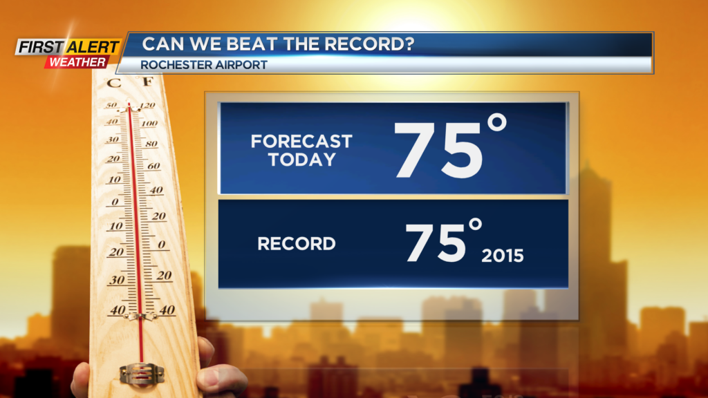
We are only going to warm up once again as we move through our Saturday. Highs this afternoon will reach record temperatures as we are forecasting a high of 75 degrees. This would tie the record of 75 set back in 2015, and we have a good chance to break that later today.
The two changes for today will be the increased cloud cover and gusty winds. First, we will start with sunshine before clouds increase this afternoon and evening. We will remain dry, but mostly cloudy skies are expected this evening and early tonight.
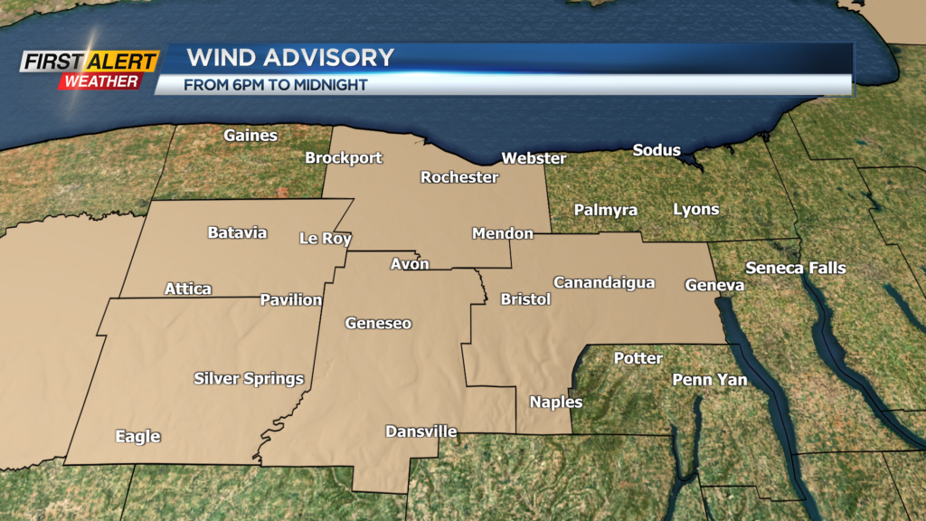
As for the winds, a Wind Advisory will go into effect for Monroe, Livingston, Ontario, Genesee, and Wyoming Counties at 6 p.m. with gusts potentially near or over 40 m.p.h. No Yellow alert, as strong gusts will be localized rather than widespread.
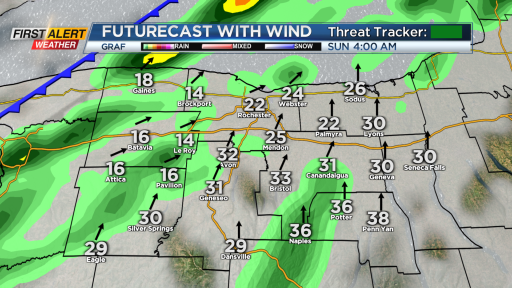
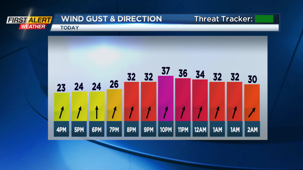
We will be breezy through today with gusts near 30 m.p.h. through the afternoon, but the windiest time of the day will be this evening and tonight before a cold front swings through. This cold front will bring us a chance for scattered showers after midnight before drying out early Sunday morning.
A few showers may linger into early Sunday afternoon east of Rochester, but most of the region will dry out by the middle of the day. Afterward, we will remain breezy with gusts near 20 m.p.h., but the sunshine will return in the afternoon as highs reach the upper 60s.
Also, don’t forget to turn back those clocks tonight as we fall back and enjoy the extra hour of sleep. Tomorrow’s sunset is 4:55 p.m.