First-Alert Weather: Records keep falling for Rochester
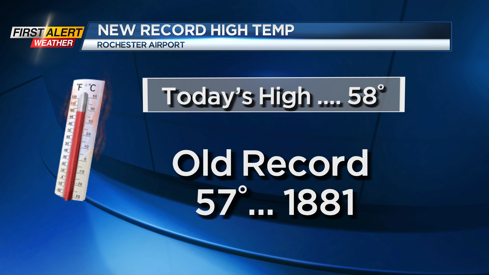
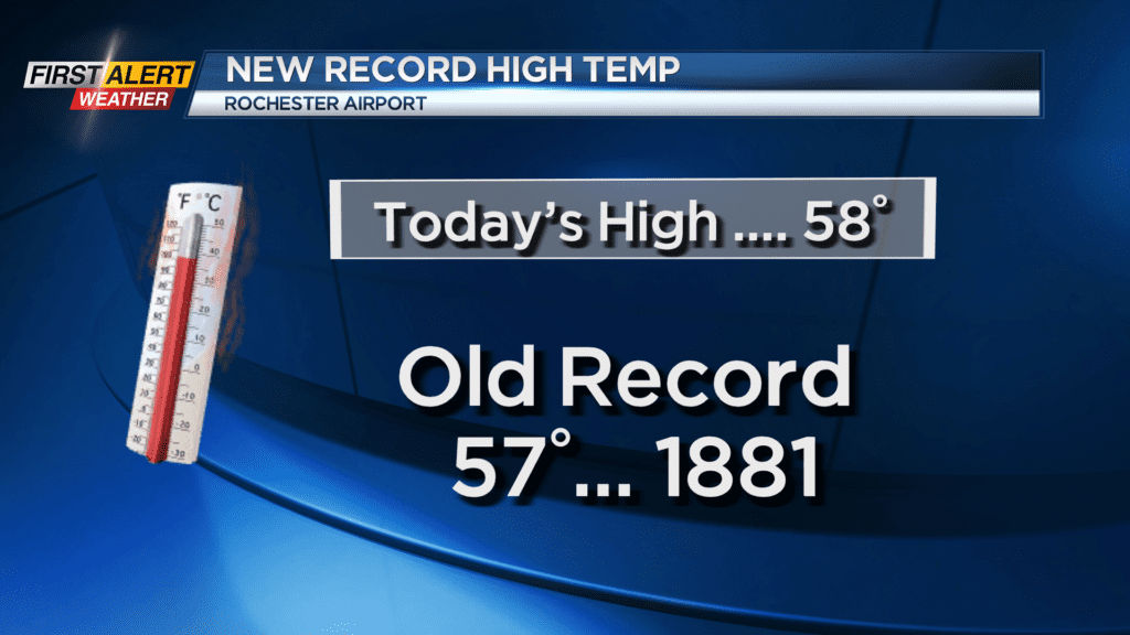
Saturday was the second time for a record high temperature for the Flower City. If you remember, Friday we reached 62 degrees, which tied the record set back in 2001. On Saturday, the Rochester airport pushed the temperature to 58 degrees. The old record was 57 degrees set back in the year 1881. This is a record that has stood for 143 years! Looking forward in time, the record warmth will be coming to an end.
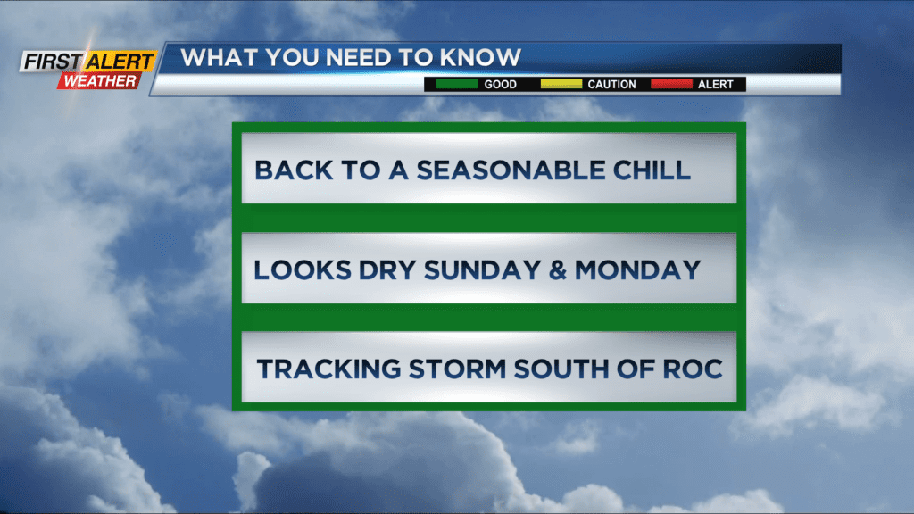
One cold front has already passed through Western New York. This will serve to bring a more seasonable chill back to the area with more typical winter weather for the remainder of this week. The News10NBC First Alert weather team has been tracking a storm which will be moving from the Tennessee Valley to the Delmarva Peninsula for late Monday into Tuesday. This appears to be far enough to the south to put Western New York right on the edge of any accumulating snow. The Southern Tier, along the Pennsylvania border, will see most of the accumulation with 3 to 6 inches possible over this portion of the state and the higher elevations of near Binghamton measuring as much as 8 to 10 inches. Once again, Rochester will miss out on the big snow.
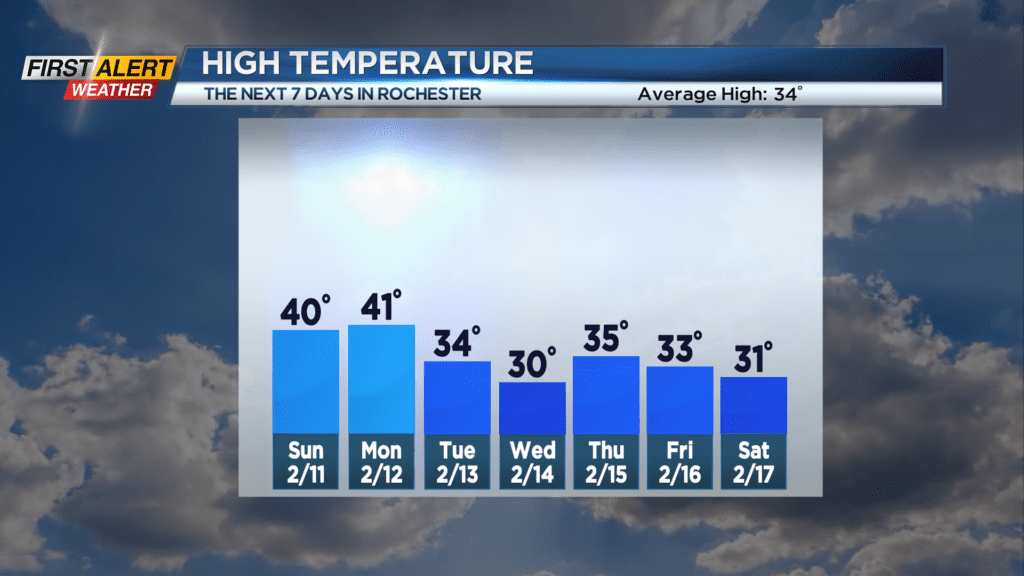
Saturday night, look for mostly cloudy skies and a temperature falling into the lower 30s. Sunday looks dry with mostly cloudy skies. We may see a few breaks of sun for the afternoon, with the high temperature near 40 degrees Monday, just a mix of clouds and sun with the temperature again near 40 degrees. Tuesday, there could be a few flurries or a snow shower south of Rochester with the temperature in the middle 30s.
Stay tuned to News10NBC First Alert Weather for any updates on the forecast.