First Alert Weather: Rochester may see the warmest Christmas in 40 years
The cold air will be difficult to come by during this Christmas holiday.
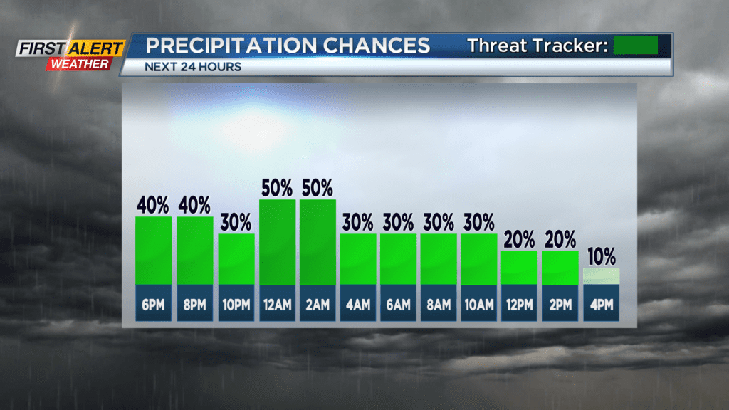
As a result, any precipitation will be in the form of rain over the next 24 hours as a rather weak area of low-pressure continues to move across the eastern Great Lakes. Maybe not good news for Santa and his sleigh, but certainly a better forecast for other travels through the holiday.
As the weather begins to dry out later on Christmas Eve, a more pronounced southerly wind will be developing. This will serve to push the temperature well above normal for December 25th. Instead of being in the usual mid-30s, the mercury will end up in the low to middle 50s.
Depending where the high temperature ultimately ends up, this could be the warmest Christmas day in more than 40 years for Rochester.
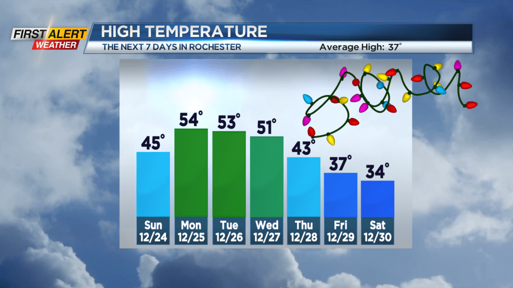
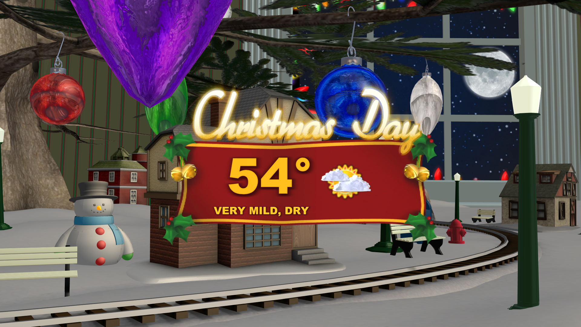
Saturday night, look for passing light rain showers with maybe some drizzle and light fog. The low temperature will be in the upper 30s. Sunday, Christmas Eve, will bring a spotty rain shower for the morning. Otherwise for the balance of the day, look for just gray skies. The temperature will reach the middle 40s. Christmas Day, clouds will give way to partial sunshine. Again, it will turn out to be unseasonably warm with the high temperature close to 54 degrees.
More rain is likely later Tuesday and Wednesday. However, the temperature will begin to fall for Thursday with a much better chance of by the end of the week.
Stay tuned to News 10NBC First Alert Weather for updates on the forecast.