First Alert Weather: Shower returns on Thursday, followed up by a brief visit from winter
ROCHESTER, N.Y. — We’ve lost the beautiful sunshine of the last few days, but we’ll hang onto the mild air for one more day on Thursday.
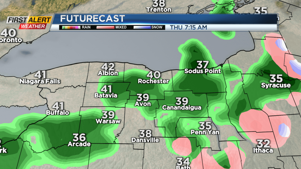
Temperatures should reach the mid and upper 40s on Thursday, but we’ll see off and on rain showers, become more widespread later in the afternoon. A few showers may linger into Friday morning, before tapering as a cold front passes through. A second cold front plows through later in the evening. This may bring some brief snow showers, but the drop in temperatures will be the bigger weather story.

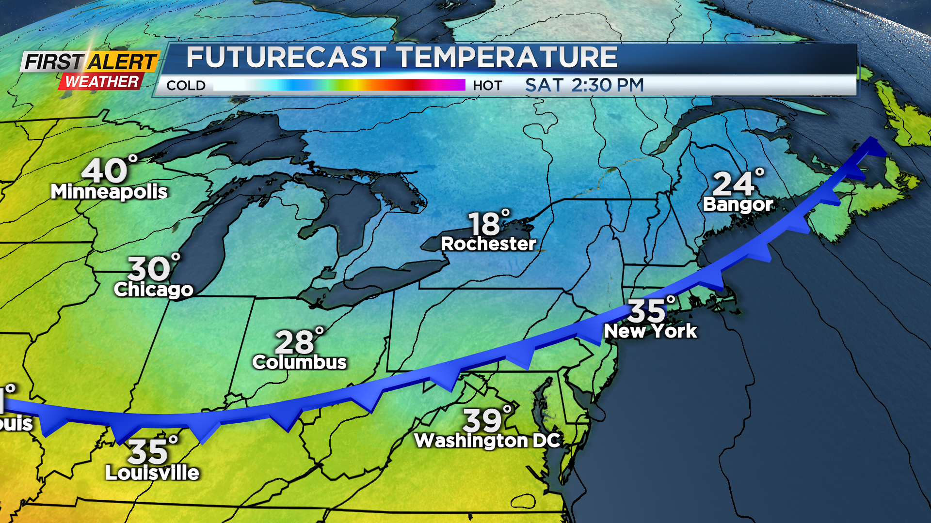
Temperatures will drop from the lower 40s on Friday into the 30s Friday evening, and teens by Saturday morning. The weekend starts off quite chilly with highs only making it into the lower 20s after starting in the teens. The air will be fairly dry, but we should see some light lake snow showers, especially earlier in the day. Sunday will start off chilly in the teens, but climb nicely into the 40s with some sunshine.
Clouds thicken up later in the day but we should stay dry. We’ll see another impressive warm up next week ahead of another powerful storm system. This will push temperatures well into the 50s and perhaps 60s by Tuesday and Wednesday, but this will come with a breeze and some rain, followed by another big drop in temperatures by Friday. Despite the wild temperature swings, we don’t expect any wild weather or big storms through next week.