First Alert Weather: Showers and cloudy today before storms tomorrow
[anvplayer video=”5134303″ station=”998131″]
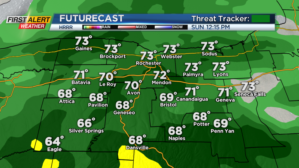
ROCHESTER, N.Y. A cloudy and cool start for us on this Sunday, and it looks like this will continue with rain arriving later this morning.
Rain will arrive this morning and continue into the early afternoon hours before turning scattered then isolated this evening. Rain may be a little heavy at times, but mostly light for today. Keep the umbrellas and rain coats with you today.
Also, with the thick cloud cover once again in place, we will struggle to warm up as highs this afternoon only reach the lower 70s. Many will also be stuck in the upper 60s this afternoon. We will begin to dry out tonight before another round of showers and storms moves in for Monday.
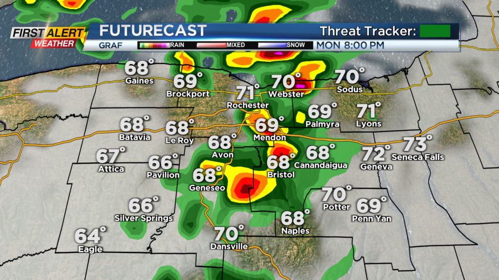
Most of the day Monday will be dry, but we will start off the day with mainly cloudy skies before sunshine tries to break through toward the middle of the day and into the afternoon. This is where things could get a bit interesting.
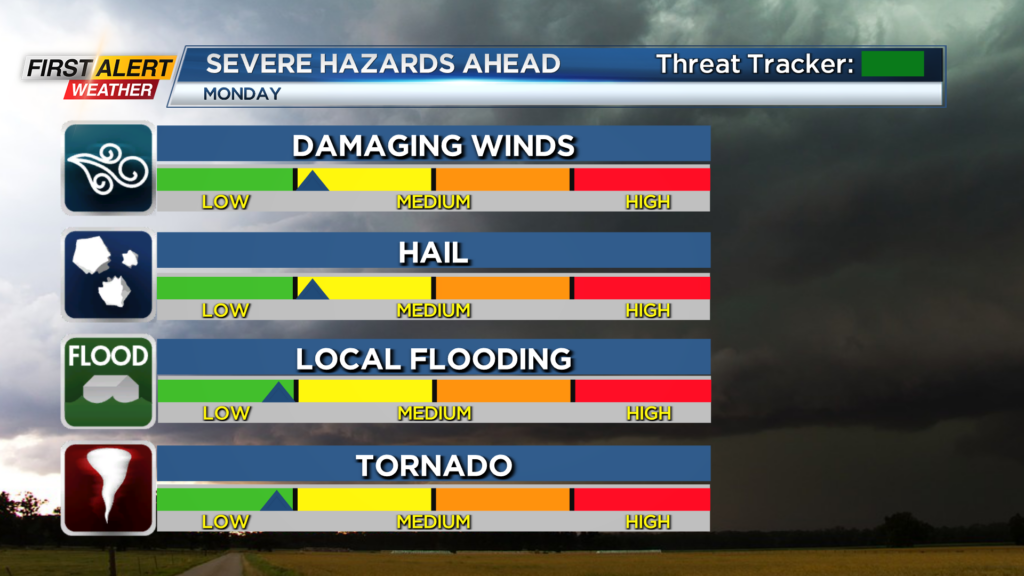
Depending on how much sunshine will be available, we could see a strong storm or two in the evening. The cold front will begin to push through during the evening hours tomorrow and could pop a few thunderstorms depending on the energy available.
Also with a decent support of upper-level winds, we could have a storm or two be on the stronger side of things with gusty winds and small hail. No Yellow Alert as of Sunday morning, but something to keep an eye on after 3 p.m. Monday.
First Alert Meteorologist Alex Bielfeld has your Sunday forecast.
One thing to note as well is that we will be near the center of low pressure, which could provide a bit more spin in the atmosphere for rotating storms Monday evening. This severe threat does not look widespread but something to monitor through tomorrow if we break out to more sunshine.
After this system passes through though, we will be looking at drier weather by Tuesday evening, and then cooler weather into the end of the week with another taste of fall!