First-Alert Weather: Showers linger Wednesday, then clear for Thanksgiving
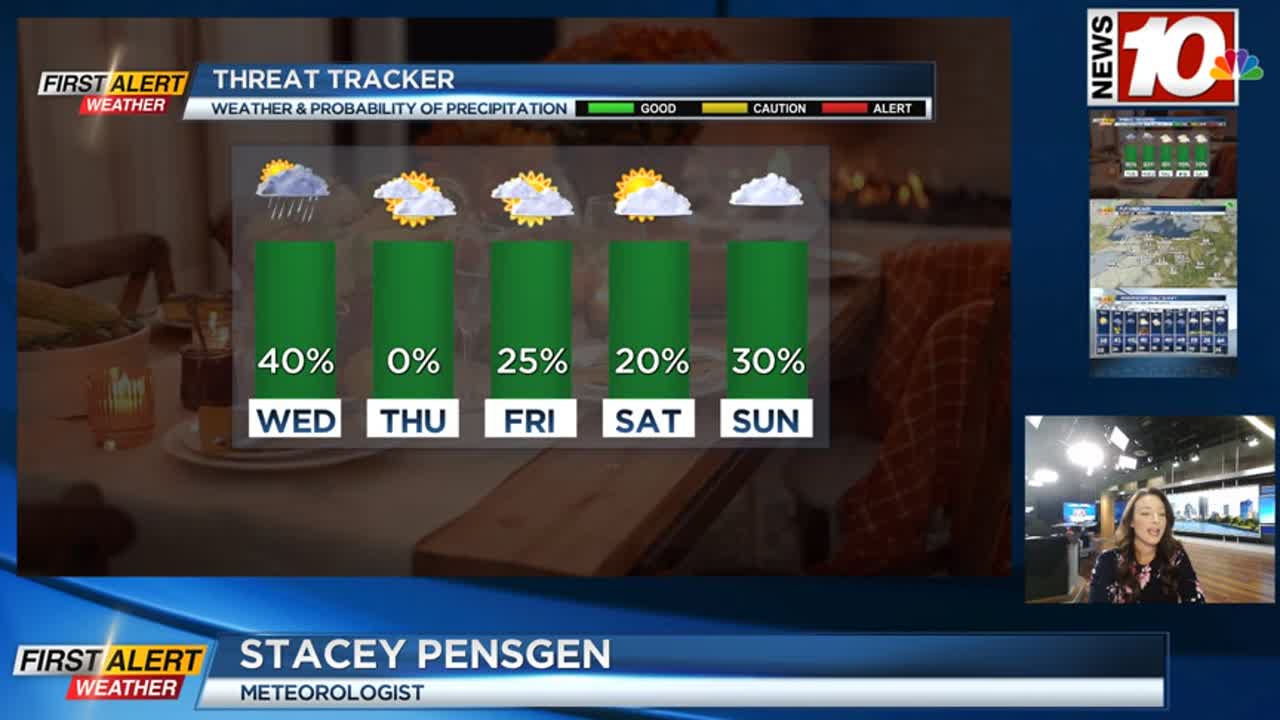
Steady rain from Tuesday tapers to scattered showers overnight and into Wednesday morning, before ending altogether. Temperatures will actually rise overnight into the 40s and stay there much of Wednesday, before dropping back a bit late Wednesday. As luck would have it, our nicest weather will fall on Thanksgiving Day! We’ll see intervals of clouds and sun, dry weather and seasonable temperatures in the upper 40s. So if you’re running in the Turkey Trot or just want to go for a post-dinner walk, weather shouldn’t be an issue. A cold front coming through late Thursday will bring in a push of much cooler air, but not much else.
Temperatures will drop into the 30s for highs for Friday and Saturday, with a limited late response. Dry air will limit any lake effect snow to just some lake flurries southeast of Lake Ontario with no accumulation expected.
Our next system moves in later Sunday, and could bring some mixed rain/snow showers Sunday night into Monday, but no accumulation, and travel shouldn’t be a concern. Then we’ll get another shot of chillier air by mid-week, which may bring some minor lake effect snow by Wednesday, but will most certainly bring much colder temperatures. So, we’ll be feeling winter in the 10-day forecast, but not necessarily seeing much of it yet.