First Alert Weather: Slow-moving storms and downpours slide east overnight
[anvplayer video=”5188793″ station=”998131″]
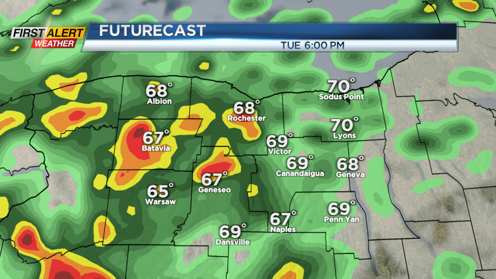
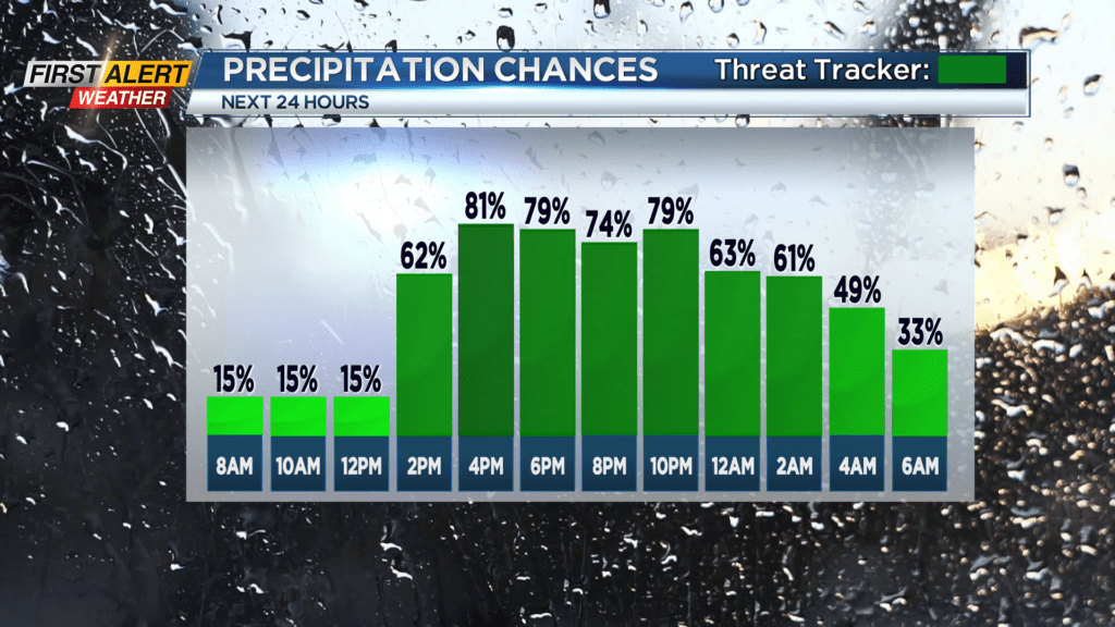
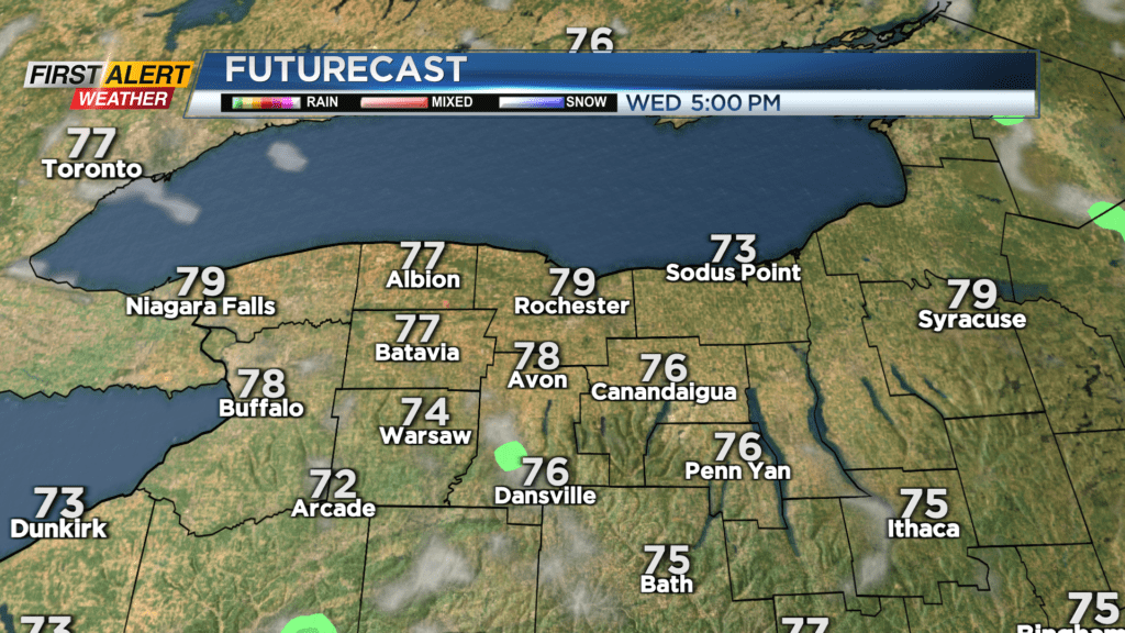
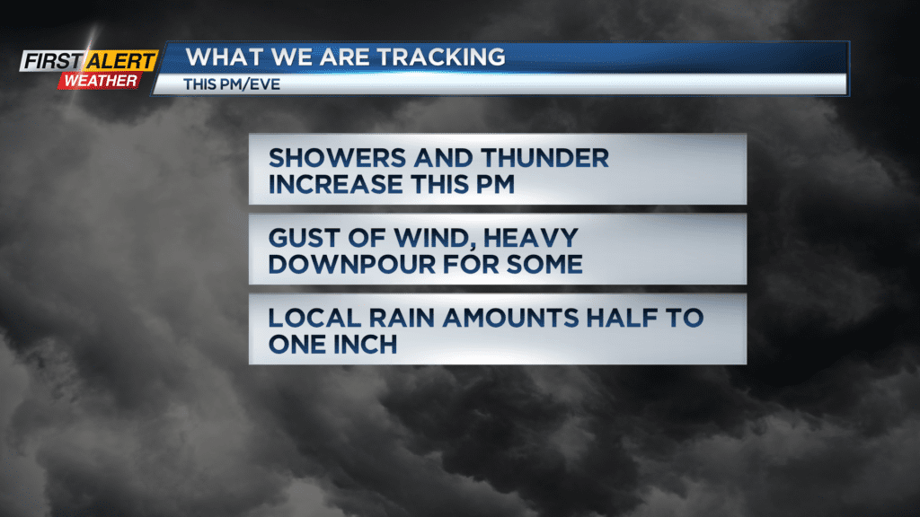
Wet weather has moved back in, with slow-moving showers and some scattered storms associated with an area of low pressure over Lake Erie. As this low moves overhead, the bands of rain will slowly pivot right over western New York. Any storm that moves in will have the potential to produce locally heavy rain, and some very localized flooding as a result of the slow-moving nature of them. A storm or two may also produce gusty winds. That low pulls east overnight, taking most of the rain with it. Wednesday starts off with some clouds and a few lingering showers, but drier air working in will bring a return to more sunshine through the afternoon.
We’ll crank up the heat a little more on Thursday, with highs rebounding back into the lower and mid 80s. Most of the day will be dry, but an approaching cold front will bring another round of storms. The timing of these storms appear to be late enough Thursday evening/night to reduce our risk of severe weather. But, if the front speeds up a little bit, we’ll need to watch the potential for some strong to severe storms Thursday evening. The cold front pushes east on Friday, with some lingering scattered showers in the morning, followed by a gusty wind by afternoon.
The weekend looks very nice at this point, with 70s on Saturday, 80s on Sunday and dry weather both days.