First Alert Weather: Snow and wind to end the weekend
ROCHESTER, N.Y. — Waking up this Sunday morning to a much colder start as temperatures are starting off in the upper 30s.
Unlike Saturday where we made our way into the upper 40s, we will see temperatures drop to near freezing by Sunday evening. That colder weather will bring a transition from rain to snow showers through the day on Sunday. A mixture of rain and snow is likely Sunday morning before we are all snow by the afternoon. Snow will have a tough time sticking through the day as temperatures will be above freezing for the most part.
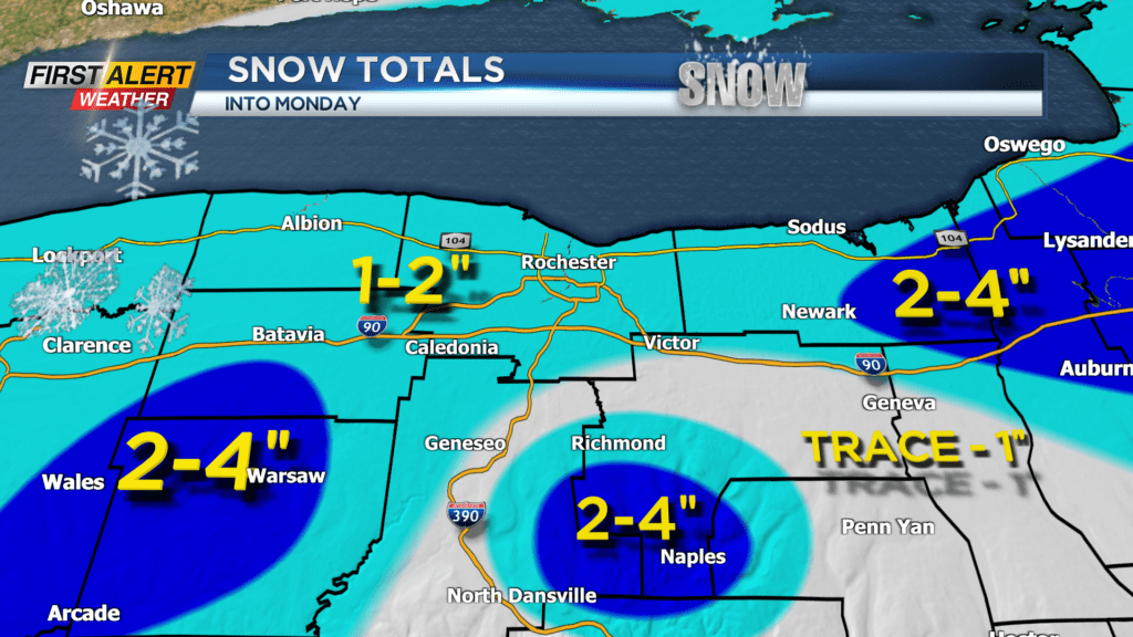
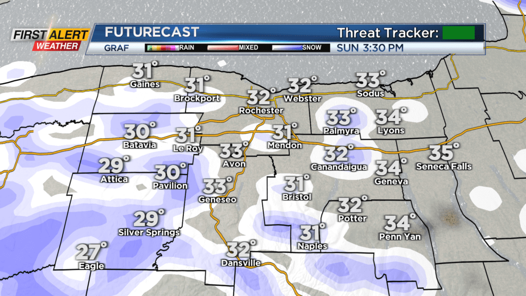
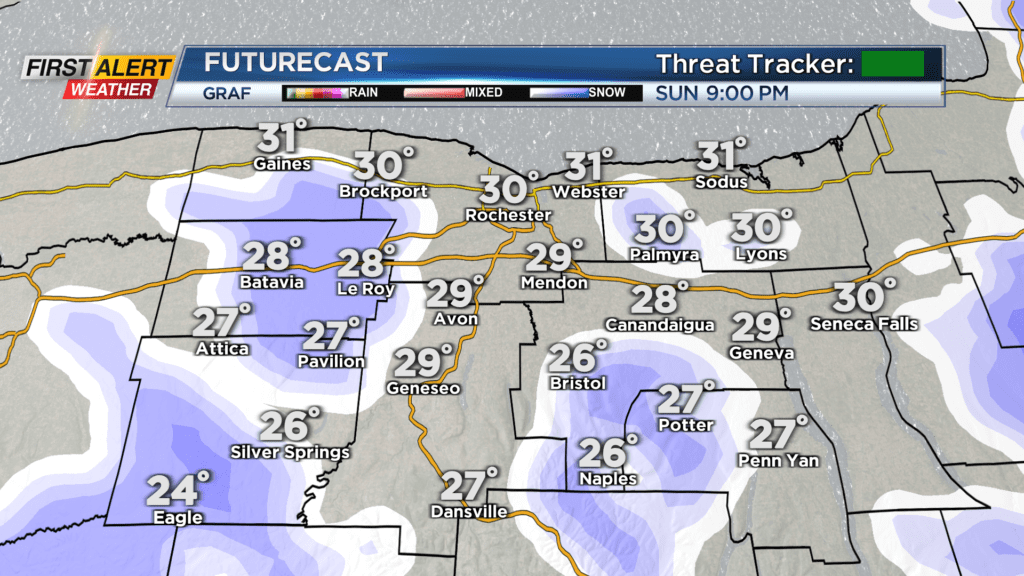
The higher elevations will see some accumulation during the day Sunday, but most will not. Once the sun sets Sunday evening, the snow will begin to stick across our entire region with snow showers through Sunday night. A few lingering flakes will be possible early Monday, but most are dry. When things are all said and done, generally an inch or two will be possible for most with higher elevations south receiving as much as four inches of snow.
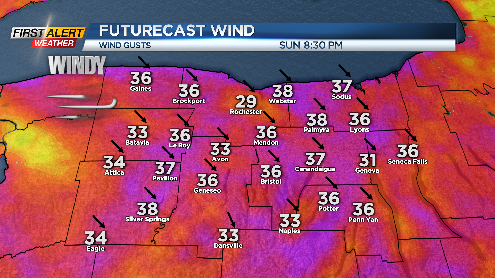
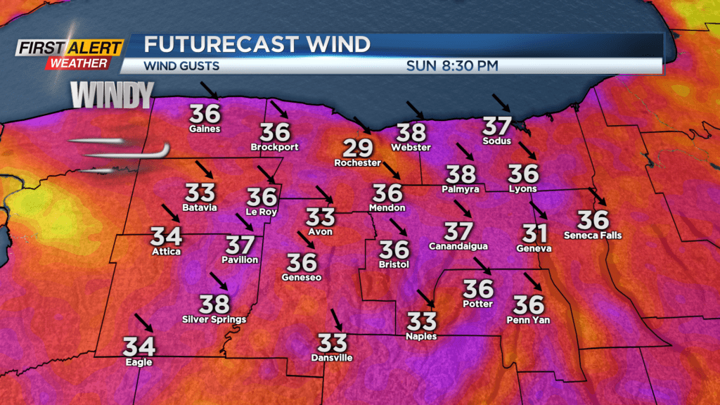
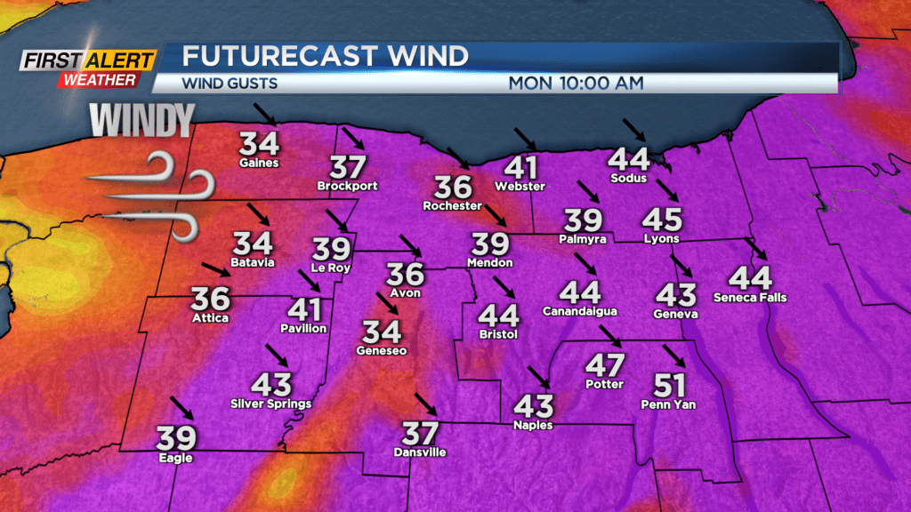
Winds will also pick up late Sunday and they will gust to about 40 mph from Sunday evening through early Monday afternoon. With that, the National Weather Service will let a Wind Advisory go into effect for Monroe, Wayne, Ontario, Seneca, Yates, Livingston, and Orleans Counties until then.
Power outages are not likely, but a few isolated outages are possible. The bigger story with the wind will be the wind chill. Wind chills from Sunday afternoon through Monday morning will be in the teens. After a snowy and cold start to Monday, the sun quickly returns with highs in the mid-40s and then near 60 for Tuesday!