First Alert Weather: Snow ends, sun returns

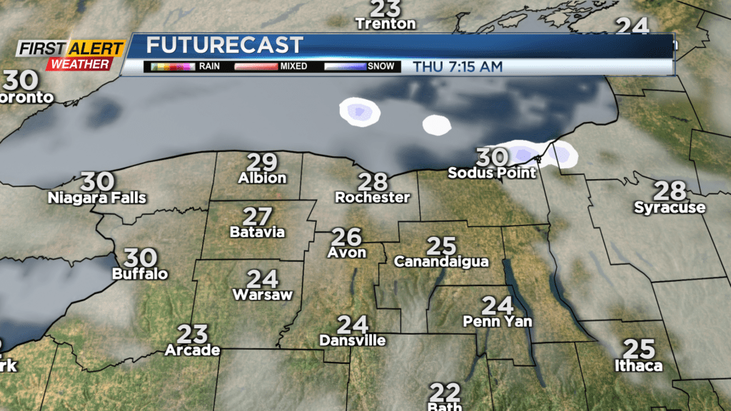
ROCHESTER, N.Y. — Lake effect snow will be coming to an end overnight Wednesday as high pressure begins to move in.
This will help to dry the air out, but also shift the wind, pushing the lake snow east and then out over Lake Ontario. Most of the accumulating snow will be confined to the Route 104 corridor, with several inches of fluff into parts of Wayne County. Thursday will see a clearing sky, and our sky becomes mostly sunny by the afternoon, and we’ll keep that sun around right into Friday.
In fact, Friday may be nice enough to play a quick round of golf, go for a walk outside, or even a bike ride with temperatures flirting with 50.
The weekend still looks decent with temperatures in the mid 40s and dry weather on Saturday. We’ll be tracking our next storm system moving up the coast on Sunday.
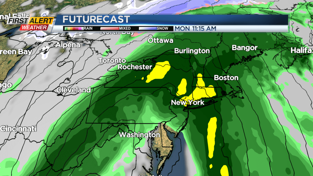
The majority of Sunday should remain dry, but rain will begin to work in from the south by late in the day and overnight. That will leave us with rain likely to start Monday. Depending on how quickly colder air moves in, we may see some snow on the backside of the departing low Monday night, before the moisture moves out. At this point though, this appears to be another big storm for the bit cities along the coast with wind and rain, and a mainly rain event for us, with limited snow potential.
This is still four to five days out, so stay tuned for any updates to this forecast.