First Alert Weather: Snow on Sunday with bitter cold this week

ROCHESTER, N.Y. — Waking up to a wintry start in Western New York and the Finger Lakes with snow covered grounds and cold temperatures.
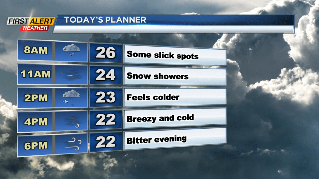
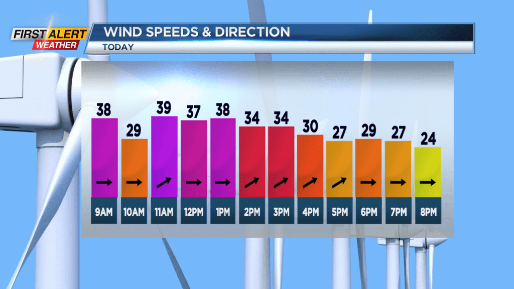
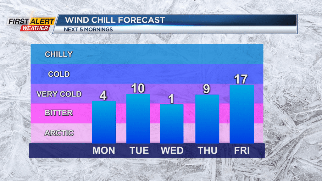
Temperatures are starting off this Sunday in the mid-20s but will drop again with them in the teens by the evening. Winds will also remain gusty at times, but damaging gusts are not expected. A Wind Advisory is still in effect for Wayne, Ontario, Yates, and Seneca Counties until 4 p.m. Sunday. Winds will be gusty and blustery at times Saturday with gusts near 40 mph possible. No power outages are expected as the bigger story with the winds will be the real feel. Wind chills Sunday will be in the teens early before dropping into the single digits this evening, and then near zero by Saturday night.
As far as lake effect snow, most of our region will not see much through Sunday nor Monday. For Sunday morning, the lake effect band will begin to drift back south and bring a period of snow across our region through the middle of the day. A Winter Weather Advisory is in effect for Monroe and Livingston Counties until 7 p.m. Sunday evening, and a Winter Storm Warning is in effect for Orleans, Genesee, and Wyoming Counties until 7 a.m. Monday. Visibility will be limited at times, and snowy roads are likely before things clear. As far as snow totals, an additional inch or two will be possible for most of us as the band drifts south. The band will then settle in Genesee and Wyoming Counties Sunday afternoon and bring additional accumulations there through Sunday night. The lake effect snow band will then begin to dissipate and lift back north on Monday with additional minor accumulations expected.
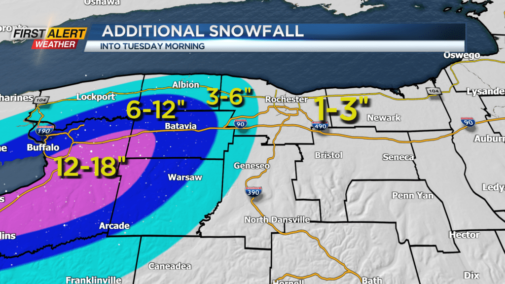

Areas within the winter storm warning could see anywhere between six and 12 additional inches by the end of the day Monday with even more expected out towards Buffalo. Speaking of Buffalo, Bills fans can expect cold and snowy weather for the Bills game Monday afternoon. Snow will not be as bad on Monday as it will be on Sunday, but snow showers and locally heavy snow will be possible early Monday morning near Orchard Park before the band dissipates Monday evening.
Prepare for extra time to head to and from Highmark Stadium on Monday, and also bring extra layers as wind chills will be near zero.