First Alert Weather: Snow returns to the forecast on Sunday
ROCHESTER, N.Y. — Waking up Saturday morning to another foggy and cloudy start.
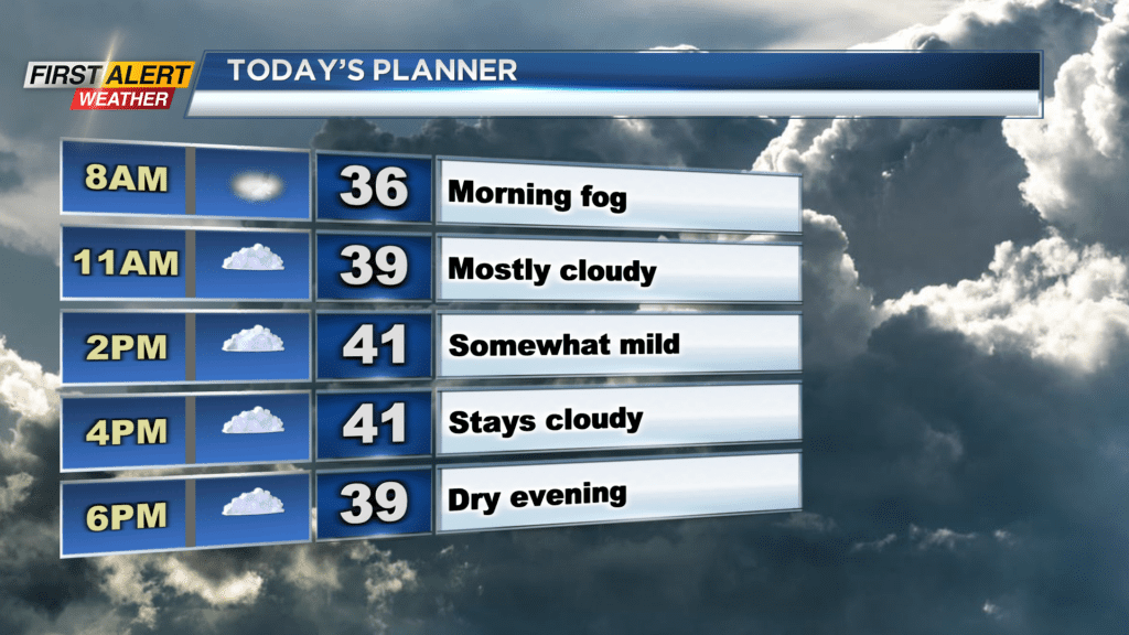
Fog Has dropped visibility to a mile or less in many locations, so make sure you take it easy on the roads Saturday morning. A Dense Fog Advisory is in effect until 10 a.m. for Genesee, Orleans, and Wyoming counties. Fog will lift Saturday afternoon and leave behind cloudy conditions. Cloudy skies expected through much of Saturday, along with afternoon highs near 40 degrees. Cloudy conditions Saturday will eventually give way to rain and snow showers by daybreak Sunday as our next weather maker moves in.
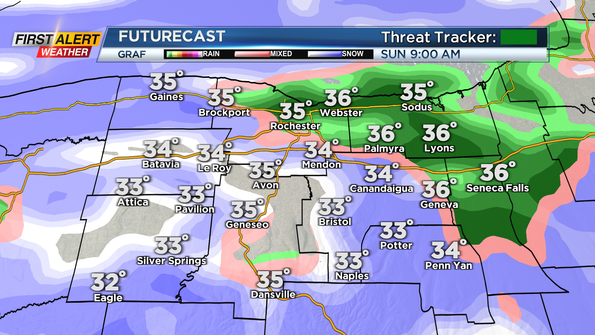
We will likely start off Sunday with a mixture of rain and snow showers before changing over to all snow by the middle of the day. Snow will continue through much of Sunday evening before transitioning over to snow showers Sunday night, and then drying out Monday morning. Snow on Sunday can be heavy at times, especially south of the thruway, but it will have a tough time sticking. This is because temperatures through early Sunday will be above the freezing mark, and snow won’t pick up in intensity until Sunday afternoon.

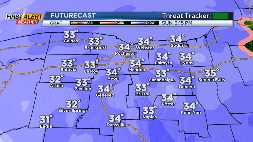
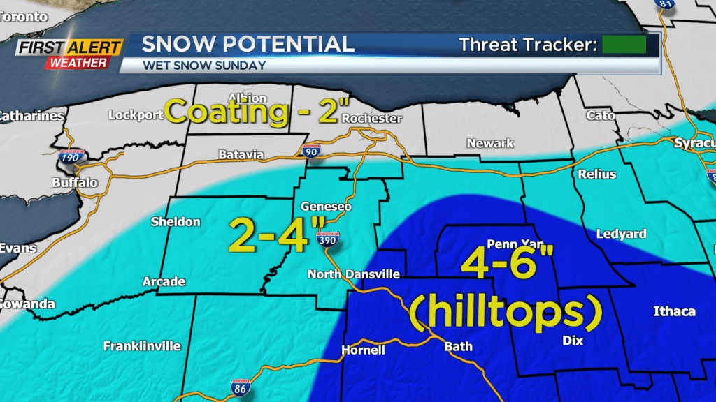
Best chance for snow accumulation Sunday morning will be the higher elevations as they will be closer to freezing. We will all eventually cool down to the freezing mark Sunday afternoon, and this is when most of us will see accumulation. By Monday morning, a coating to two inches will be possible for those north of thruway with areas south expecting between two and four inches of snow.
The highest hilltops in the Finger Lakes southeast could potentially see between 3 and 6 inches of snow when things are done. Threat Tracker remains green as no big issues are expected, btu a few slick spots will be possible on Sunday.