First Alert Weather: Two days of calm weather then a Yellow Alert for Tuesday
[anvplayer video=”5167078″ station=”998131″]
ROCHESTER, N.Y. – Two areas of low-pressure are located in the western portion of the United States on Saturday.
These two storms will trek across the country and will eventually have an impact on Western New York in the coming days with an accumulation of snow. Until that happens our weather will be largely uneventful.
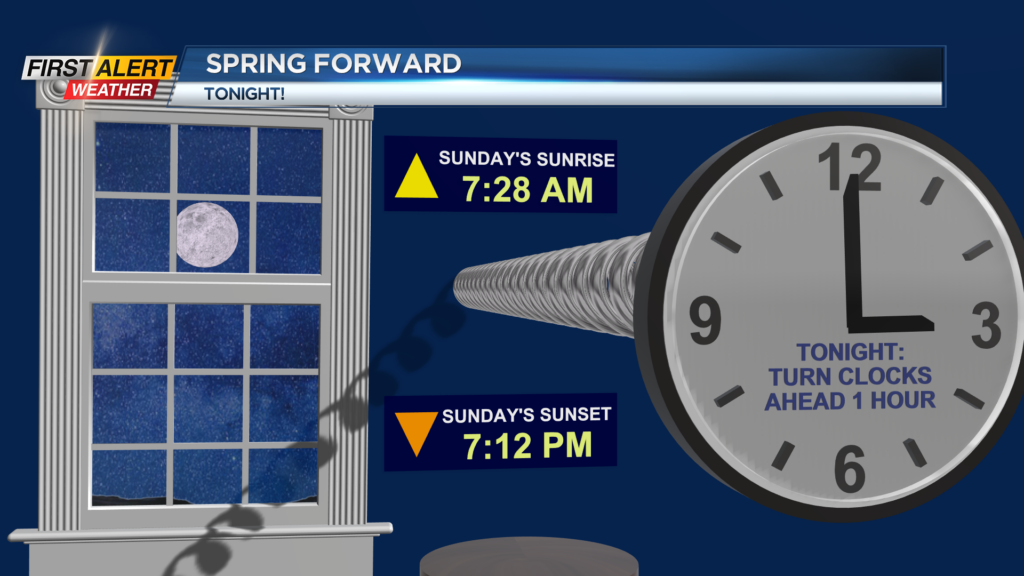
On Saturday night, look for patchy clouds with increasing clouds. It should remain dry with low temperatures near 19 degrees. In addition, at 2:00 AM we will revert to Daylight Saving Time. Do not forget to “spring ahead” one hour for early Sunday morning.
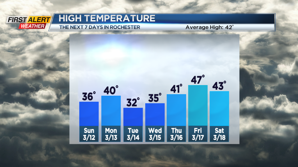
Sunday the skies may brighten from time to time, otherwise look for mostly cloudy skies. There could be a few flurries lake side, otherwise it will be mainly dry with the high temperature in the middle 30s.
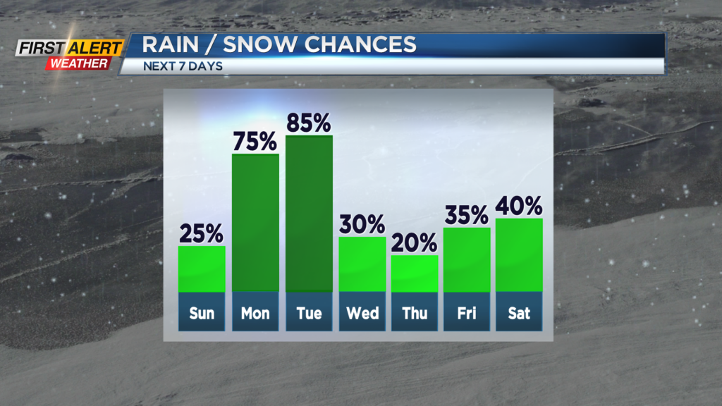
Monday will bring a few rain and wet snow showers. The high temperature is expected to reach near 40 degrees. Tuesday, the News 10NBC First Alert meteorologists have issued a yellow alert for a developing storm. This will eventually turn into a potent coastal storm with early indications showing significant snowfall totals well east of Rochester.
This could be a “shutdown” storm for communities in eastern New York. Right now, it appears Rochester will be on the edge of heaviest of snow, but shoveling will still be likely Tuesday and Tuesday night. It is too early to predict exact measurements as the exact track of the storm is not known.
However, it is recommended to stay tuned to News 10NBC First Alert for updates on the forecast – especially if your plans include travel.
______________
Download the WHEC First Alert Weather app to stay up to date while on the go.
Watch the latest full forecast online.