First Alert Weather: Soggy weather returns tonight
[anvplayer video=”5188667″ station=”998131″]
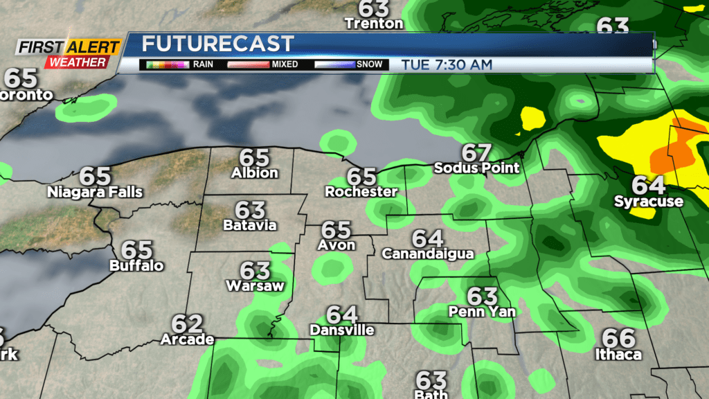
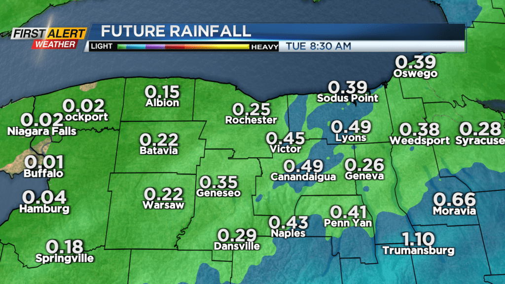
We enjoyed dry weather on Monday, but a wave of low pressure moving in will bring showers and a few hours of a steadier rain to the region tonight. The steadiest and heaviest rain will likely fall south of the Thruway overnight, with 0.50-0.75 inches of rain there, and generally a tenth to a quarter of an inch closer to Rochester. The Lake Ontario shoreline will see the least amount of rain.
The bulk of the wet weather will be east of us by Tuesday morning, with mainly dry weather through the morning and midday, but we won’t be done with the wet weather. Scattered showers and some thunder will likely return by the afternoon and evening as the main low moves overhead. Once that pulls away, we’ll see some lingering showers Tuesday night, with most rain gone by Wednesday.
That will lead us into nearly two days of dry weather — which, as you may know, has been hard to do for much of this summer! Wednesday will see a clearing sky with warmer air on Thursday. Our next cold front arrives late Thursday and into Friday. If the front speeds up a little bit, and arrives earlier on Thursday, we may see a stronger storm or two, but for now, we’re green on the Threat Tracker with no concern for severe weather.