First Alert Weather: Some rain will fall on your weekend plans
[anvplayer video=”5174563″ station=”998131″]
ROCHESTER, N.Y. If you have any plans outdoors this weekend, you’ll need to plan around some wet weather.
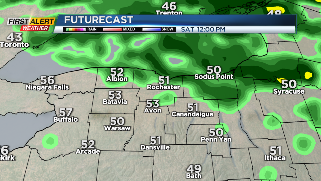
Showers Friday night will linger into early Saturday morning, then tend to taper off. That means we’ll see a drying trend after Saturday morning. It may not be completely dry the rest of the day, but it will most certainly be the drier weekend day, with just a passing shower or two.
We may see some limited breaks of sun, but clouds will rule. Sunday is trending wetter, with rain redeveloping by Sunday morning. Expect periods of steady rain and heavy rain in some spots. The heaviest rain looks like it’ll fall later in the afternoon and evening and may line up east of Rochester into the Finger Lakes.
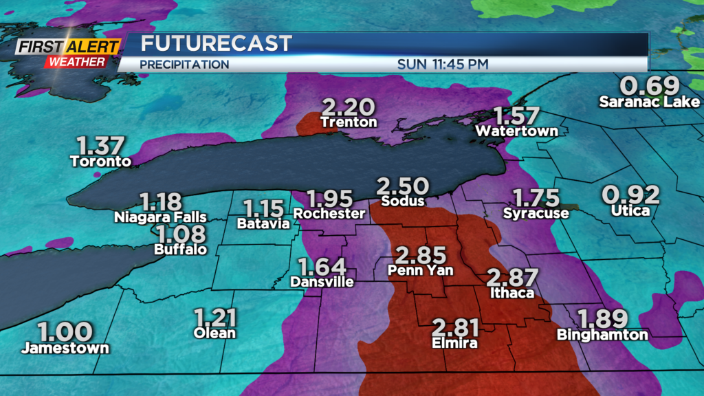
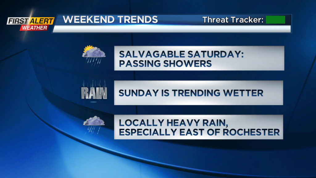
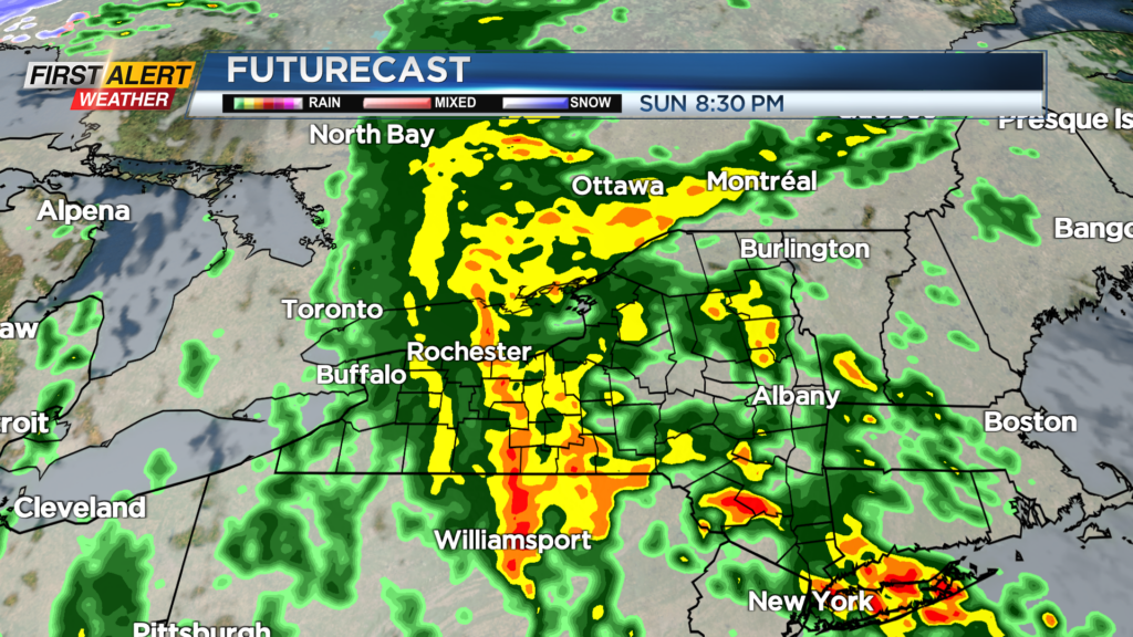
Most of the area will see 1-2” of rain, but it is possible parts of the Finger Lakes may end up on the higher end of that, possibly pushing 2.5” of rain from Friday evening through Monday morning. This may cause some ponding on roads and poor drainage areas. Check your sump pump if you tend to have a wet basement.
Compared to Sunday, Monday will be drier, but scattered showers will still fall, and it’ll be turning cooler and breezy. Temperatures will fall back through the 50s on Monday and hold in the 40s on Tuesday and most of Wednesday.
It may be cool enough for some wet snowflakes in the hilltops south of Rochester later Tuesday and into early Wednesday. Much of next week will be cooler than average and unsettled, but we are seeing some improvements by the end of next week, hopefully into next weekend.