First Alert Weather: Some showers return Tuesday
[anvplayer video=”5191797″ station=”998131″]
ROCHESTER, N.Y. — Some sun and dry weather made a return to start the new work week, and that’ll lead us into a quiet overnight.
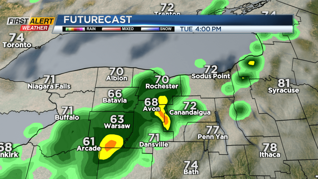
A partly cloudy sky Monday night means we see at least some sun to start Tuesday, but it won’t last. We’re waiting on a cold front to sweep through, which will not only increase our clouds, but increase our rain chances into the afternoon.
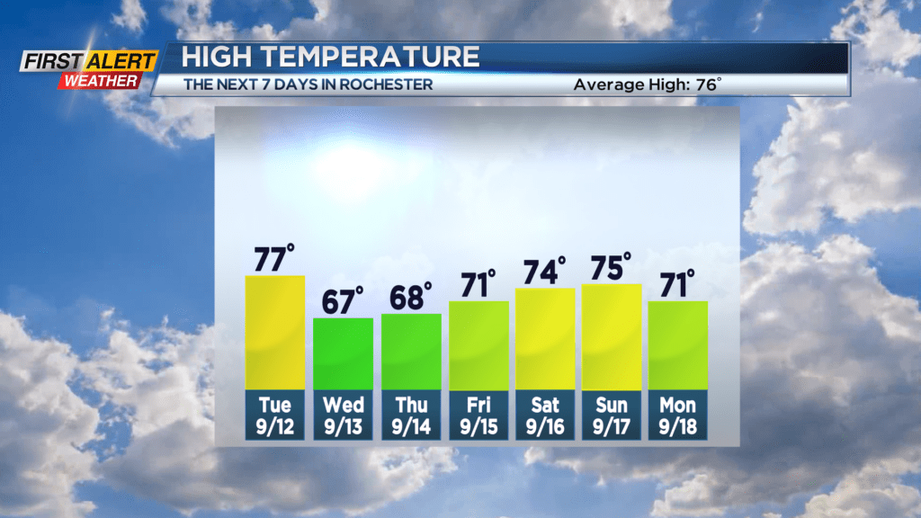
A rumble of thunder is also possible. Temperatures will make their way into the mid 70s before shower arrive. We’ll have a hint of fall following that cold front, with highs in the upper 60s to near 70 on Wednesday and Thursday. Both days will feature some sun and mainly dry weather with high pressure building in.
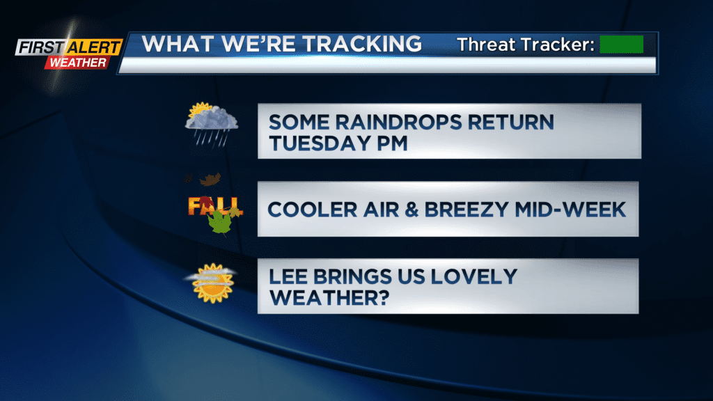
Hurricane Lee will be working it’s way north through the Atlantic off the east coast late week and into the weekend. While landfall isn’t expected, coastal New England may very well feel the impacts from the massive storm, with wind, waves and rain.
The only impacts for us will likely be some high clouds on Friday and Saturday, doing very little to block out our sun. In fact, our weekend is looking pretty nice, with dry weather and milder air on Saturday, and only the slight chance of a shower on Sunday.