First Alert Weather: Some sun and milder air mid-week
[anvplayer video=”5196255″ station=”998131″]
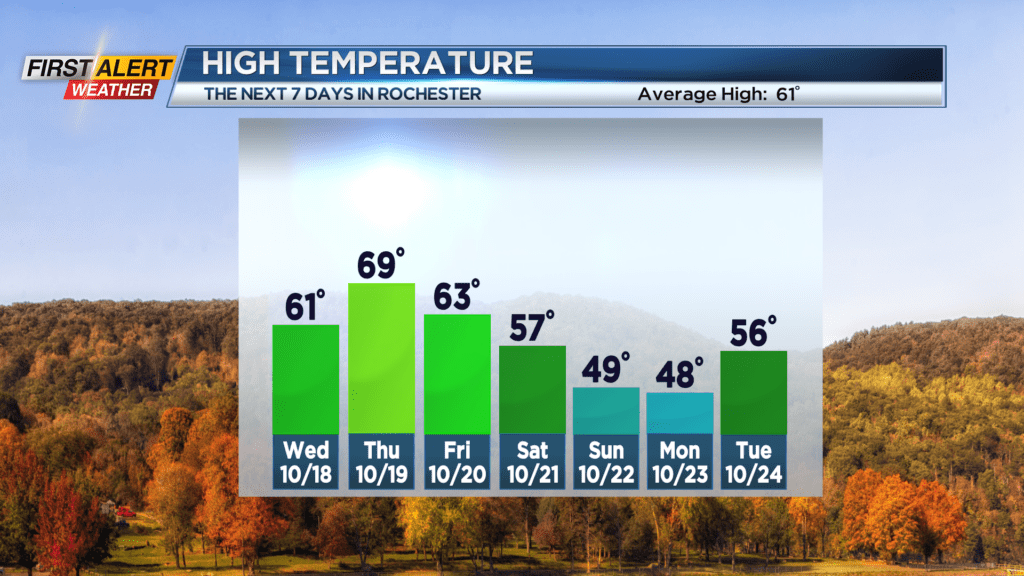
We’ve been stuck in the clouds so far this week with off-and-on light rain and drizzle, but we’re breaking that pattern starting now. Drier air moving in will help to clear some of those clouds tonight, leaving us with a mix of clouds and sunshine on Wednesday, along with temperatures in the lower 60s. Thursday will remain dry and turn milder, with highs pushing into the mid and upper 60s with the help of a southwesterly breeze.
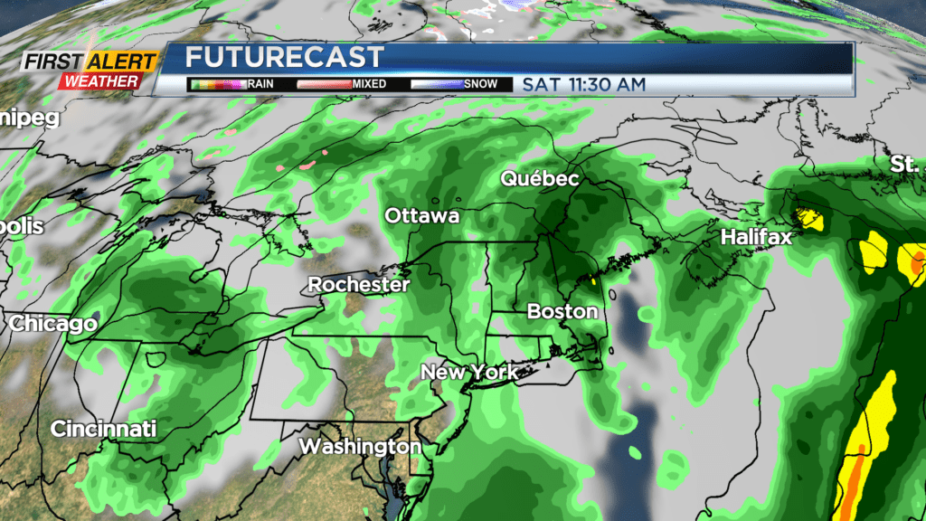
This is out ahead of our next storm system, which will bring rain back to the region starting Thursday night. Showers will continue off and on Friday and Saturday, as a coastal low begins to take over. This will help to draw down much cooler air for Sunday. In fact, it may be hard to make it out of the 40s on Sunday with a brisk breeze. Showers to start Sunday will tend to taper through the afternoon.
So, while we have rain in the forecast again starting on Friday, no day looks to be a washout at this point. Still, you’ll have to plan any outdoor activities this weekend around some wet weather.
We’ll see a drying and warming trend next week, with temperatures starting on Monday in the 40s, and climbing into the 50s on Tuesday, then 60s again by next Wednesday and Thursday with a nice dry stretch.