First Alert Weather: Some sun on Monday before rain and changes starting on Tuesday
[anvplayer video=”5155414″ station=”998131″]
ROCHESTER, N.Y. — We’re waking up to a cool Monday as a few folks head back to work and some kids head back to school.
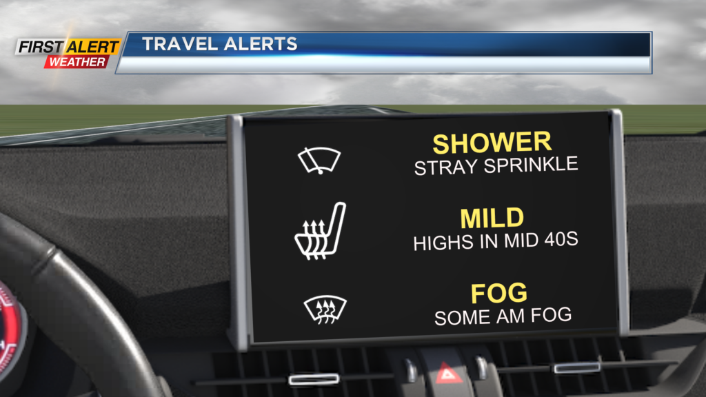
Temperatures will start off near 40 degrees in the morning before making their way into the mid 40s this afternoon. Monday morning will also come with a lot of cloud cover once again before some sun breaks its way through late in the afternoon.
There is the opportunity in the morning, before the sunshine, for a light shower or an isolated sprinkle. Although only a bit of unsettled weather today, a better chance for rain will roll in starting Tuesday.
An area of low pressure in the Central U.S. will move northeast, towards our region, and bring us rain for Tuesday and showers for Wednesday. Early Tuesday morning, there will be the chance for a light shower, but most of us are dry before rain rolls in by the mid-morning hours.
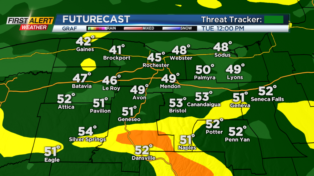
Rain will continue into the mid-afternoon on Tuesday before transitioning over to isolated showers Tuesday evening.
Rain on Tuesday could be heavy at times, towards the middle of the day, and limit visibility on roadways at times. Showers will then continue through Tuesday night and into Wednesday with scattered showers expected.
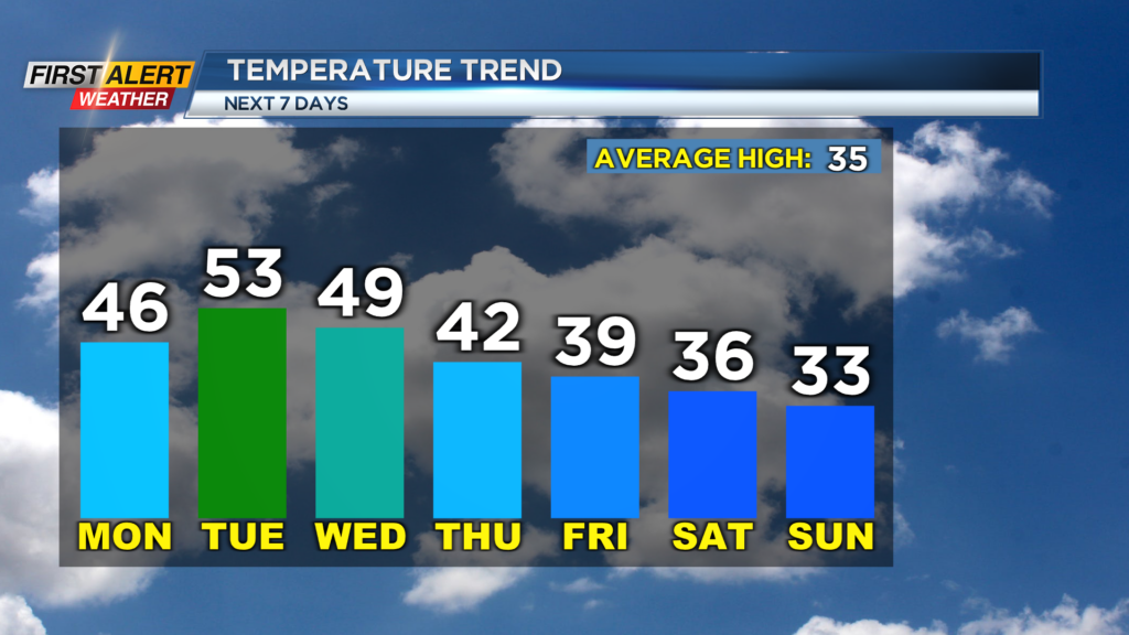
As far as temperatures over the next two days, it will all be determined on how far north a warm front moves. Models have trimmed down from the high of 60 degrees for Tuesday and have begun to show highs in the upper 40s and low 50s instead.
This is due to a southerly trend with the warm front, which is now being depicted to our south as opposed to our north. There is an even larger discrepancy for Wednesday.
Models remain in large disagreement on how far north the warm front moves. Depending on if it move to our north or not will once again determine how warm we get. A further south orientation of the front will leave our highs in the low 40s, while a northerly movement of the front will bring us highs in the mid 50s.
Right now, we are leaning towards the cooler solution as our forecast is cooling down our afternoon highs for Tuesday and Wednesday with a high near 50 Tuesday and mid 40s for Wednesday. Chilly air will continue to move in for the remainder of the week, and our afternoon highs will drop into the mid 30s by Saturday.
______________
Download the WHEC First Alert Weather app to stay up to date while on the go.
Watch the latest full forecast online.