First Alert Weather: Some sun, some rain for the first weekend of fall
[anvplayer video=”5137058″ station=”998131″]
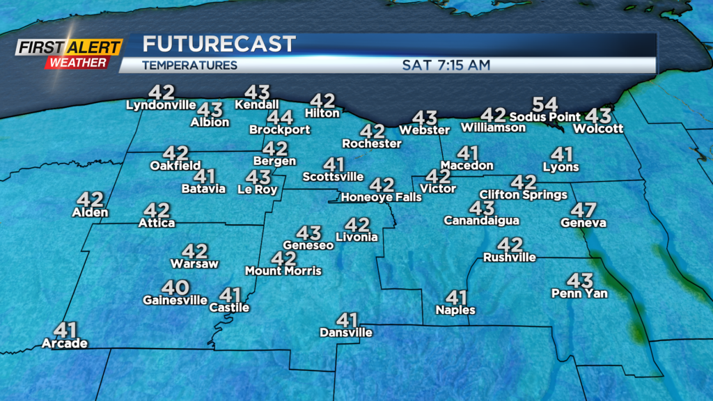
ROCHESTER, N.Y. We’ll start the weekend off chilly, with temperatures in the 40s, even some upper 30s well south of Rochester.
While widespread frost isn’t in the cards for us yet, we may see some patchy frost, especially south of the thruway. If you have particularly temperature-sensitive plants outdoors, it’s not a bad idea to bring them inside tonight if you live south of Rochester.
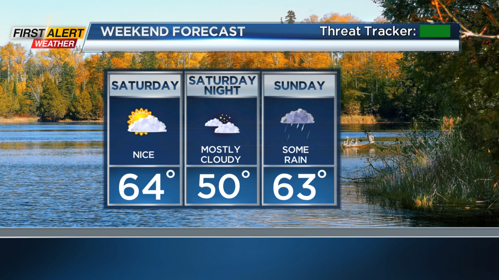
Despite the chilly start, we’ll warm back into the 60s on Saturday, which is still cooler than our average high of 71 but milder than the 50s of the last few days! Sunday will turn damp, with scattered showers, even a rumble of thunder.
Our unsettled and rather cool weather will continue into the first half of next week, as an upper level low spins overhead. We’ll see periods of rain, even some bands of lake effect rain, and temperatures in the upper 50s and lower 60s.
We start to dry out a bit by Thursday and Friday. The next tropical system will be Ian, and it will likely have an impact on the Gulf Coast states by early next week.
Where it goes from there is highly questionable, but there are some signs that it may track up the east coast, perhaps bringing us some remnant tropical rain by next weekend. We’ll keep you posted.