First Alert Weather: Spring is in the air Wednesday
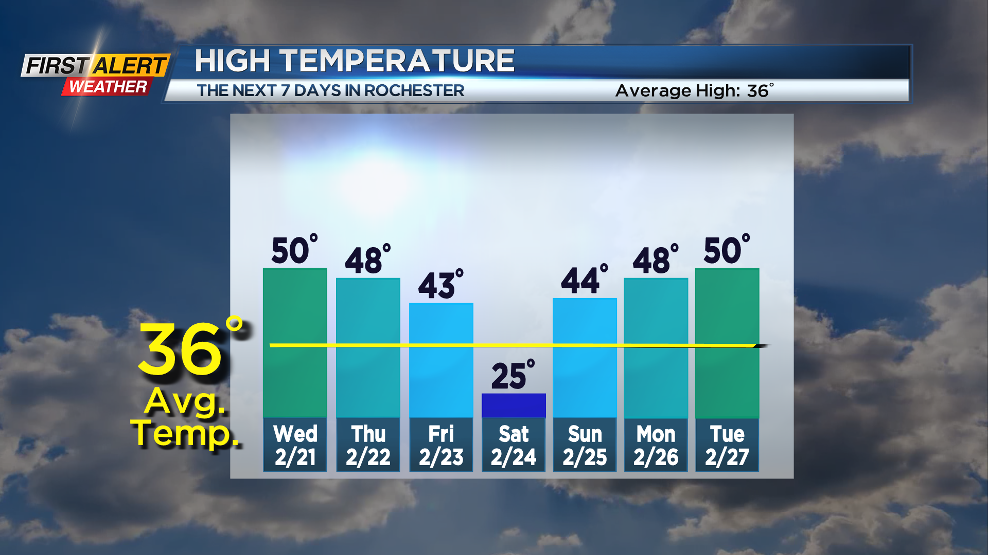
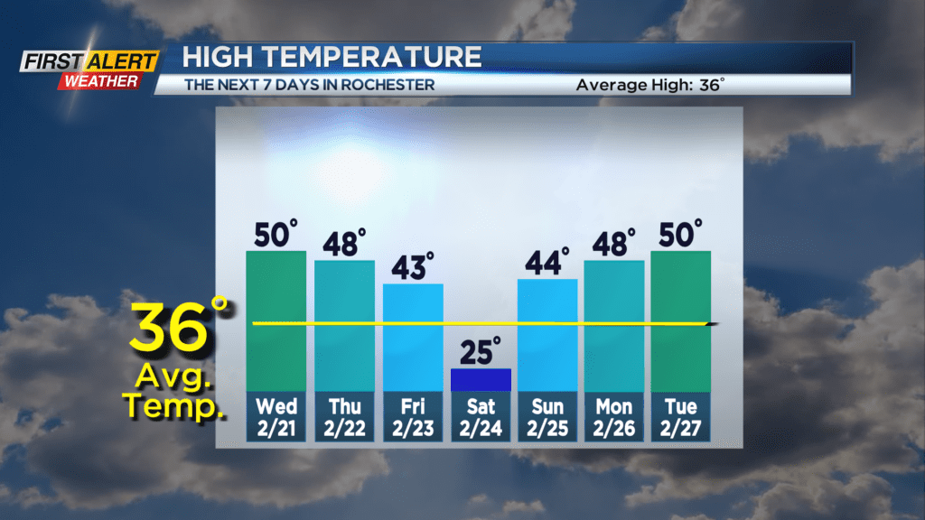
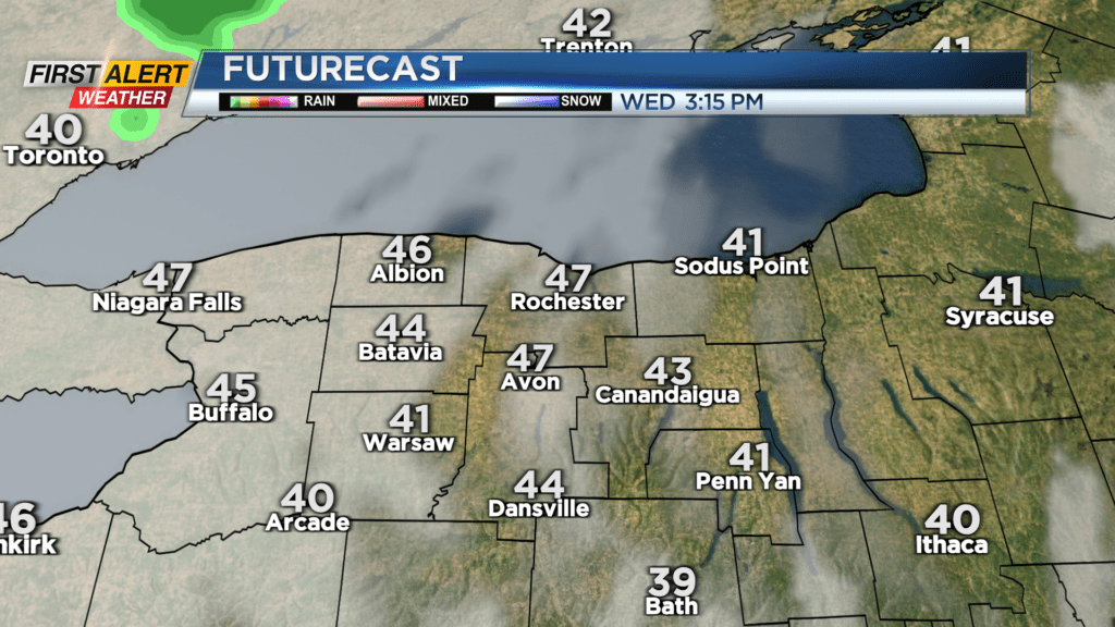
Our quiet weather will continue on Wednesday, with high pressure slowly sliding to our east. This will allow us to warm up a little more compared to recent days, reaching the upper 40s and lower 50s after starting in the 20s. We’ll also see dry weather and some sun. The sky may not be quite as flawless and blue as Tuesday, but still at least a partly cloudy sky into early afternoon.
Clouds tend to thicken up late and into the overnight, with rain showers arriving on Thursday. While not a washout, you’ll have to dodge some wet weather on Thursday as an area of low pressure passes to our south. We’ll muster one more mild day in the 40s on Thursday before falling back on Friday with a cold front. Friday will start with some showers, then end with a mostly cloudy sky.
We’ll get a brief punch of winter on Saturday with temperatures in the teens to start and low to mid 20s for highs, along with some light lake snow showers. But much like our weather has been this winter, it won’t last. We’ll see quiet weather with some sun and temperatures back into the 40s on Sunday. The big weather story next week with be another big swing in temperatures, with 50s through mid-week, before another punch of colder air by late next week. This will also come with another round of some rain.