First Alert Weather: Spring-like feel for this weekend into early next week
ROCHESTER, N.Y. — We’re waking up to a cold start to Friday as temperatures have dropped off into the low 20s. The good news is that the winds and snow are not a factor compared to Thursday morning and we are dealing with an abundance of sunshine.
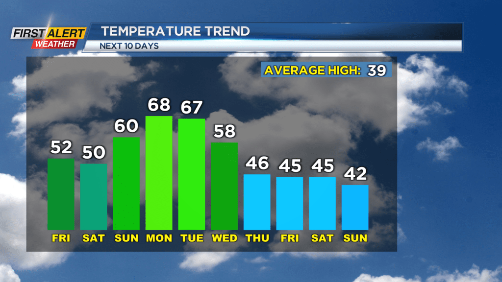
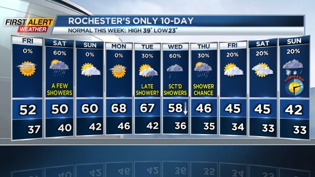
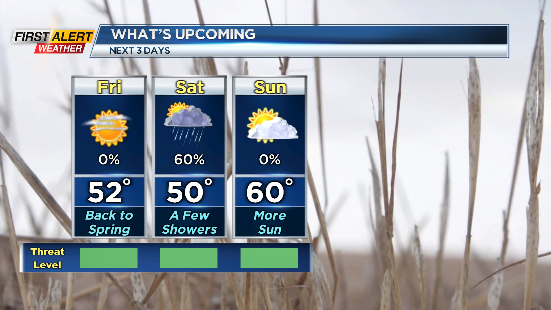
The sunny skies Friday morning will continue through the afternoon hours and help warm us up to around 50. We will remain dry through the evening, but clouds will begin to build late tonight.
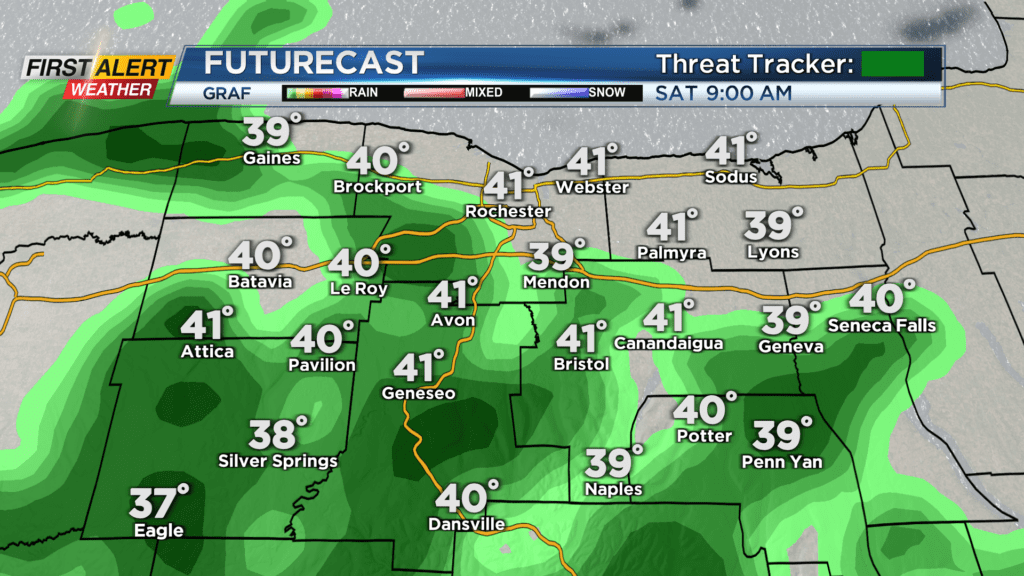
Friday night will be dry, but by daybreak Saturday, we will have a few rain showers around. Scattered showers continue through most of Saturday morning before drying up in the afternoon. Cloudy skies will generally be in the forecast for Saturday afternoon, and with the clouds we will not be as mild as Friday with highs only in the mid and upper 40s.
It won’t be a horrible day on Saturday, but an awesome day is expected Sunday. Clouds decrease Sunday morning and sunny skies are expected by the afternoon. Highs on Sunday will reach the 60-degree mark, if not, at least the upper 50s.
That mild weather will continue through the early part of next week as we see more near record high warmth as highs approach 70 degrees. It will not last too long next week though as a cold front passes by on Wednesday and drops our highs into the 40s for the latter part of the work week.
Good news with the cold front is that it will not be as strong as out last front so winds will not be much of a factor.