First Alert Weather: Spring will be in the air, but that also means strong winds possible
ROCHESTER, N.Y. — Waking up Sunday morning to another cold start, but unlike Saturday where we stay cold, milder weather is expected Sunday afternoon.
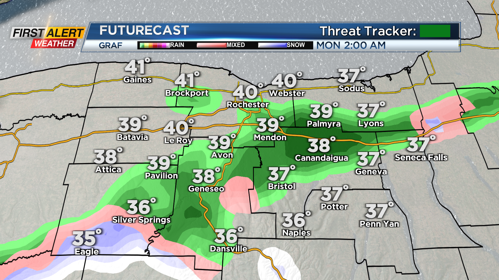
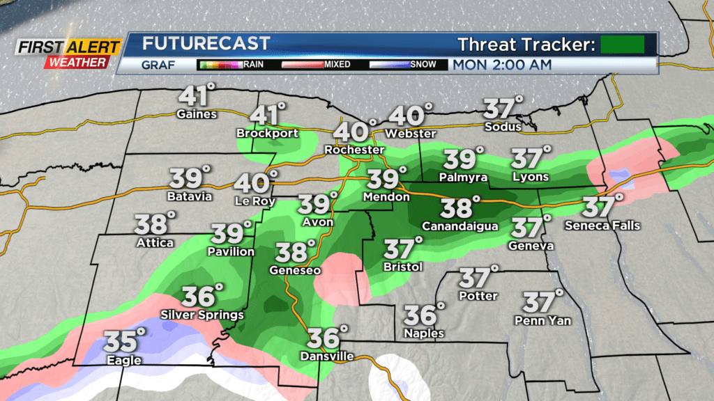
Highs on Sunday will reach the mid and low 40s under partly cloudy to mostly sunny skies. Sunday will remain dry and clear until the overnight period when clouds begin to build and then a passing rain or wet snow showers pops up after midnight. Nothing to worry about, but Monday may start off a bit damp due to a passing overnight shower.
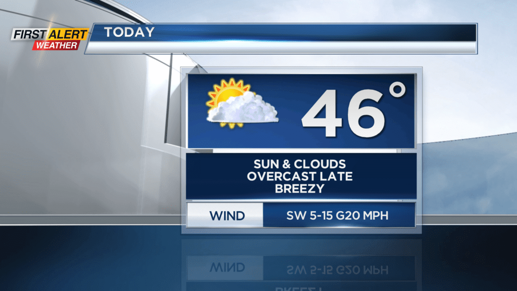
After clouds to start off Monday, the sun will return by the afternoon with highs back in the 40s. We turn even warmer on Tuesday with near record warmth as temperatures make their way into the 60s! The record of 66 degrees from 2001 will be in jeopardy, but we are not expected to beat it just yet. Tuesday will feature an increase in clouds through the day as a cold front approaches for Wednesday. A late day rain shower will be possible on Tuesday, but most of the day looks dry for those wanting to enjoy the Spring warmth.
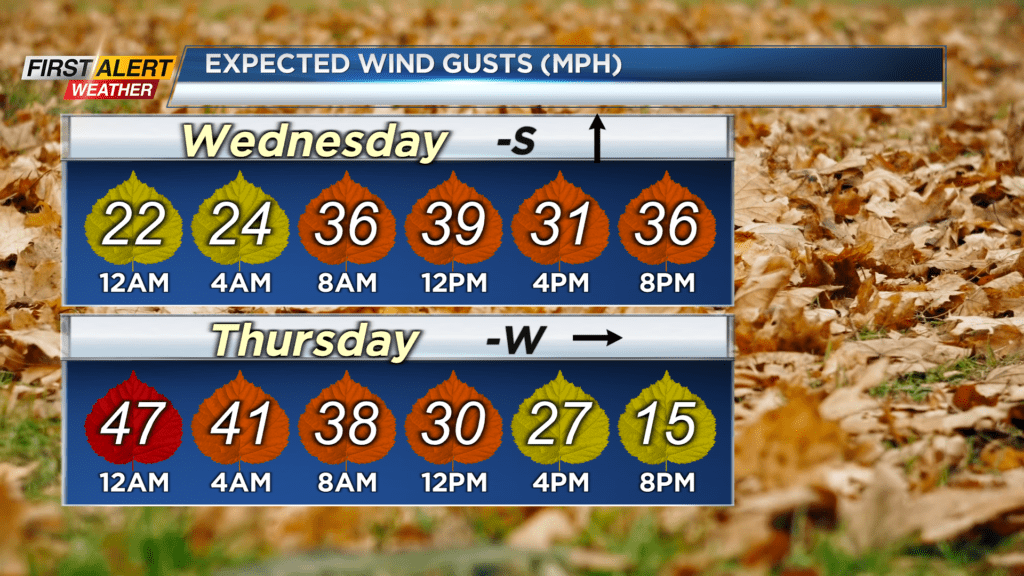
The cold front will pass by on Wednesday and after an early afternoon record breaking 65 (record is 63 from 1954), our temperatures will crash into the low 20s by Thursday morning. We will see a good amount of rain showers to start off the day Wednesday, but by the end we could end with a little light snow! This large temperature crash will increase our winds locally. Our winds will be strongest Wednesday night as gust could be between 40 and 50 mph.
A long duration wind event is not expected, but with the strong gusts a few power outages will be possible. We will be windy and cold on Thursday, but after that Spring returns heading into next weekend with highs returning to the 60s!