First Alert Weather: Starting the weekend cool, but we turn up the heat
[anvplayer video=”5131510″ station=”998131″]
ROCHESTER, N.Y. (WHEC) — A cold front passing through Friday evening means a much cooler start to the weekend, but we quickly crank up the heat again.
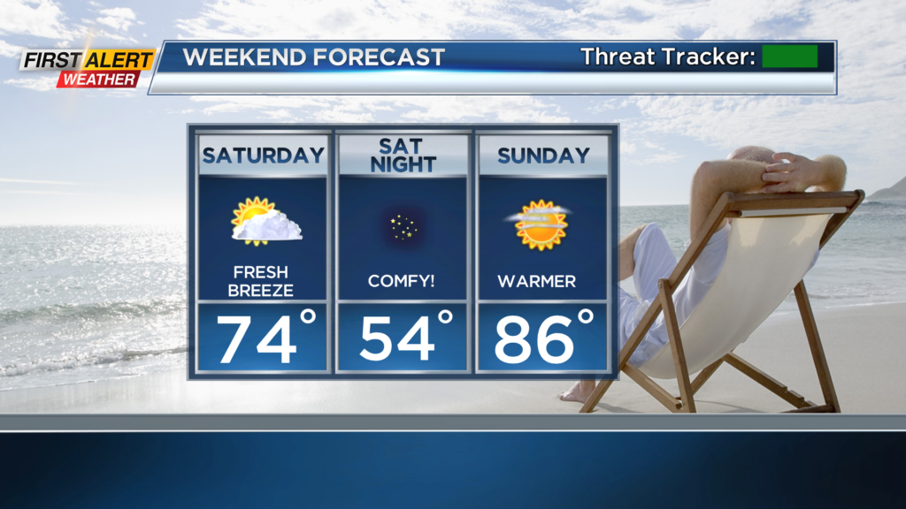
Any leftover storms with the passage of a cold front will end, but we’ll see the slight chance of another shower or two overnight, as much cooler air aloft flows in over Lake Ontario. Yes, we could see some minor lake effect rain tonight, along with some cloud cover. This means we’ll see some clouds to start the weekend, but we’ll clear things out quickly on Saturday, becoming mostly sunny. Saturday will be a cooler day, and very comfortable for outdoor events, picnics and barbeques. Then, Sunday features much warmer air, and the better day for those who have plans to be on or in the water! Overall, we’ll see a lovely last weekend of August!
Monday turns hot, with highs near 90 and the slight chance for a late-day shower or storm ahead of our next cold front, which will arrive on Tuesday. That’ll bring another round of showers and thunderstorms to the region, followed by another punch of cooler, fresher and drier air for the remainder of next week.