First Alert Weather: Steady snow Friday night, then Yellow Alert for possibly bigger impact snow next week
[anvplayer video=”5166913″ station=”998131″]
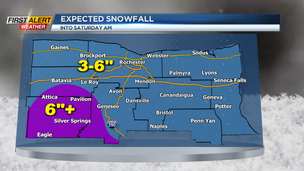
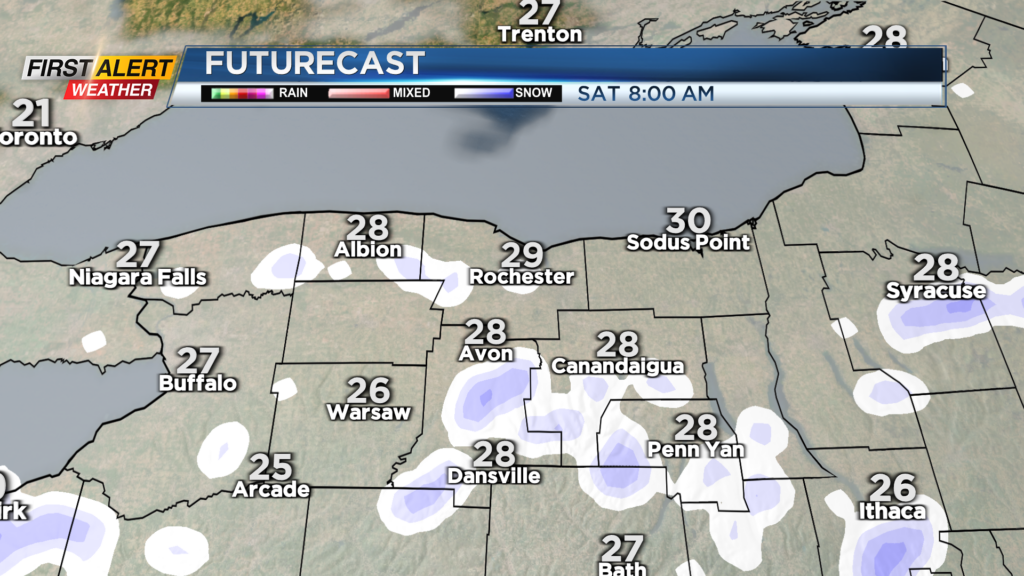
ROCHESTER, N.Y. Our latest round of Friday snow should be a general 3-6” accumulation by Saturday morning when most of the snow winds down.
A few spots may pick up slightly higher amounts, especially the higher terrain south. Roads may become slick Friday night as temperatures continue to drop into the 20s. The snow will have little impact on the Rochester St. Patrick’s Day Parade in Rochester, with just some snowbanks from the night before.
We’ll see a little sun trying to return later Saturday and to start Sunday, but it won’t last. Our next storm system is already in our sights. It will develop on Monday, with some rain or wet snow showers developing but very little impact.
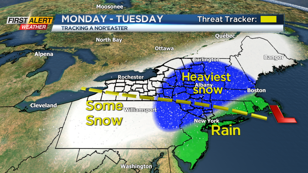
Then, a Nor’easter is forecast to develop on Tuesday, bringing a potentially big impact storm to the big cities in the Northeast. At this point, we expect it to be too far east of us to produce a major snowstorm locally. But we are seeing the potential for moderate impact snow.
This is still five days out, but we see enough agreement in the data and potential for a Yellow Alert. This is simply a heads-up and to pay closer attention to the forecast as it evolves. Stick with News10NBC this weekend. First Alert meteorologists Alex Bielfeld and Glenn Johnson will have the latest updates.