First Alert Weather: Summer-like air Friday helps to usher in some weekend rain
[anvplayer video=”5173456″ station=”998131″]
ROCHESTER, N.Y. – A warm front will continue to lift through the area Thursday and into Friday, allowing summer-like air to make a return to western New York. We’ll see a partly cloudy sky tonight, and a fair amount of sun for much of Friday.
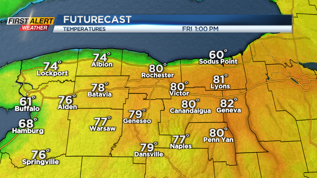
Friday will climb into the lower 80s as far north as Route 104, at least for a few hours. A cooler lake breeze will keep the immediate Lake Ontario shoreline in the 50s and 60s. That lake breeze will drop south, pushing cooler air toward Rochester later in the afternoon, but still holding in the upper 60s and 70s. We’ll be dry through about 2-3 p.m., then we see some scattered showers or isolated thunder developing late afternoon and into the evening as moisture increases ahead of our next storm system.
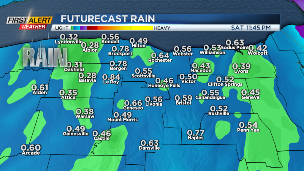
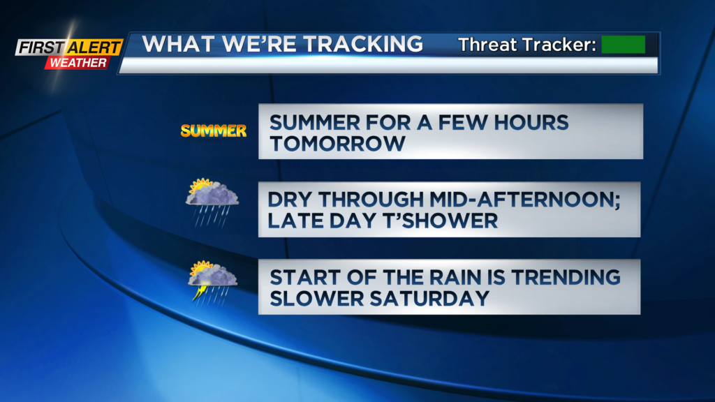
We’re still tracking rain and some storms to start the weekend, but the trend has been a slower one for the arrival of the wet weather. This means a mainly dry morning (though a few isolated showers are still possible), and temperatures likely making it into the 70s, especially from Rochester east into the Finger Lakes.
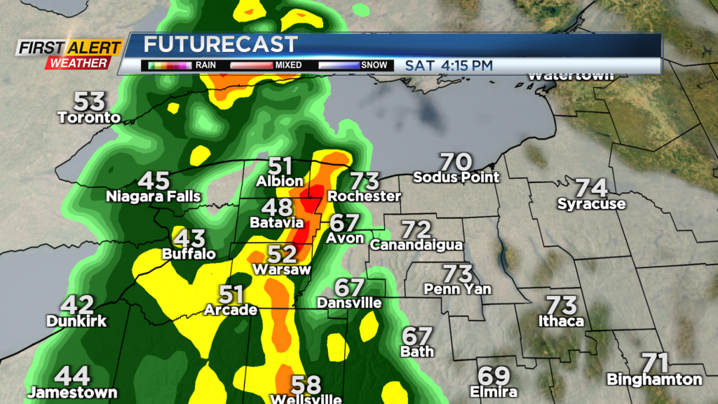
Rain with a cold front arrive after lunchtime from west to east. Once the rain moves in, it’ll stick around for the rest of the day, and temperatures will drop back into the 50s quickly. Some thunder and downpours are possible as the cold front moves through. Expect about a half inch of rain, before tapering overnight. This will set the stage for a cooler but drier Sunday. Temperatures will top out in the lower 50s, with just a few passing rain showers.