First Alert Weather: Summer returns before showers late into Labor Day weekend
[anvplayer video=”5132758″ station=”998131″]
ROCHESTER, N.Y. — There’s a great fall start to Friday across our region but summer returns in the afternoon.
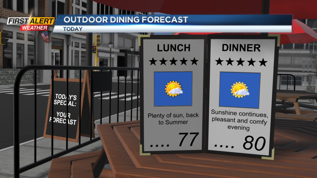
After the cool start, highs in the afternoon will reach the mid and low 80s. An abundance of sunshine will greet us and we will remain dry.
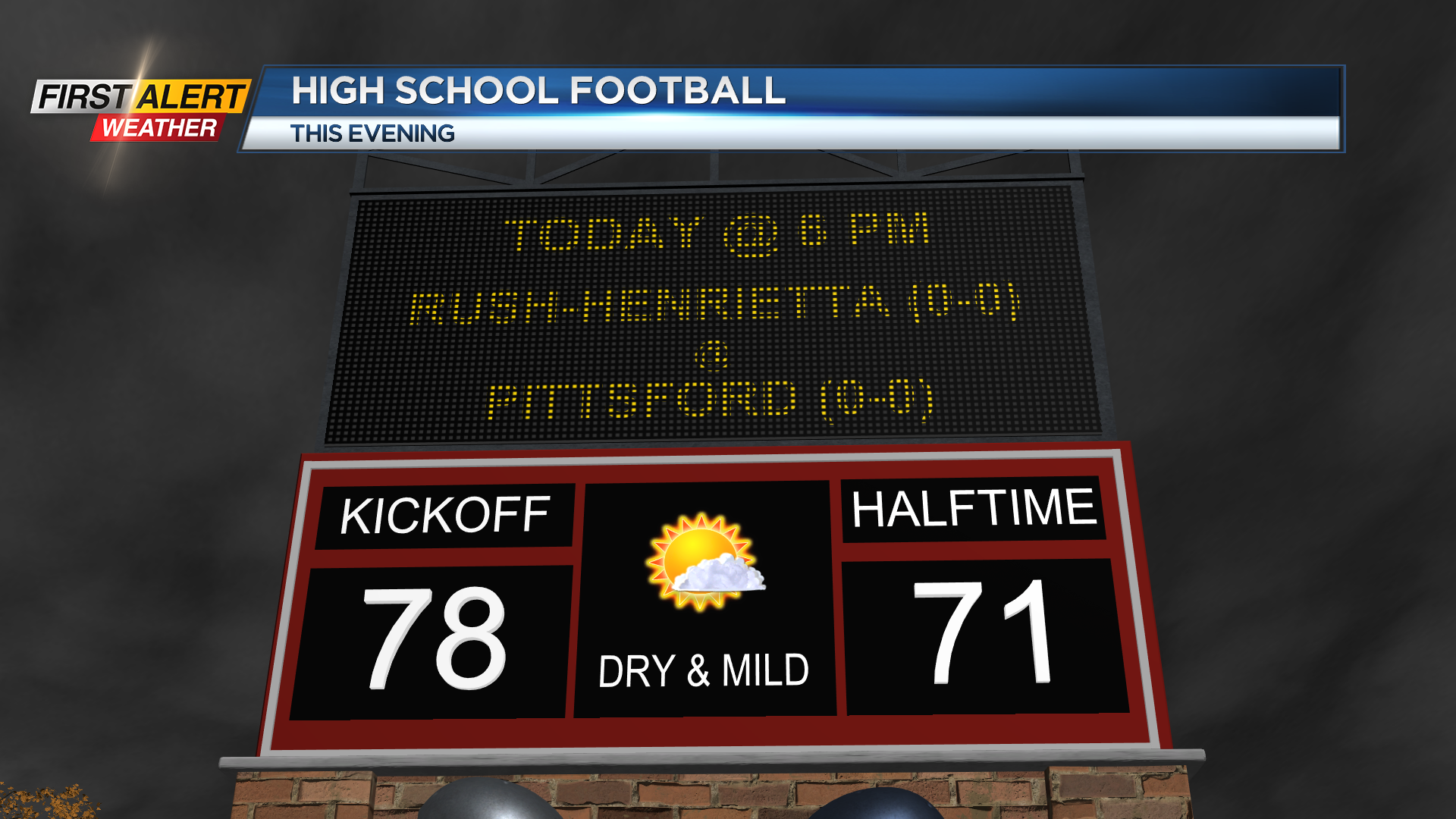
This is great news for any outdoor plans for Friday and for the return of High school Football across our region in the evening. The weather will continue to be great in the evening as we remain dry and temperatures remain comfortable.
The comfortable conditions will continue through Friday night before turning a bit muggy on Saturday afternoon. Temperatures on Saturday afternoon will be even warmer with highs in the upper 80s under plenty of sunshine once again. At times, we could see heat indices reach the low 90s in the afternoon with the humidity increase.
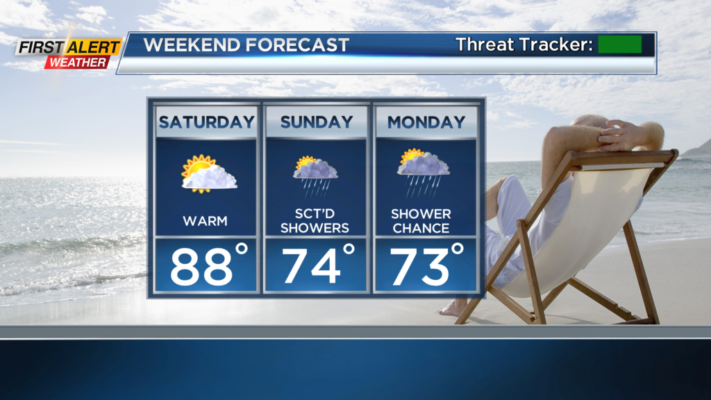
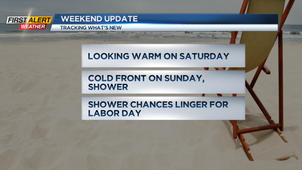
We will continue to be dry on Saturday but a few clouds arrive late ahead of a few chances for showers on Sunday.
A cold front will push through our region on Sunday with increased cloud cover and the chance for a few passing showers. At this moment a washout is still not likely, but just be mindful of a few showers throughout the day.
Uncertainty remains for Labor Day as models have the cold front settling to our south and potentially bringing us widespread rain. As far as the forecast, we are expecting a few showers possible on Labor Day with no washout at this moment.
However, we are monitoring the chance for widespread rain on Monday as some models have begun to trend in that direction. So, if you have plans for Sunday and Monday make sure you pay attention to the forecast for continued updates!
______________
Download the WHEC First Alert Weather app to stay up to date while on the go.
Watch the latest full forecast online.