First Alert Weather: Summer returns with heat and humidity
[anvplayer video=”5131631″ station=”998131″]
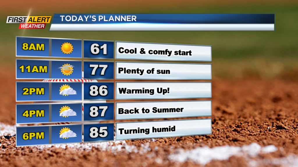
ROCHESTER, N.Y. You couldn’t ask for a better start across our region this morning with cool, comfortable, and clear conditions in place.
The sunshine will continue through today as mostly sunny skies are expected in the afternoon, but the cool weather will not as highs this afternoon will reach the mid and upper 80s!
As far as the conditions, we will remain comfortable through the majority of the day before the dew points increase late this evening and tonight. The humidity increasing is all ahead of our next chance for thunderstorms for Monday and Tuesday.
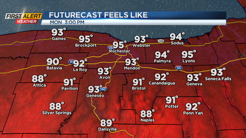
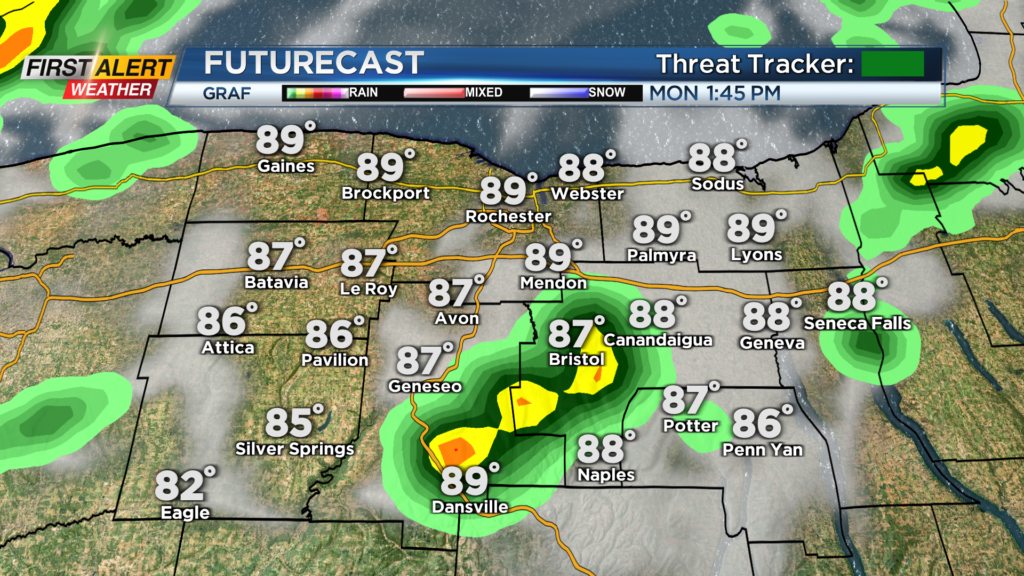
A cold front from the Midwest will begin to approach our region tomorrow and help pop up an isolated shower or thunderstorm through the afternoon and evening. The chance for a storm or two will be isolated and everyone will not see rain, but the bigger story will likely be the heat indices in the afternoon.
The combination of heat and humidity will make it feel like the mid and low 90s at times in the afternoon. The better chance for storms will arrive Tuesday.
We were tracking the possibility for severe weather across our region, but the timing of the front will not cooperate to see the strongest of storms locally. A gustier shower or storm will be possible as the front rolls through, but widespread severe weather is not expected.
First Alert Meteorologist Alex Bielfeld has your Sunday forecast.
Best chance for showers and storms Tuesday looks to be the late morning and into the mid afternoon at this moment. Then behind this front a strong surge of cool, refreshing fall air is expected with highs only in the 60s for the first day of September!