First Alert Weather: Sun returns Wednesday but with rounds of storms into the weekend
[anvplayer video=”5188123″ station=”998131″]
ROCHESTER, N.Y. — It’s a cool, comfortable, and clear start to Wednesday and that will transition into the afternoon.
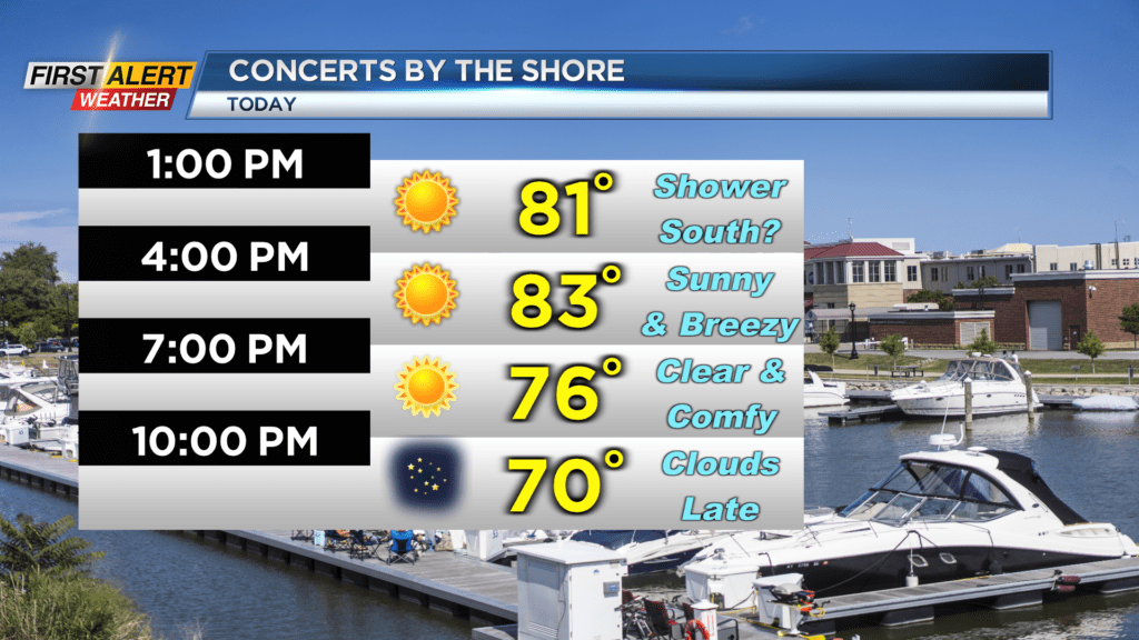
Wednesday will feature plenty of sunshine with high temperatures reaching the low 80s. It will be a much better day than Tuesday but there is still a shower chance thruway southward. On Wednesday afternoon, there is the chance for a brief light shower thruway southward but nothing to cancel afternoon plans over.
Any shower that does pop will be light and are expected to move out by this evening. We will also be a bit breezy again today with gusts out of the west of about 20mph.
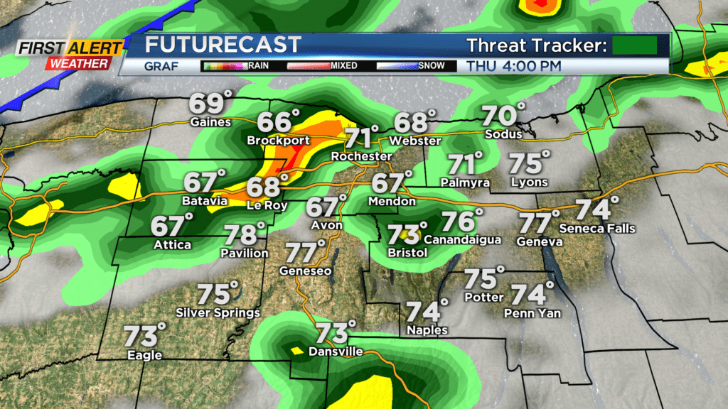
Wednesday evening and night is when we will see more clouds roll back into the region ahead of some showers and storms for Thursday. No severe weather is in the forecast for Thursday, but we will be tracking another unsettled day.
We will wake up Thursday morning under overcast skies with showers rolling in by the late morning hours. Shower chances continue into the afternoon before a cold front approaches and helps pop up a few thunderstorms.
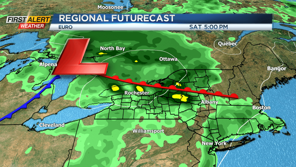
Thursday will not be a washout, but we will be tracking showers and storms through most of the day. We will then dry out for Friday with plenty of sun and cool temperatures, but then another round of showers and storms rolls in for Saturday.
A warm front will lift through Saturday morning with a few showers before thunderstorms pop up in the afternoon. A storm Saturday afternoon will pose the threat for gusty winds, but our severe threat remains low. Rain can also be heavy at times Saturday afternoon which could washout any afternoon plans.
Threat Tracker for Saturday remains green for now, but we will continue to keep you updated into the weekend with any changes.