First Alert Weather: Sun Sunday, but severe storms, heavy rain possible through Tuesday
[anvplayer video=”5187767″ station=”998131″]
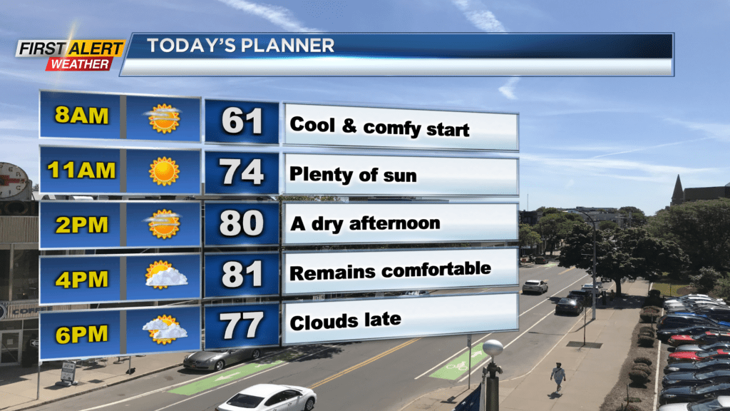
ROCHESTER, N.Y. — Waking up to an amazing start on this Sunday with plenty of sunshine and comfortable temperatures.
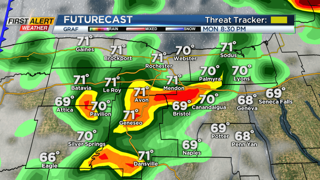
Sunday will feature about the same as Saturday with plenty of sunshine and comfortable conditions. We will see our afternoon highs reach the low 80s later. However, clouds will increase late Sunday ahead of our chance for rain and thunderstorms on Monday. Around midnight Sunday, rain will begin to push in from the southwest. Rain will be heavy at times for some in the evening but moves out by daybreak Monday.
An isolated shower is possible Monday morning, but most of the day looks dry. Most of Monday morning and afternoon will be filled with partly cloudy skies. We will be turning much warmer with highs in the mid-80s, and we are turning much more humid as dew points rise into the upper 60s. That moisture will help fuel a few afternoon thunderstorms on Monday.
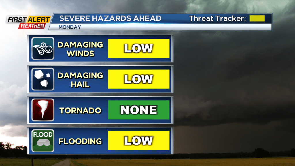
A Yellow Alert is still in effect for Monday as severe storms are expected to pop in the afternoon and evening. Isolated storms will begin to pop around 3 in the afternoon before turning scattered Monday evening and Monday night. Storms that do pop Monday afternoon and evening will have the chance for strong gusty winds, small hail, and locally heavy downpours. Our severe threat will continue through about 9 Monday evening as a cold front pushes through afterwards.
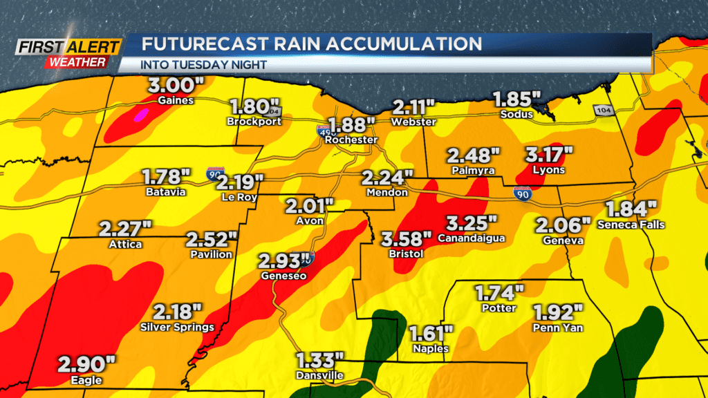
This will drop our severe threat from west to east. We will then be left with cooler weather for Tuesday, but we will remain unsettled with scattered showers through the day. Rain totals through Tuesday night could exceed than 2.5 inches with even locally higher amounts possible. This is over a two-day stretch, but with that much rain possible across our region there is a chance for flash flooding. Pooling and ponding on our roadways, along with limited visibility, will be possible through the next two days.