First Alert Weather: Sun Wednesday, then a sloppy wintry mix develops later this week
[anvplayer video=”5152530″ station=”998131″]
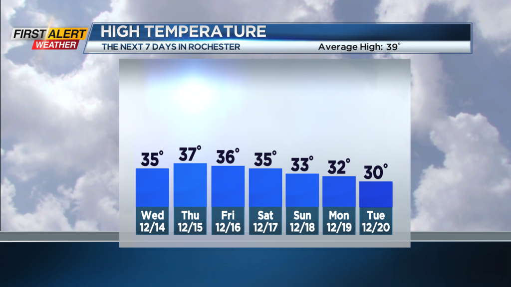
ROCHESTER N.Y. We’ll see one more quiet and bright but chilly day on Wednesday with highs in the lower to mid-30s under a mix of clouds and sunshine.
Thursday starts dry, so our morning commute should be smooth sailing, but a messy mix develops from south to north, starting late morning into the early afternoon. This will likely include everything from wet snow to sleet and a little freezing rain.
We’re working through the details on which locations will see more of which type of precipitation, as the temperature profile of the atmosphere will be borderline for each type of precipitation, making the forecast a very close call.
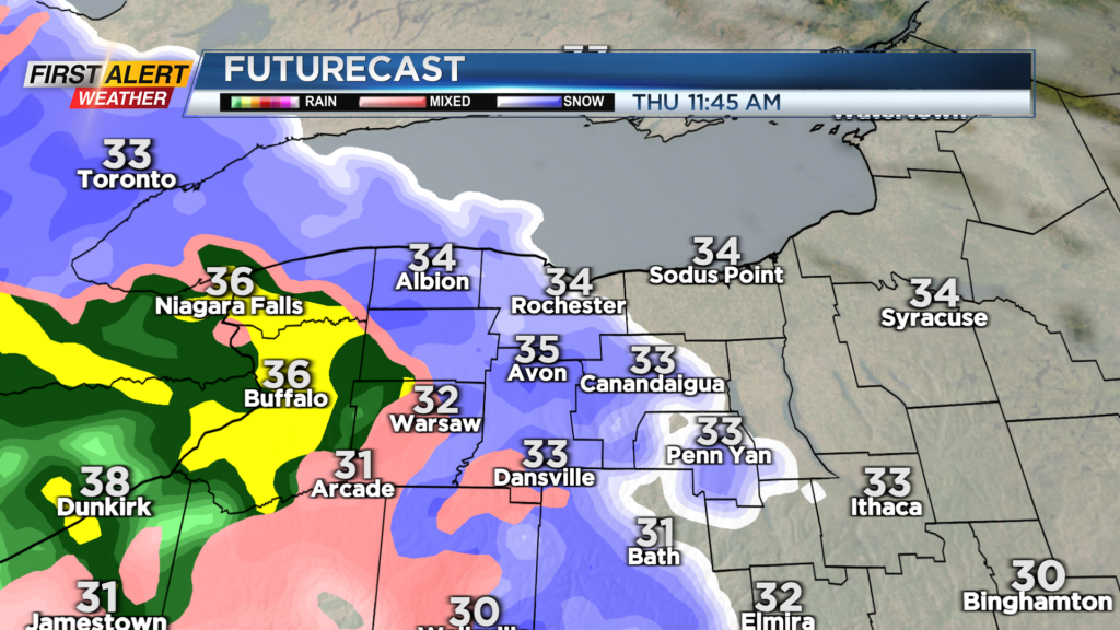
If we switch over to snow quicker, we’ll likely see a few inches of dense, wet snow on the ground by the evening commute. If we see less snow, we’ll have to deal with a slick layer of sleet or ice, but this mainly looks to be the case west and south of Rochester in the western Southern Tier.
Either way, we expect the Thursday evening commute to be impacted by the incoming wintry weather. Wet snow will continue into most of the overnight, but the fluff factor will be low and the water content high, meaning you’ll wake up to a heavy, wet snow Friday morning.
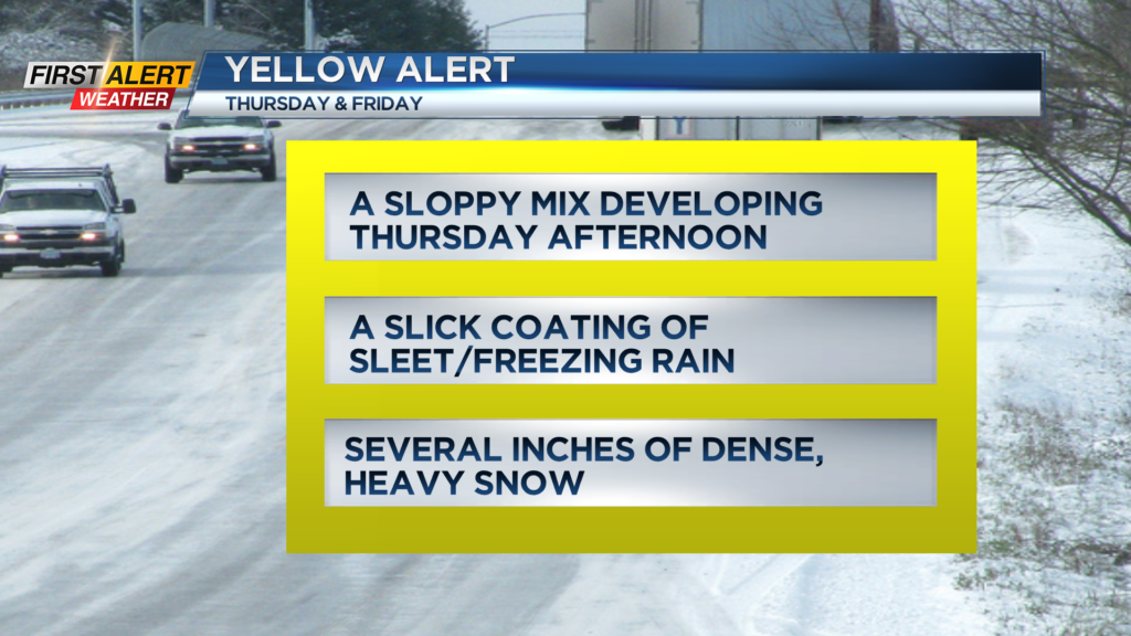
At this point, we also expect the Friday morning commute to be impacted by some of this wet snow, so a Yellow Alert remains in effect for Thursday afternoon and Friday morning. This won’t be a major winter storm for our area, but rather a modest storm with moderate impacts on roads.
First Alert Meteorologist Stacey Pensgen has your Tuesday forecast.
Snowfall will likely come in less than 6 inches for most of our area, but we’ll fine-tune numbers as precipitation types become a little more clear. After the area-wide system moves out later Friday, we’ll focus on lake effect from Lake Erie on Saturday and Sunday, which may have an impact on the Bills game in Orchard Park on Saturday night. Stay tuned!