First Alert Weather: Sunday snow depends on elevation
We are waking up to another cloudy and wet start this Sunday as another storm system is set to impact our region.
This one will come with a mixture of rain and snow. Rain will continue for most of our region Sunday morning before changing over to snow in the afternoon. Higher elevations in the Finger Lakes will see the change over occur a little earlier, but most will change over just after noon.

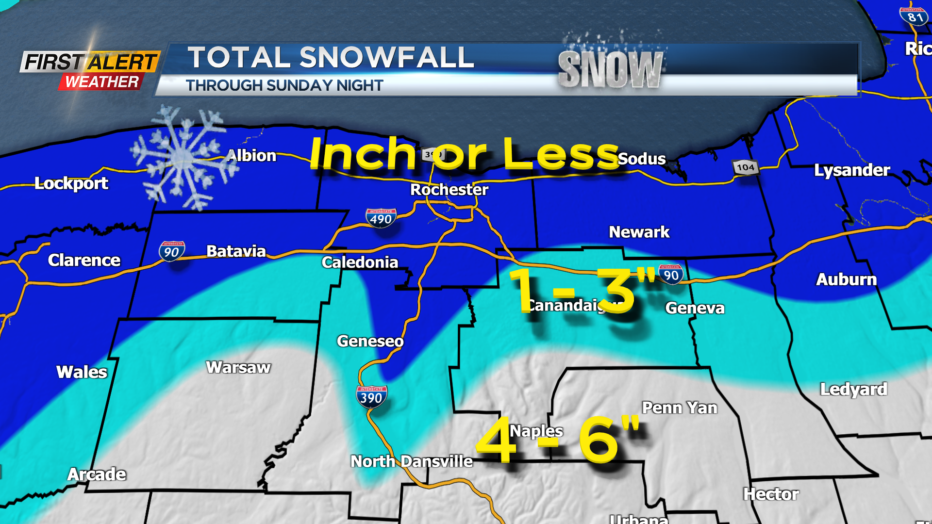
A Winter Weather Advisory is in effect for Wyoming, Livingston, Ontario, and Yates counties until 4 a.m. Monday. Snow will persist Sunday afternoon and Sunday evening before transitioning over to snow showers. Accumulation will be hard to come by: one because of the slow change over, and two because of surface temperatures.
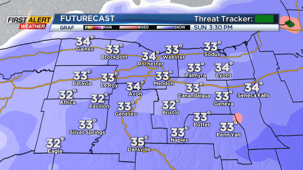
Temperatures Sunday will start off in the upper 30s, but then drop to near freezing by the evening. Higher elevations will cool off quicker which is why they are expected to see most of the snow.
When things are all said and done Monday morning, generally a coating to an inch is expected for most of our region. The Finger Lakes will see anywhere between 1 and 3 inches of snow with the highest elevations south seeing as much as 6 inches of snow.
Snow showers linger into early Monday, but no additional accumulation is expected. Generally, through the early part of this week the weather will be quiet: mainly cloudy skies expected with highs sitting in the mid and upper 30s.