First Alert Weather: Temperatures and flakes fall Friday
ROCHESTER, N.Y. — Our weather on Thanksgiving was uneventful, but there are little signs of winter on the horizon.
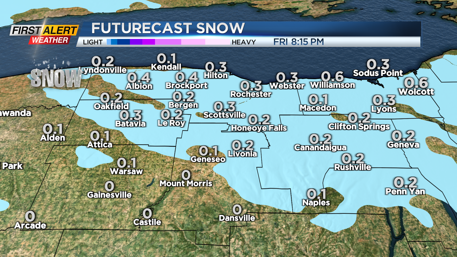
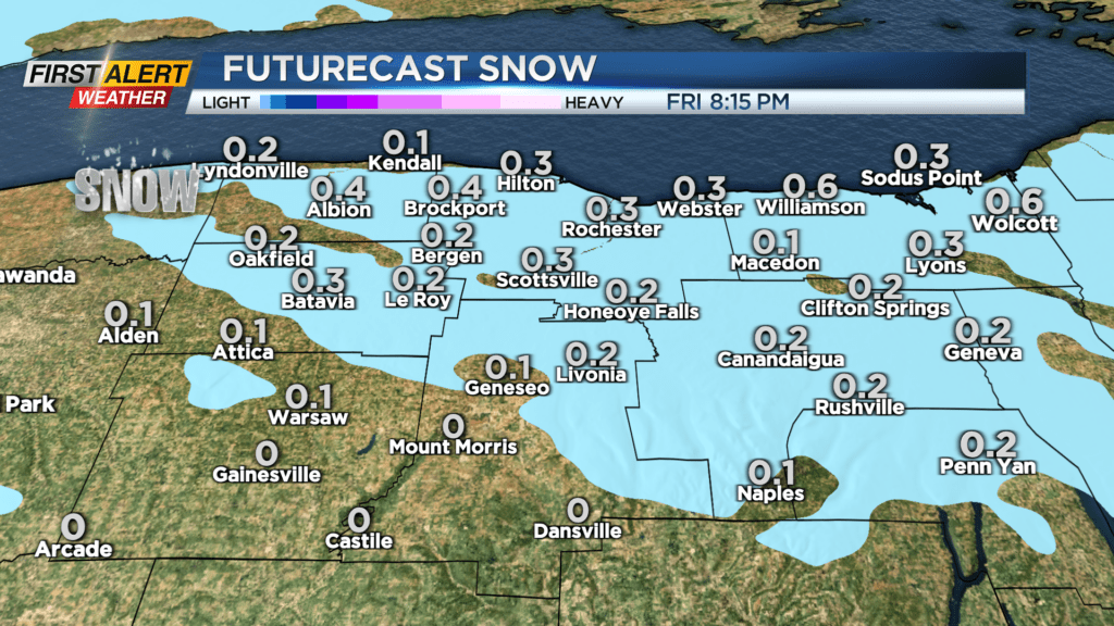
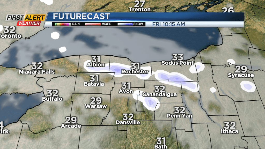
The first taste of winter arrives on Friday following a cold front. Temperatures will hold in the lower 30s on Friday, and it’ll be cold enough for some brief lake effect snow southeast of Lake Ontario. This will especially be the case in the morning, with snow showers breaking up into the afternoon. Expect little more than a half inch, 1 inch at most where the snow falls. Drier air quickly builds in, putting an end to the snow for the weekend, but we’ll keep the chill on Saturday.
Highs will struggle to make it out of the 30s on Saturday, but should climb into the 40s on Sunday. This is ahead of our next system. The air should be warm enough for just rain showers developing late on Sunday, but may mix with some elevation wet snow in the higher terrain Sunday night into Monday. If you have family or friends that will be traveling after the Thanksgiving holiday this weekend, weather looks quiet across western New York and the Finger Lakes.
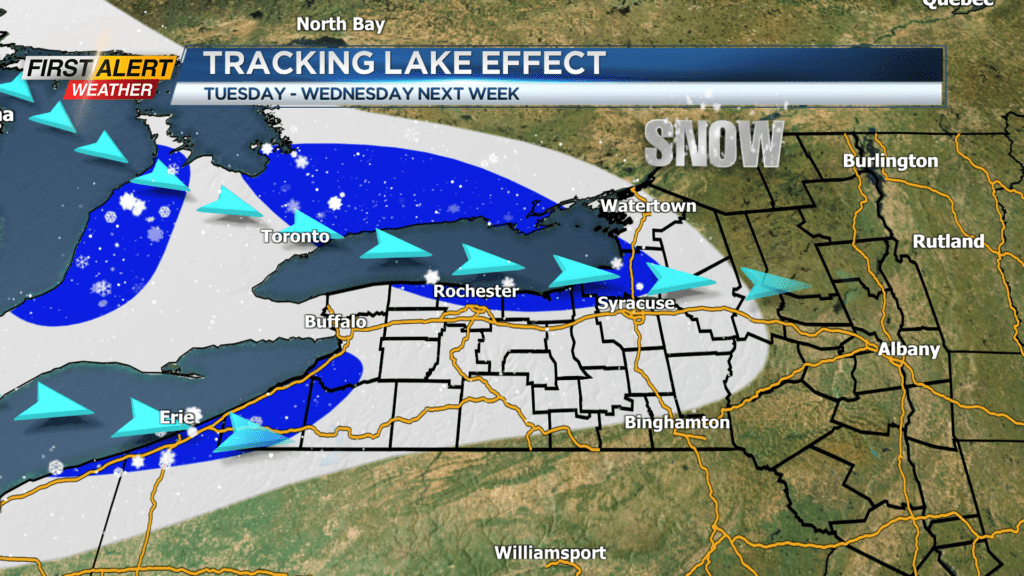
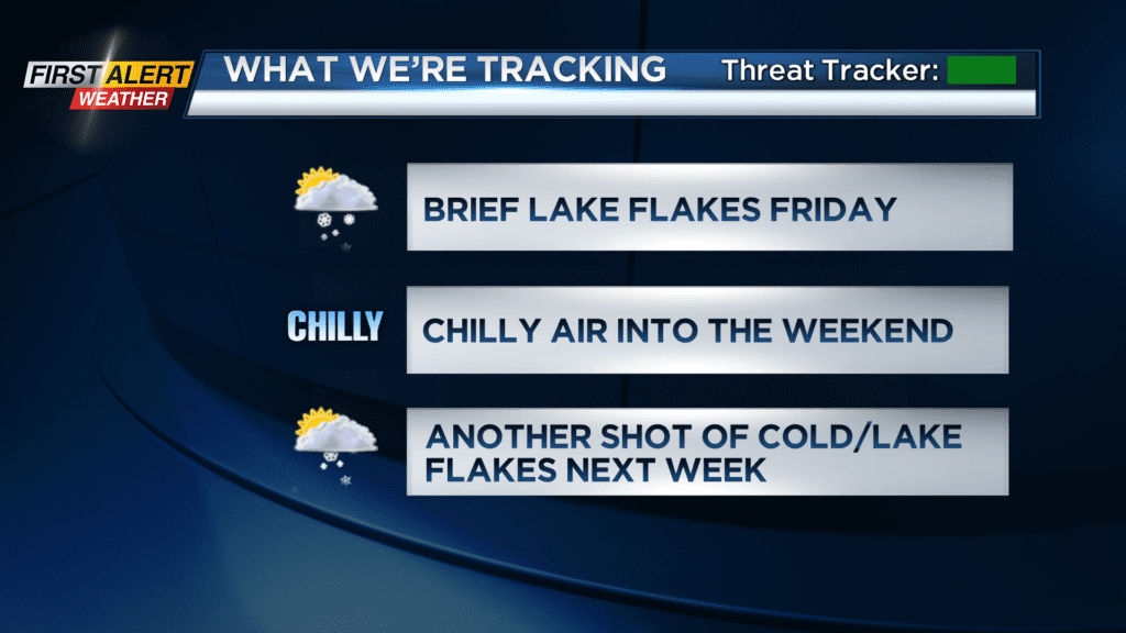
We’ll get another blast of chillier air following Monday’s system. This will bring a renewed chance for some lake effect snow southeast of lakes Erie and Ontario Tuesday into Wednesday. Some minor accumulations may be possible, and temperatures will once again struggle in the lower 30s for daytime highs and 20s for overnight lows.
So, while we have some localized snow chances from lake effect in the next week, we don’t see any widespread snow or big storms that will impact our region.