First Alert Weather: The Deep Freeze Will Not Last
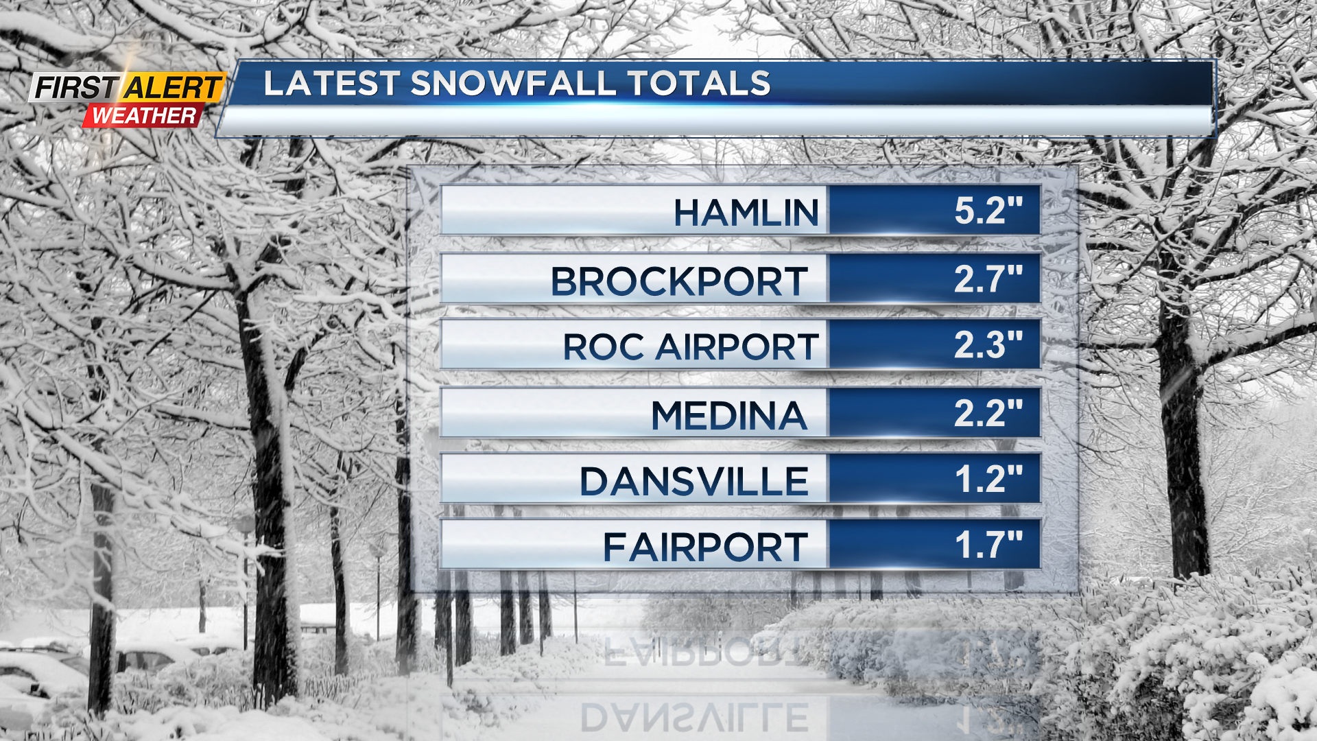
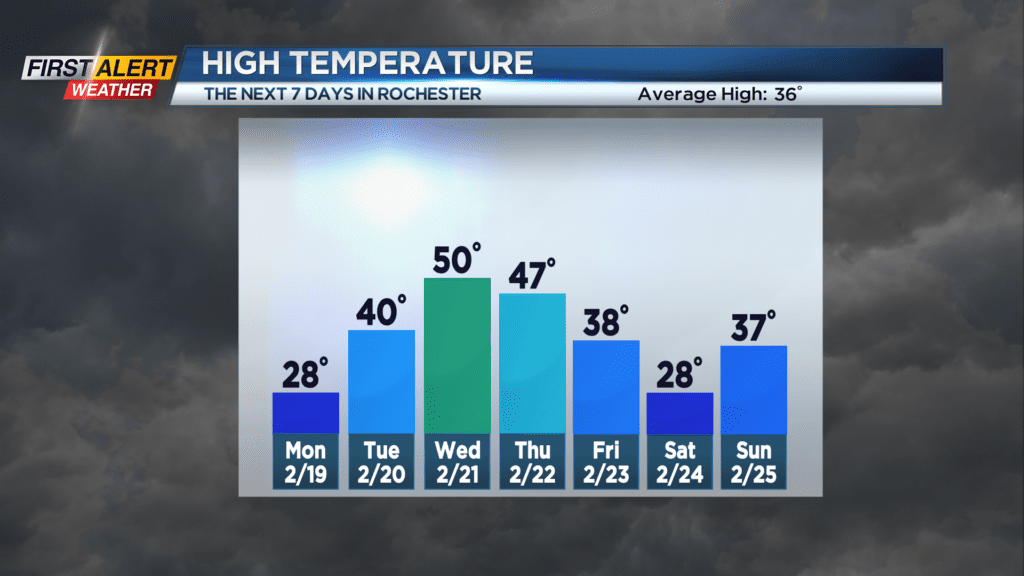
ROCHESTER, N.Y. – Even though it has been in small amounts,Sunday makes six days in row with measurable snowfall for the Rochester Airport. And we are looking for one more day with below freezing temperatures. Then the News10NBC First Alert meteorologists expect a significant change in the weather pattern. It is likely that Western New York will go from below average temperatures to above average temperatures by the middle of the week.
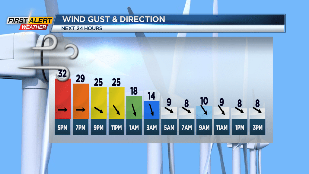
Sunday night look for occasional lake flurries and snow showers. However, any additional accumulation should be limited to less than an inch. The winds will slowly diminish for the overnight and, as a result, most of the blowing and drifting snow will come to an end. The low temperature will be near 19 degrees. Monday may start with a few early morning flurries, otherwise there will be breaks of sun by the afternoon. The high temperature will be in the upper 20s. Tuesday it should be back to mostly sunny skies. It will be a pleasant February day with the high temperature near 40 degrees. Wednesday will feature more sunshine, and it will turn noticeably warmer. The high temperature will be near 50 degrees.
Stay tuned to News 10NBC First Alert weather for updates on the forecast.