First Alert Weather: The last weekend of summer will feel like it!
[anvplayer video=”5135584″ station=”998131″]
ROCHESTER, N.Y. (WHEC) — Summer is coming to a close next week, and we’ll enjoy a nice last weekend with warm air and some sun.
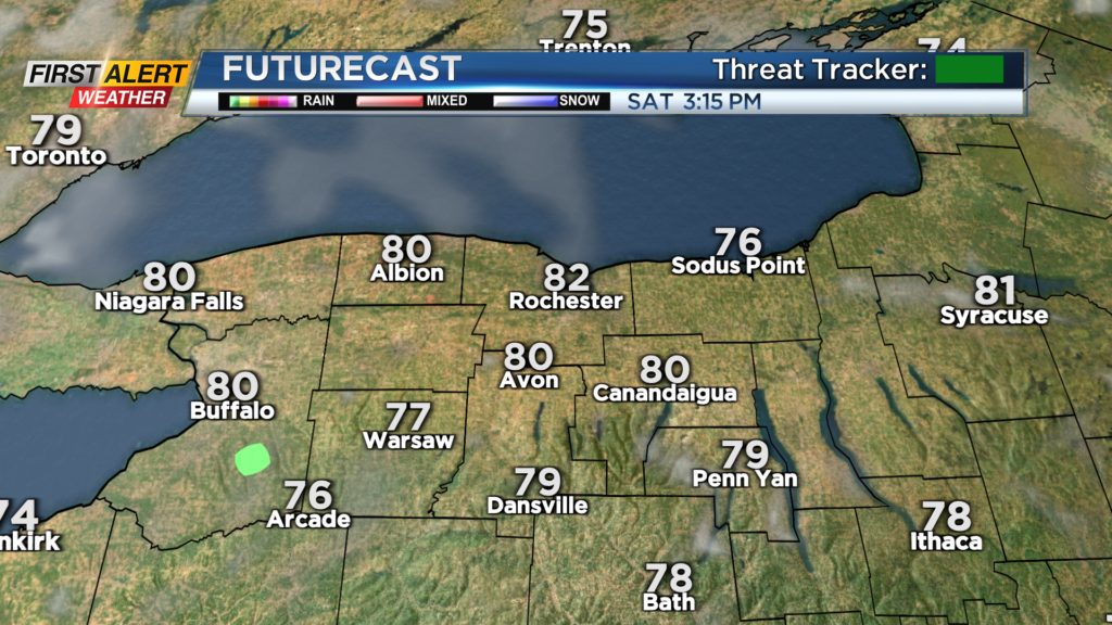
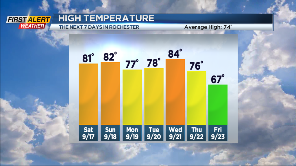
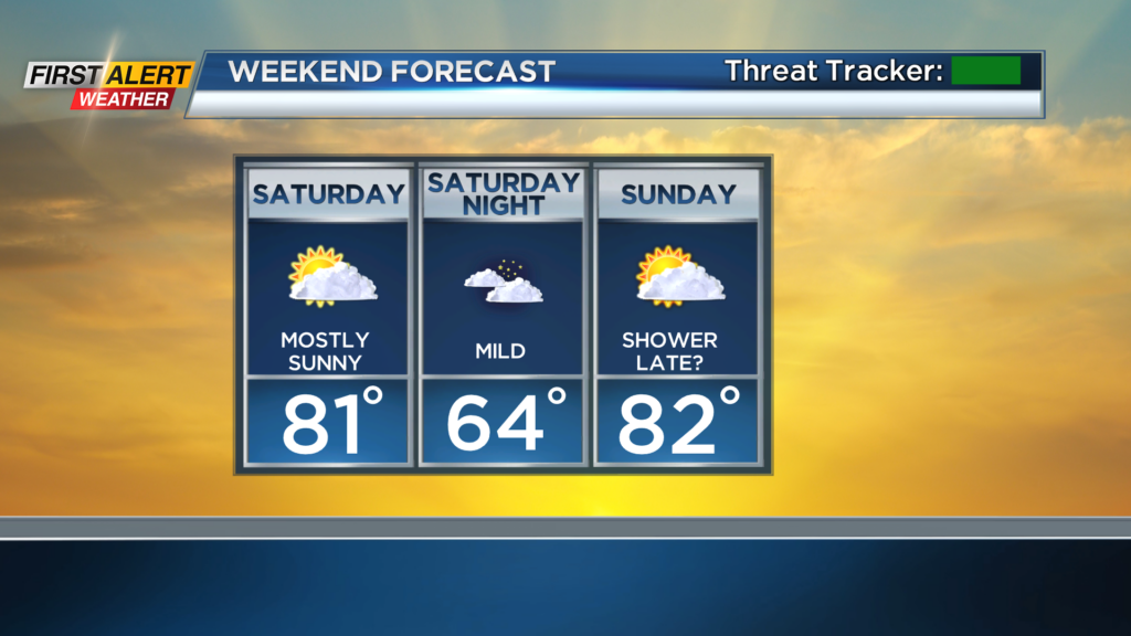
The clouds associated with a warm front lifting through the region Friday will slowly clear overnight, allowing for more sunshine on Saturday, and warmer air. Highs tomorrow will make it back into the lower 80s with dry weather. Sunday still looks pretty good with increasing clouds by later afternoon and just the slight chance of a shower or two by evening. Temperatures will once again reach the lower 80s.
A cold front will bring scattered showers and some thunderstorms into western New York Sunday night into Monday. Showers will likely begin to clear by evening, but it’ll be a close call for the Bills game in Orchard Park Monday night. We’ll keep track of the trends and exact timing throughout the weekend! Tuesday and Wednesday will be dry once again, with highs in the 70s on Tuesday and back into the 80s on Wednesday, which coincidentally is the last day of summer. Another, stronger, cold front moves through on Thursday, bringing another round of rain, thunder and some wind, followed by much more fall-like air to end next week, and welcome in the first weekend of Fall.