First Alert Weather: The snow has arrived
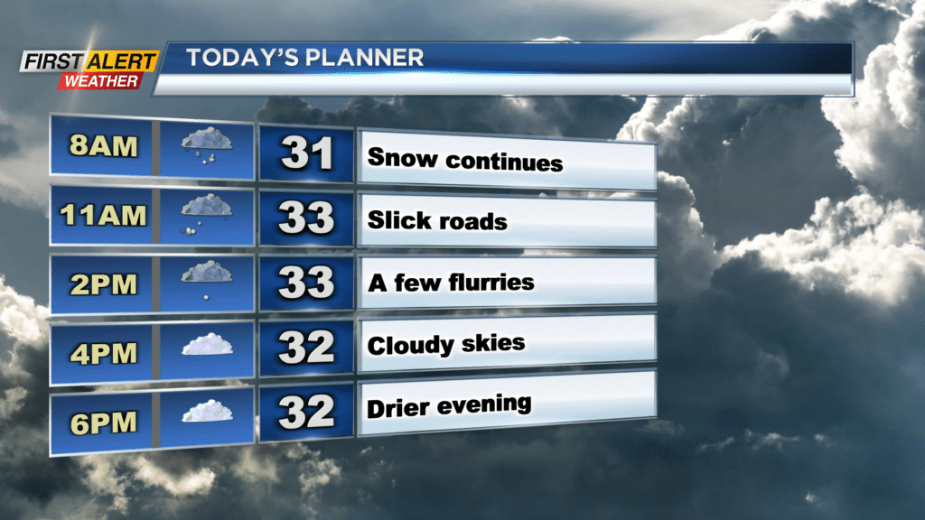
ROCHESTER, N.Y. — If you’re heading out Sunday morning, make sure you grab your snowbrush and take your time on the roads.
A good three to six inches of fresh powder fell Saturday night. We will continue to deal with a few snow showers Sunday morning, but drier weather is expected by the afternoon. Roads will be a bit slick in the morning, but conditions will be much better later Sunday.
Temperatures are in the 20s Sunday morning and will only make the low 30s during the afternoon. After a snowy Sunday, things will turn drier and milder on Monday. Mostly cloudy conditions are expected on Monday, and high temperatures will reach the upper 30s in the afternoon. On Monday, we will be tracking our next weather maker which will swing in for Tuesday and Wednesday. There is a chance for a brief period of snow Tuesday morning, but we will quickly change over to rain by Tuesday afternoon.
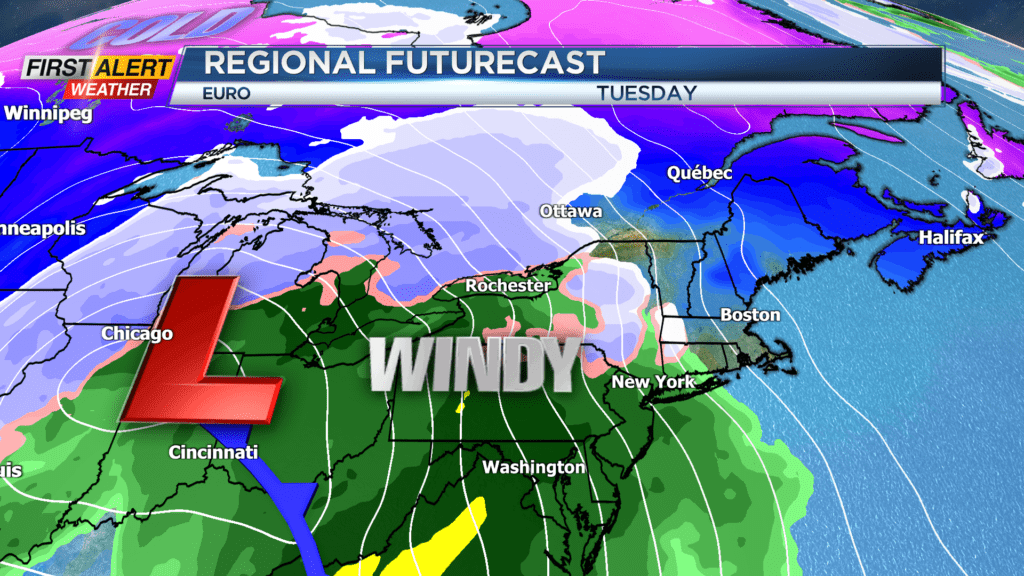
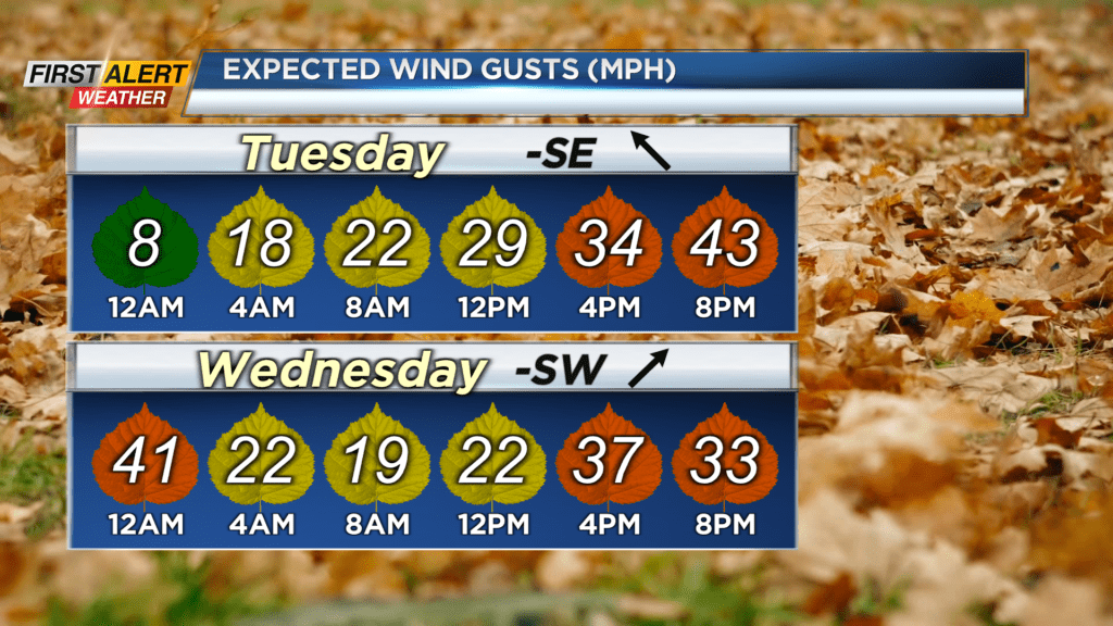
Rain and scattered showers continue into Tuesday night before changing back over to snow showers Wednesday afternoon. No snow accumulation is expected, but we will have some strong gusty winds. A High Wind Watch for Tuesday has been issued for Ontario, Livingston, Genesee, and Wyoming Counties with the threat of gusts near or over 50mph. The strongest of the winds will likely be Tuesday night and into Wednesday morning. Gusts near or over 50mph are possible across our region during that timeframe. It is a short-lived wind event, so power outages should be limited but they remain possible.
There is no Yellow Alert out there for our region yet, but we will continue to keep you updated as the days progress.