First Alert Weather: The weather will change, and not for the better, for the remainder of the holiday weekend
[anvplayer video=”5132979″ station=”998131″]
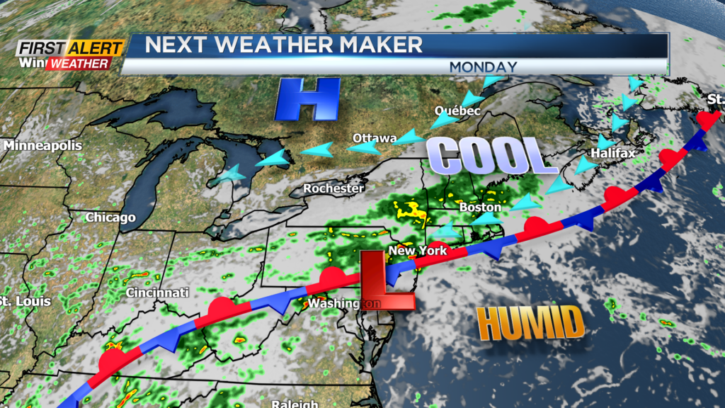
ROCHESTER, N.Y. – Some folks call it the unofficial end of summer this weekend. We had more fun in the sun for most of this Saturday. In addition, we have had a combination of heat and humidity that has produced mid-summer weather for the first portion of the holiday weekend. However, this is not likely going to continue. A cold front is approaching Western New York and that will bring much cooler temperatures and eventually some rainfall.
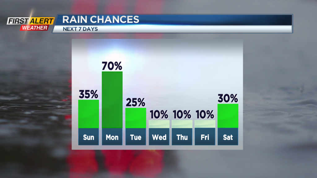
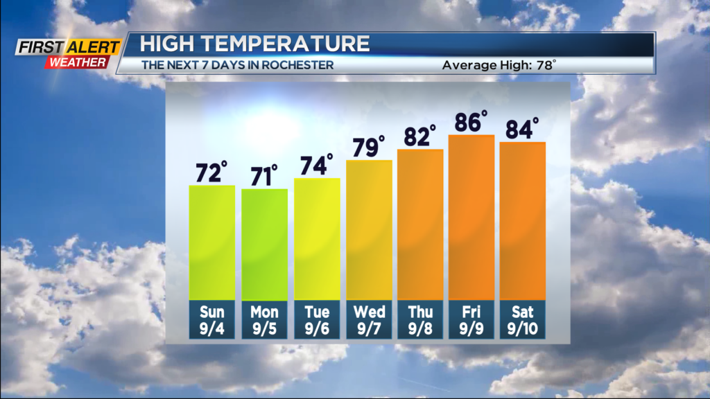
Tonight you can expect a muggy night. There is the chance of a shower or thundershower later this evening in the Finger Lakes. The low temperature falling only into the middle 60s. Sunday will feature more clouds with an increasing chance of a shower or thunderstorm for later in the afternoon. However, a good portion of the day should be rain free. This time, with a northeast wind, the temperature will only rise to the lower 70s. Rain showers should be more frequent for Sunday evening with the low temperature near 60 degrees.
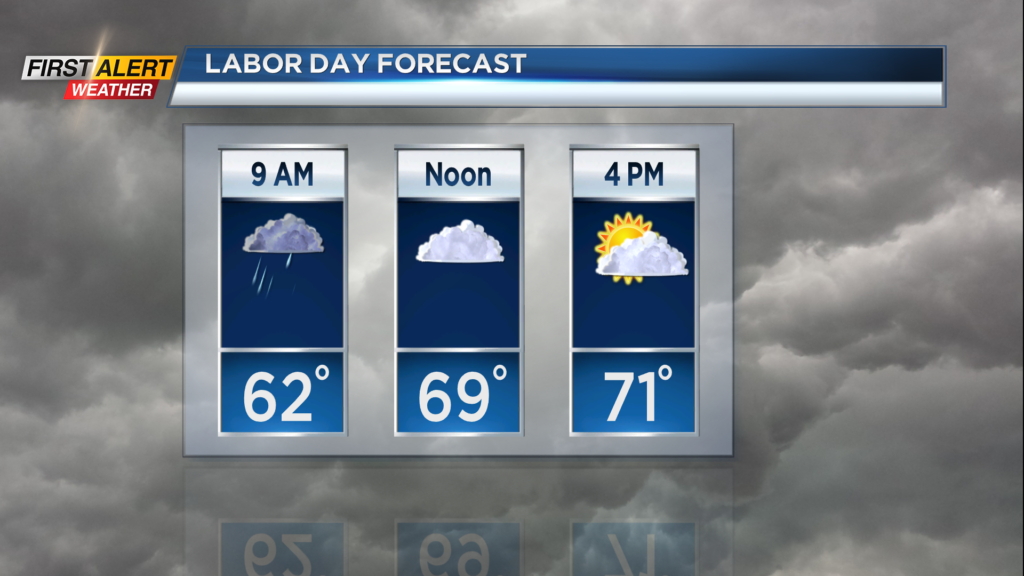
Labor Day there is a rather high probability of rain showers for the morning with the probability of rain lowering by the afternoon. Again, the high temperature will only be near 70 degrees.
An extended period of dry, sunny weather is expected as the kids heading back to school next week. Look for more sunshine for Tuesday through Friday. It will turn noticeably warmer through the week as the mercury will rise into the 70s Tuesday and Wednesday. And then back to summer conditions for Thursday and Friday with temperature readings pushing back into the 80s for the second half of the week.
Stay tuned to News 10NBC First Alert weather for any updates in the forecast.