First Alert Weather: The Weather Will Match the Calendar
[anvplayer video=”5135650″ station=”998131″]
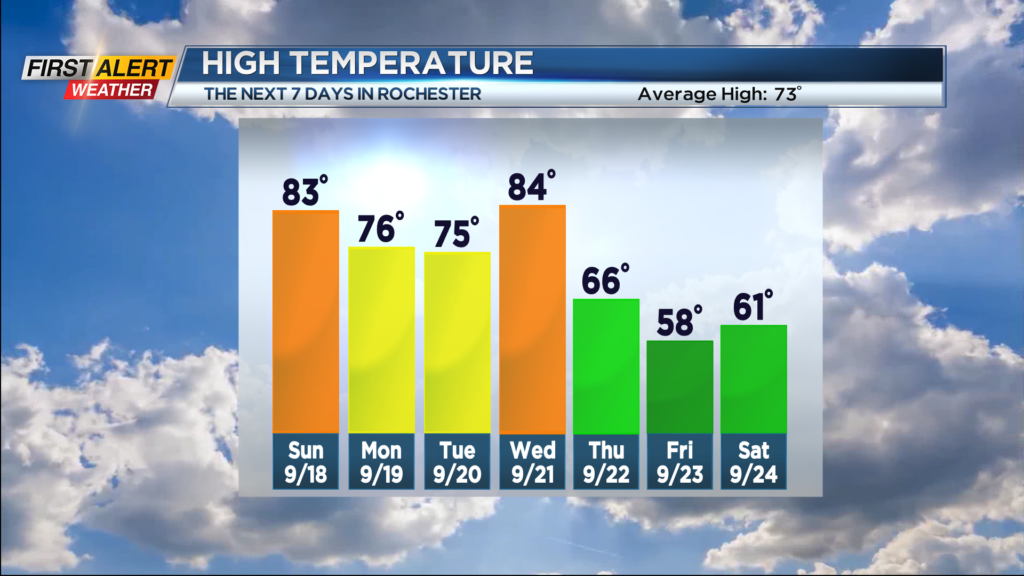
ROCHESTER, N.Y. – A warm front is in the process of moving across Western New York. This will extend summer the conditions through at least the end of the weekend. As a result, you can expect temperatures to be running some 10 degrees above normal into Sunday. Considering this is officially the last weekend of the summer season, the weather will be be matching the calendar.
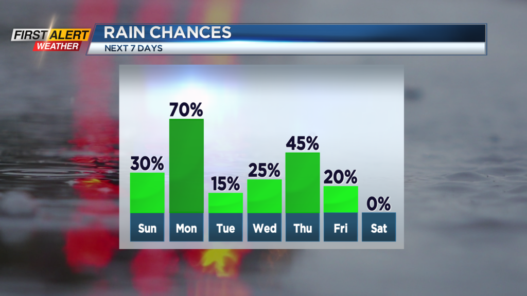
Tonight you can expect patchy clouds and it will be very mild compared to the last couple of nights. The low temperature will fall only into the low to middle 60s. Sunday will bring partial sunshine for the morning, then just a small chance of an afternoon thundershower. The temperature will rise into the lower 80s. Then a better chance of a few showers and thunderstorms for Sunday night. The mercury will drop to near 60 degrees by Monday morning. Monday the News 10NBC First Alert meteorologists expects a high probability of showers and thunderstorms, at least for the morning. Then look for breaks of sunshine later in the afternoon. It will not be as warm with the high temperature in the mid 70s.
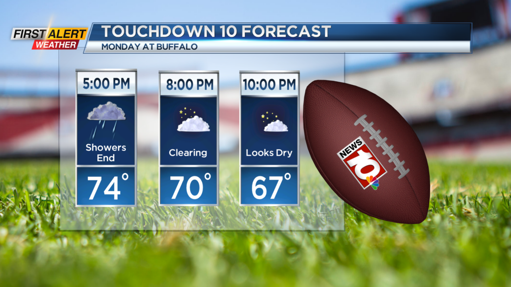
If you are going to the Bills game at Highmark Stadium in Buffalo for Monday evening, the weather should cooperate. Late afternoon tailgaters’ may see a lingering shower, but by game time it should be dry with some clearing expected. The temperature will fall through the 70s, eventually into the upper 60s. Tuesday will bring more sunshine and less humidity. The mercury will rise into the middle 70s.
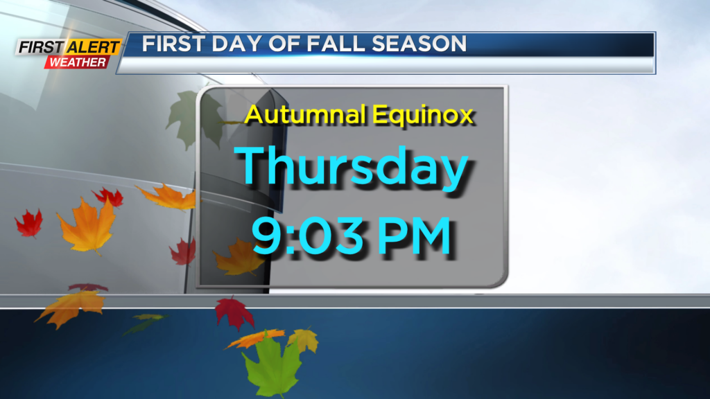
The official start of the fall season is Thursday as the autumnal equinox is at 9:03 p.m.
Stay tuned to News 10NBC First Alert for updates on the forecast.