First Alert Weather: The weekend starts dry, but the rain risk goes up Sunday
[anvplayer video=”5134079″ station=”998131″]
ROCHESTER, N.Y It is still summer, and it felt like it Friday, with highs making it into the 80s for the first time in almost a week!
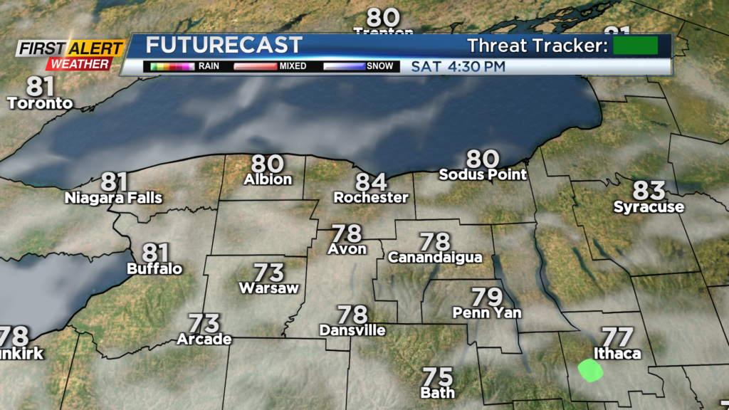
And we’ll keep that going into Saturday. High pressure remains in control on Saturday, giving us a nice, dry start to the weekend. Sunshine will mix with high clouds, but we’ll see plenty of sun and dry weather.
If you have outdoor plans, Saturday is your day. Moisture will begin to stream in late Saturday night into Sunday morning. The steadiest rain should hold into Pennsylvania, but some showers will try to sneak into the Southern Tier and southern Finger Lakes on Sunday morning, then pulling away during the afternoon.
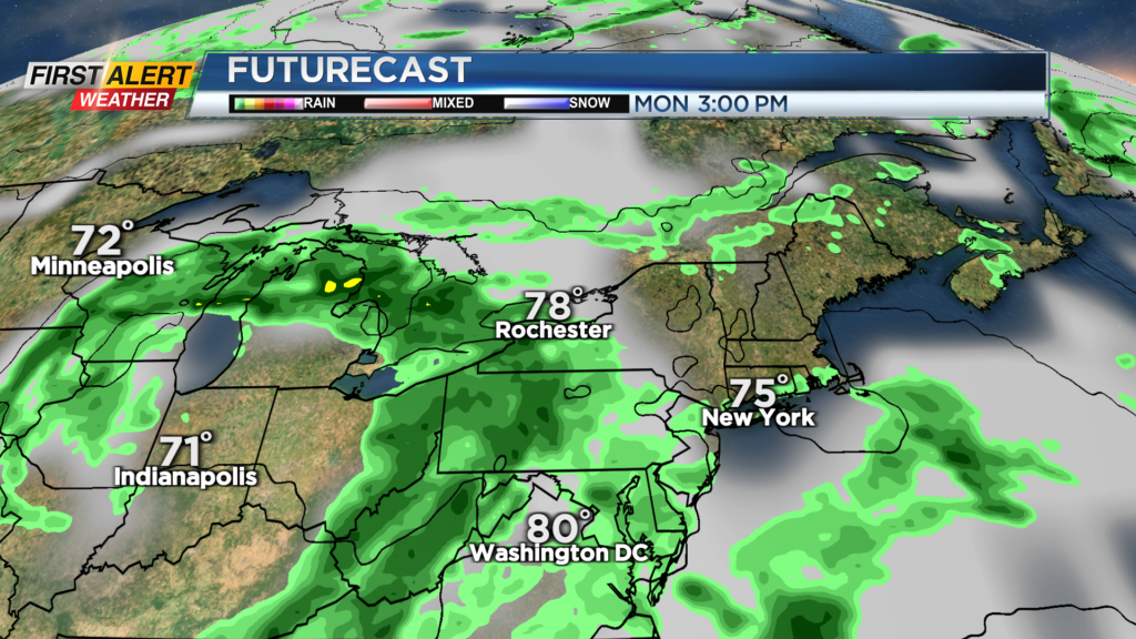
This is a slight change to the weekend forecast, with a slightly better chance for some wet weather. More clouds and a few showers will keep our temperatures locked into the 70s on Sunday.
A slow-moving area of low pressure is still expected to bring some rain, rumbles and somewhat unsettled weather Monday and Tuesday, with just the slight chance of a shower or two on Wednesday. So the wettest part of the forecast will be early next week, then dry out.
Highs will hold in the mid 70s for much of next week but may climb back into the 80s by next weekend. First Alert Meteorologists Alex Bielfeld and Glenn Johnson will have updates on our rain chances throughout the weekend, starting at 6AM on News10NBC.