First Alert Weather: Thunder ends tonight, a little unsettled into the weekend
[anvplayer video=”5191406″ station=”998131″]
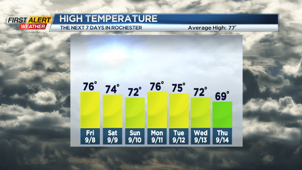
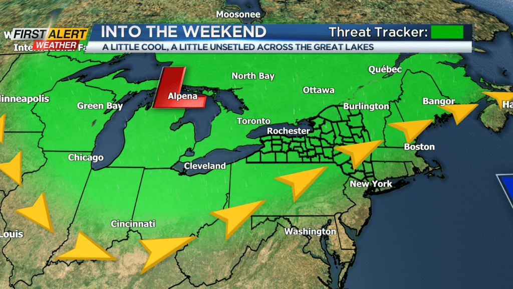
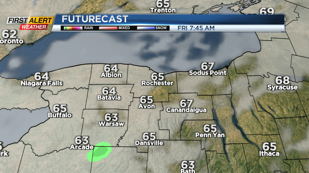
Thundery downpours Thursday night will deliver locally heavy rain, especially in the Finger Lakes, but taper heading into the overnight. Friday will be a little cooler, with a little less “stick” to the air as a cold front slowly slides through the area. There won’t be as much instability in the air, and no real trigger, so rain chances will be lower to end the week, with nothing more than a few passing showers. Saturday will have a similar feel, with that front stalled over southern and eastern New York. The best chance of a little wet weather on Saturday will be in the Finger Lakes, closer to that front. Otherwise, expect a fair amount of clouds, but lots of dry time. That will change on Sunday. That stalled front will retrograde back to the west, and back into our area. That means we’ll see a much better chance of showers and some periods of rain on Sunday.
We’ll dry things out to start the new week with some sun on Monday, but our next area of low pressure moves in later Tuesday. This will bring some late day showers or thunder, and keep that threat around into Wednesday. Overall, the next week or so will remain slightly cooler than average, and a little unsettled with more clouds than sun and off and on rain chances.