First Alert Weather: Thunderstorms return on Tuesday
[anvplayer video=”5131966″ station=”998131″]
ROCHESTER, N.Y. — The week’s first round of storms moves east tonight, with a lull for most of the overnight. It’ll be a very warm and muggy night, with temperatures likely not falling out of the 70s after hitting the 90s on Monday.
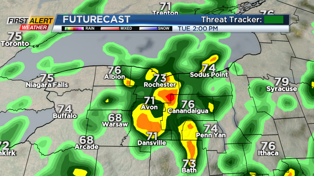
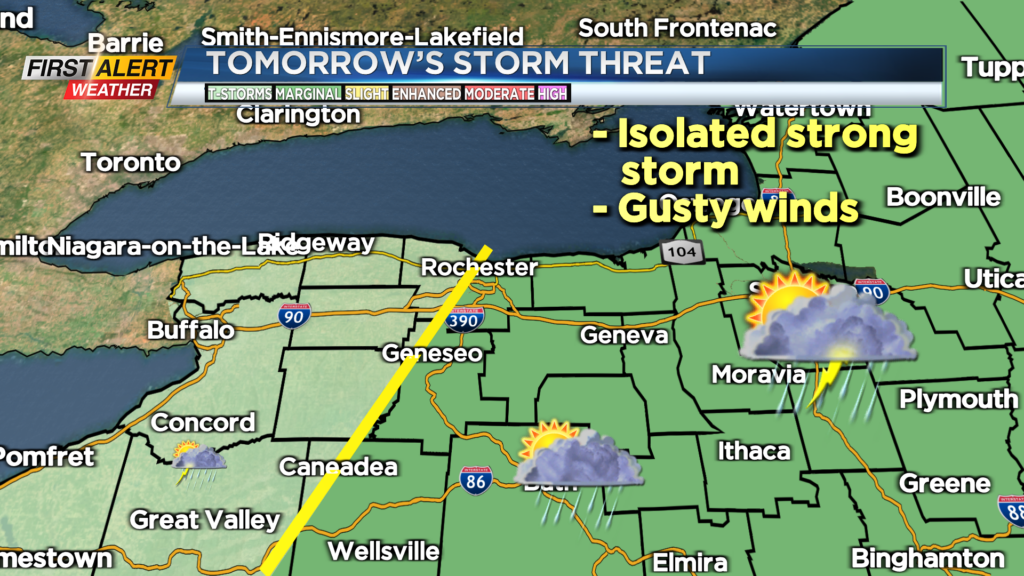
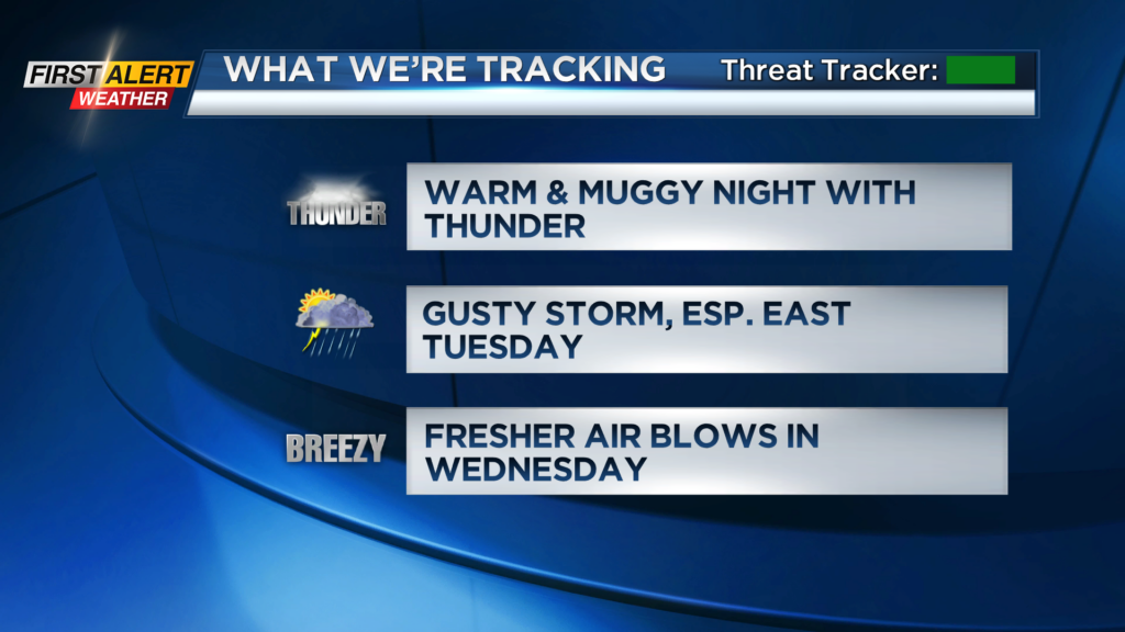
Tuesday will see another round of scattered showers and thunderstorms, with storms strengthening as they move east of Rochester into the Finger Lakes and central New York. This is where we have the best chance of seeing a gusty thunderstorm during the early afternoon.
While a gusty storm is possible, severe weather isn’t expected, so at this point we’ll remain green on the First Alert Threat Tracker. We’ll monitor the storm threat overnight and early Tuesday morning, and may need to hoist a Yellow Alert if the severe threat goes up. A secondary front drops south early Wednesday morning, with another chance of rain or rumbles, followed by a fresher breeze blowing in.
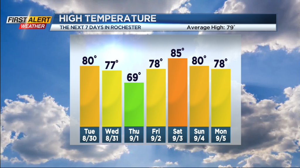
We will welcome in September, and meteorological Fall on Thursday with high temperatures likely not making it out of the 60s! But, this will be short-lived, with highs back near 80 on Friday, and into the 80s to start the Labor Day weekend.