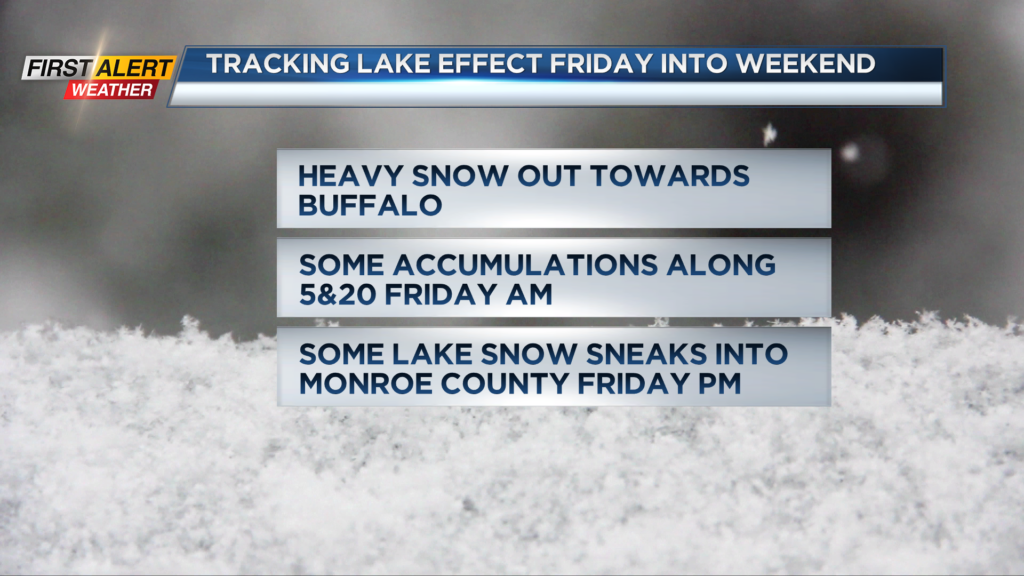
First Alert Weather: Tracking Lake Effect Snow into the weekend
[anvplayer video=”5148208″ station=”998131″]
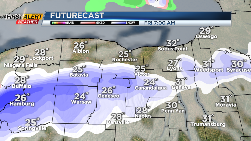
ROCHESTER, N.Y. — It will be breezy and cold with a few passing snow showers for Thursday. The heavier lake effect snow develops this evening out towards Buffalo around 8 p.m.
That band will settle south into Friday morning. The band may bring a coating overnight. While the heaviest snow is likely falling between Batavia and Warsaw on Friday morning west to Buffalo, some of that lake snow will cross into parts of Livingston and Ontario Counties with some light accumulations to start the day.
As the wind backs a bit more to the southwest during the day that heavier snow band will shift a bit to the north between Buffalo and Batavia. Some of the lake snow tomorrow afternoon is likely to move into parts of Monroe County including metro Rochester.
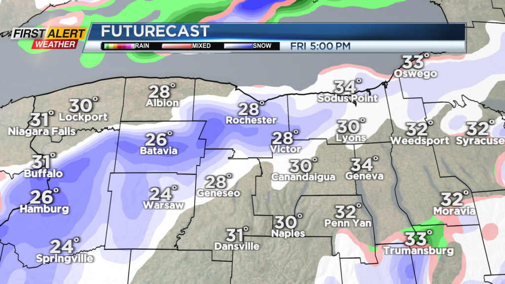
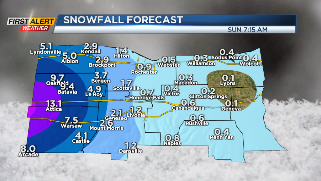
While we will not see significant impacts here locally, some light accumulations are possible for Friday afternoon and evening with a few inches over parts of the westside. The heavier snow will move further west on Saturday.
One thing to watch is a cold front on Sunday. As that front moves through the band is likely to swing across the region once again and there will be an opportunity for some lake effect off Ontario along Rt. 104, including Rochester, Sunday afternoon.
Stay tuned to News10NBC for the latest updates on the timing and placement of the snowband as it develops tonight into tomorrow.
______________
Download the WHEC First Alert Weather app to stay up to date while on the go.
Watch the latest full forecast online.