First Alert Weather: Tracking snow, rain, and wind later into Thursday
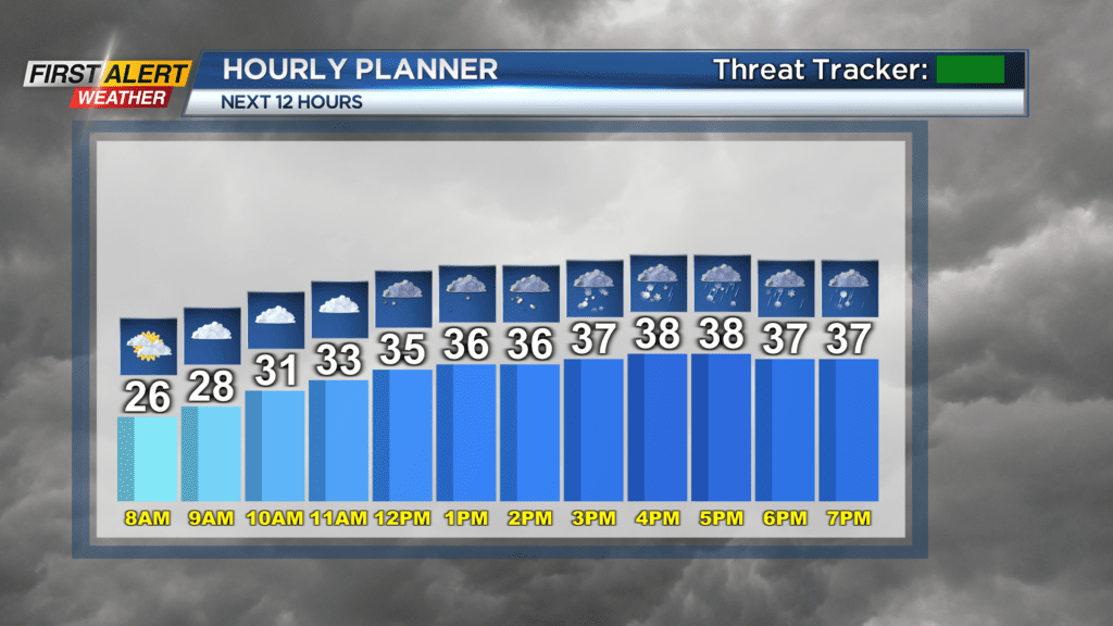
ROCHESTER, N.Y. — Expect cold and clear weather to start the day with some sunshine. Clouds will increase through the early afternoon as a quick moving system arrives later into Thursday.
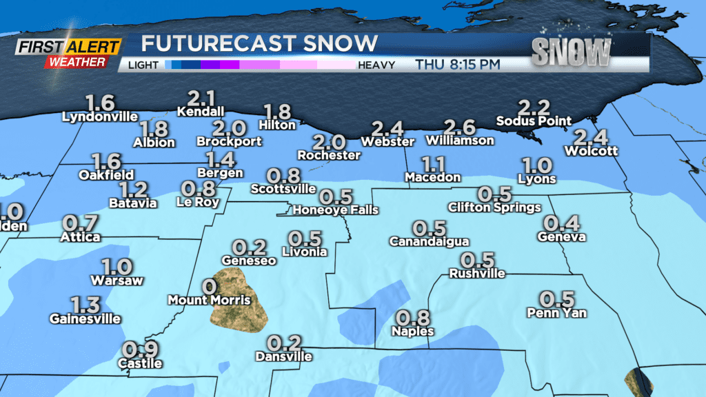
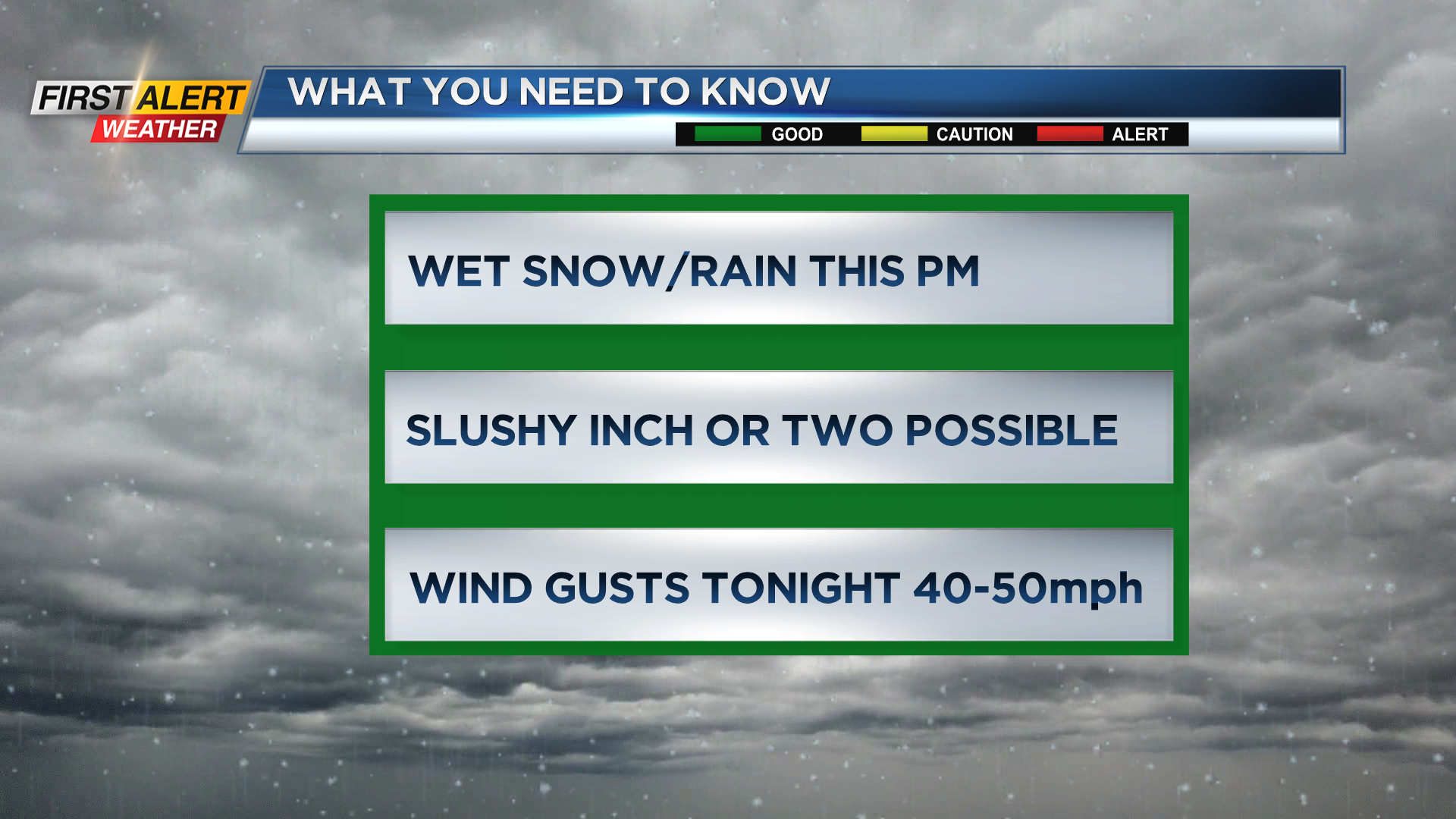
Some wet snow will develop around 2 to 3 p.m. and will bring a slushy coating to an inch for most of the region. An inch or two is possible closer to Lake Ontario.
Slightly milder air will also move in with the storm, so plan on a change to a mix or all rain later in the day. This should prevent the roads from getting to snowy but a few slick spots will be possible.
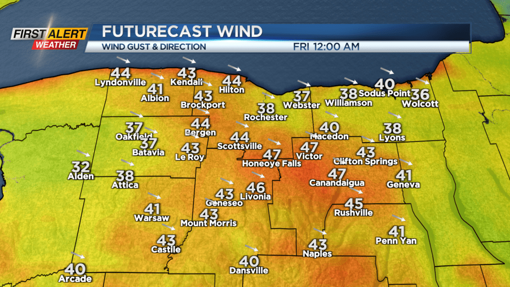
After the precipitation clears around 7 to 8 p.m., colder air will start to move back in and that will bring some stronger winds to the region for a few hours on Thursday night.
We’re not anticipating any widespread issues but a few scattered power outages will be possible with gusts 40 to 50 miles per hour. Gusty winds and a few snow showers will continue into Friday.
Keep an eye on the weekend forecast as some local lake snows may bring some accumulations to the region. Stay tuned to News10NBC for the latest updates on the wet snow and wind later on Thursday.